2025 Trans Taiga trip photographs Part C
Now looks to the hare.
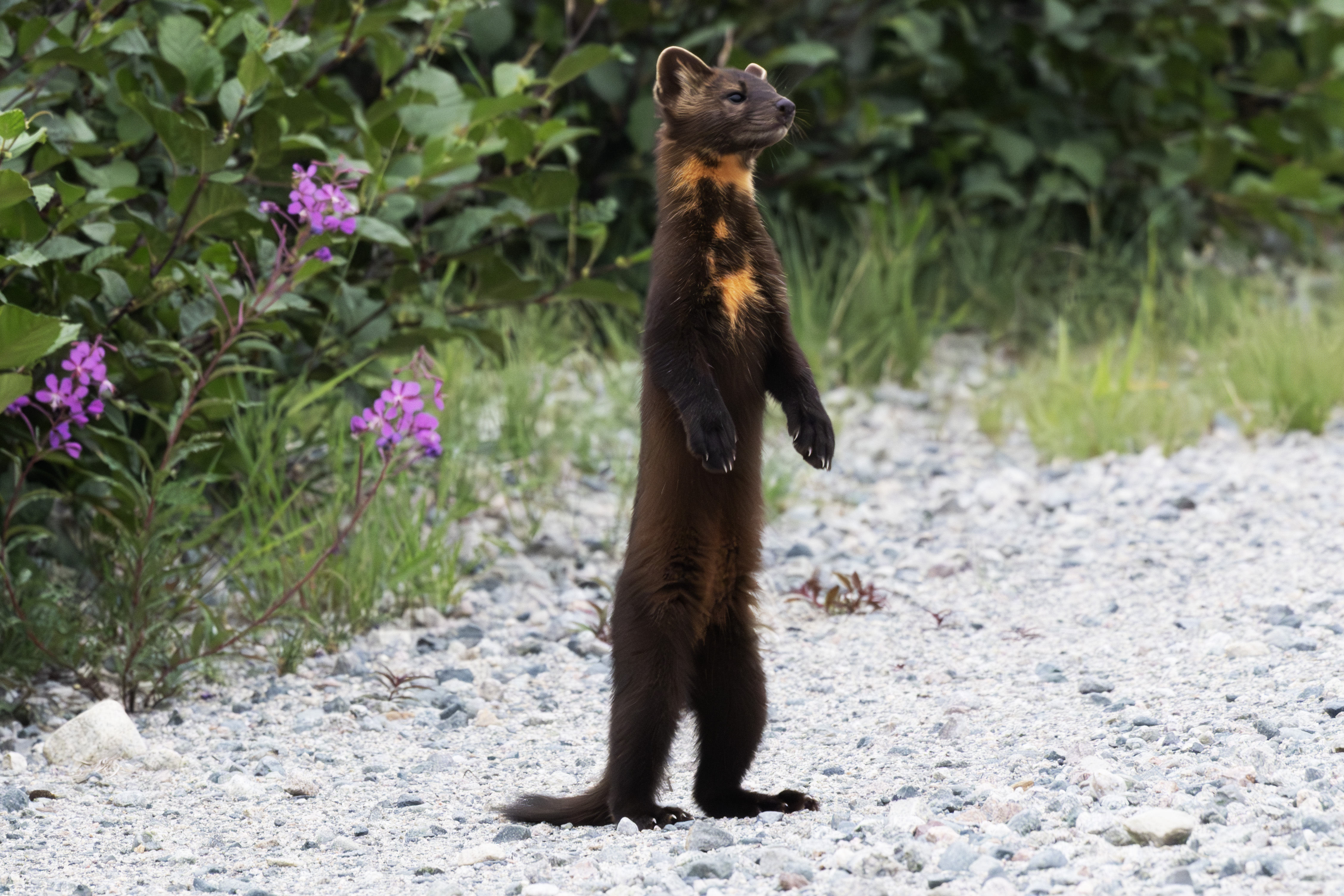
Thinking.
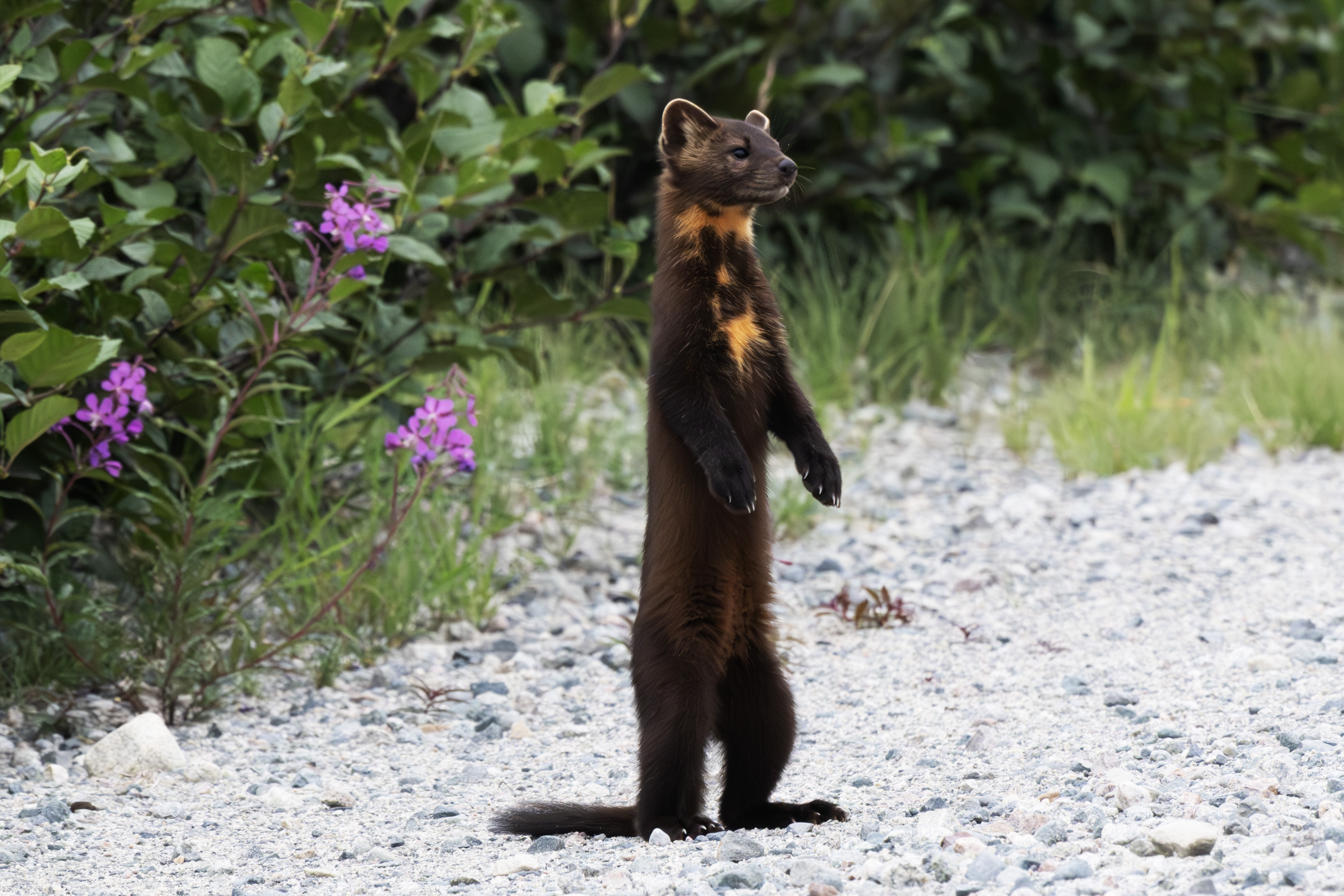
One last look.
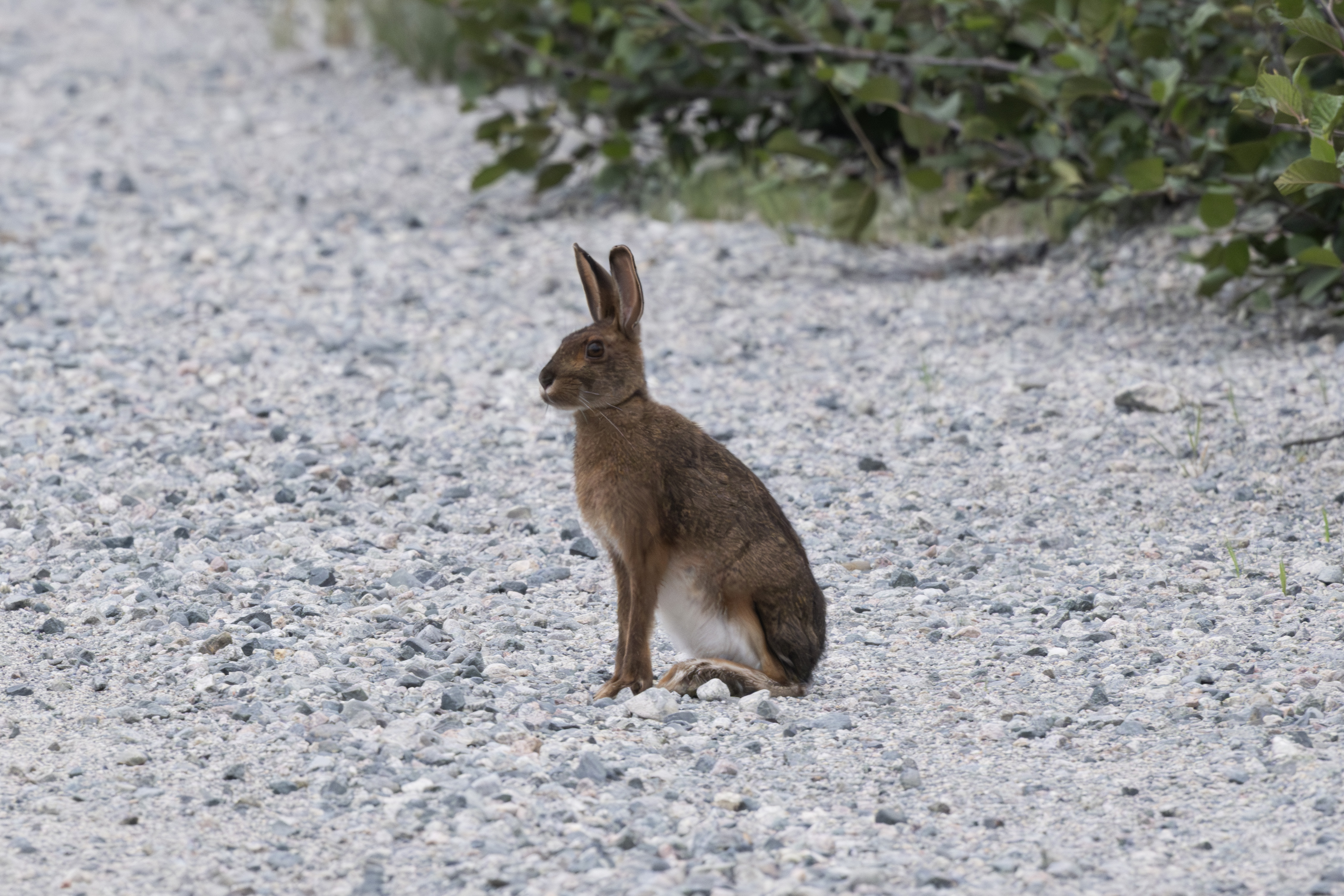
The hare never flinched.
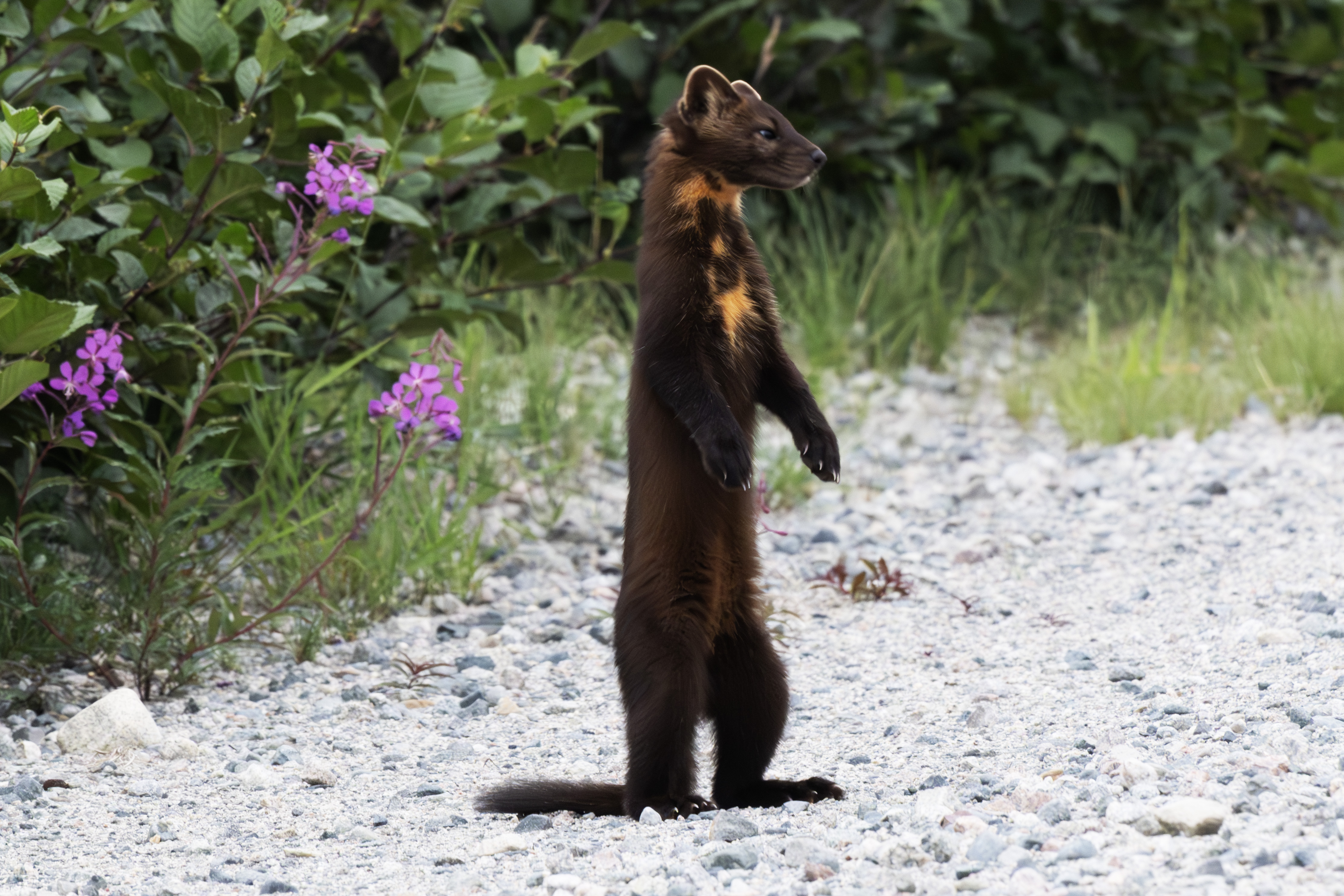
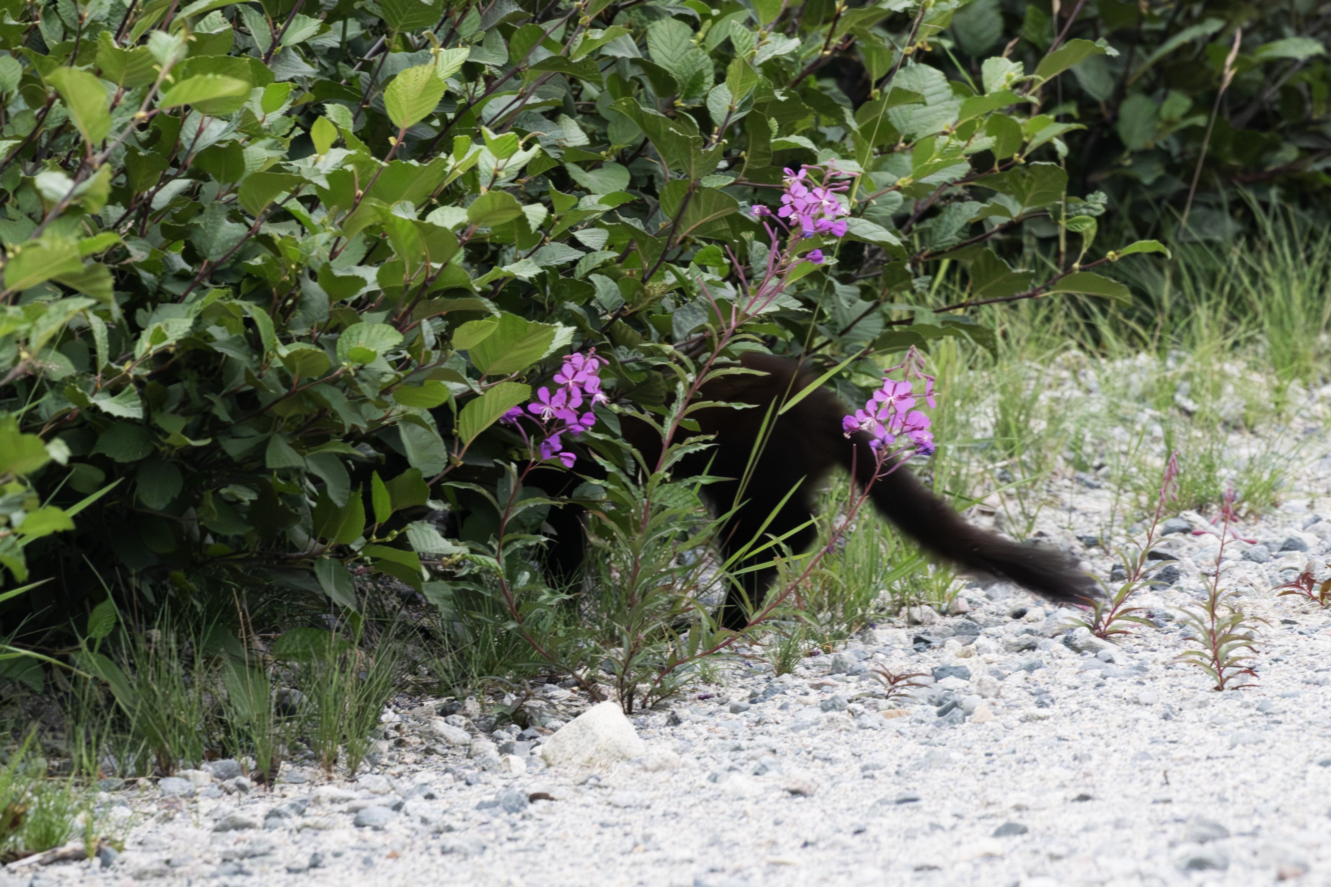
The marten calls off the hunt.
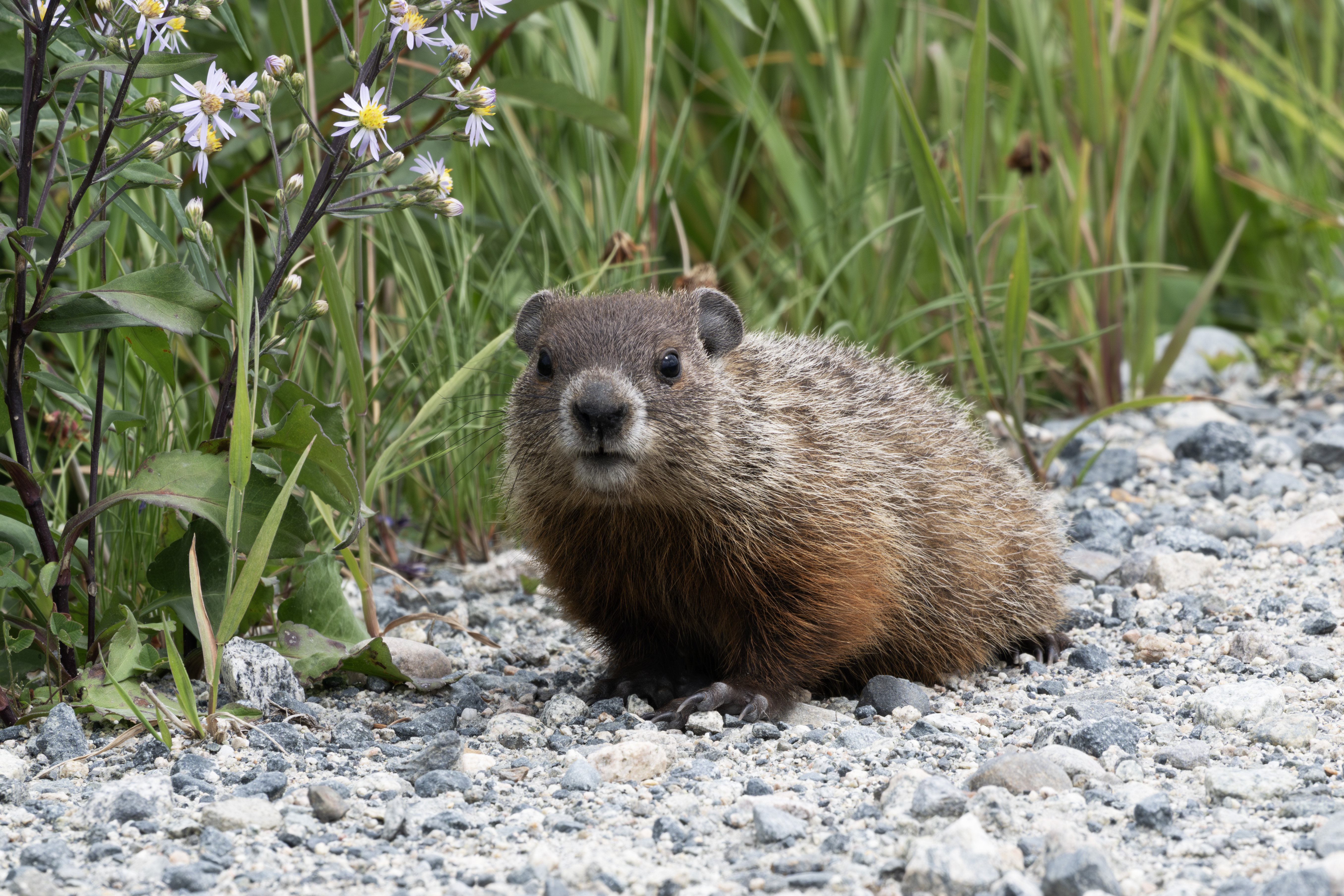
A little later, a small groundhog crossed the road.
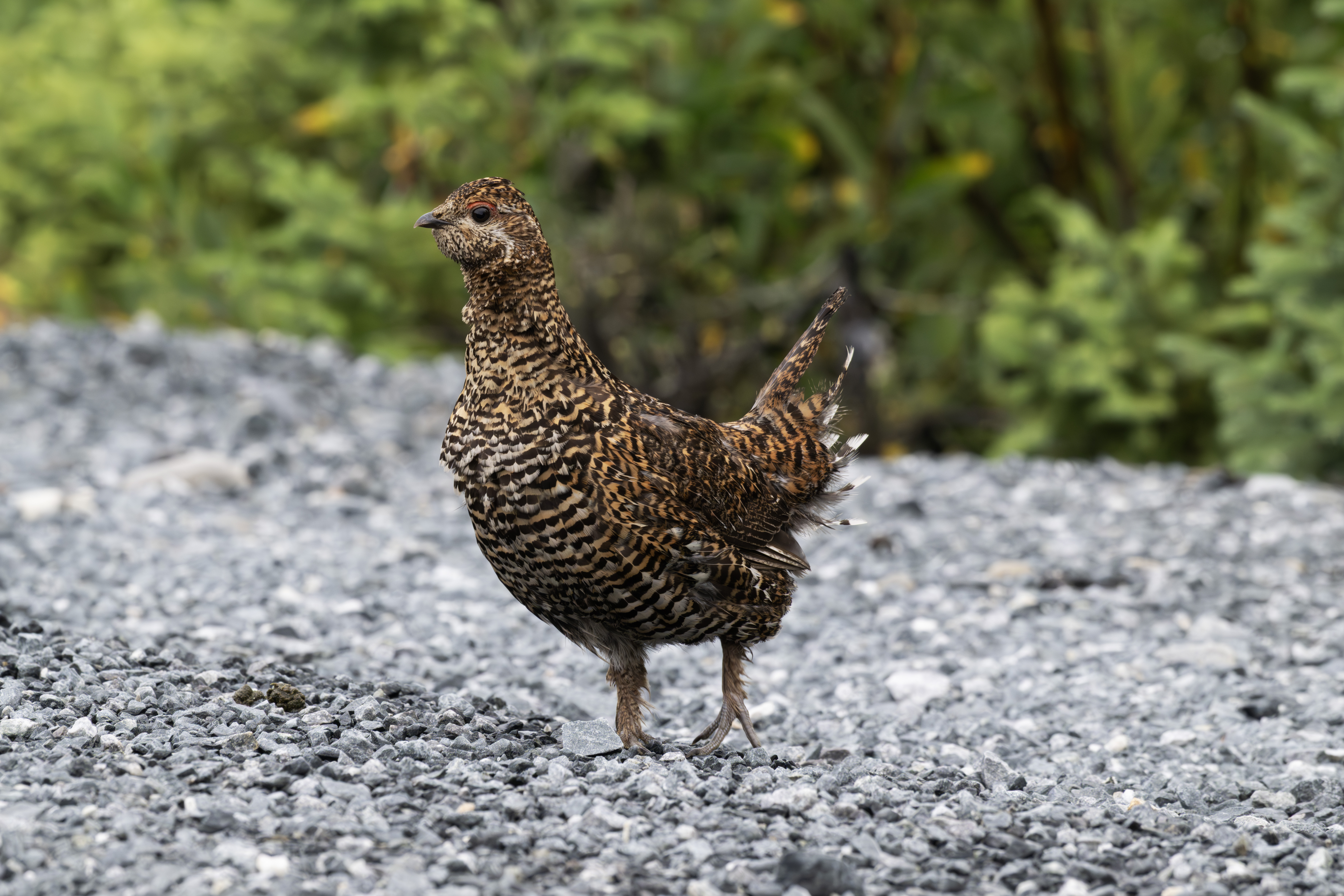
Late in the afternoon, another Grouse, on the TTH near the 381 km rest stop.
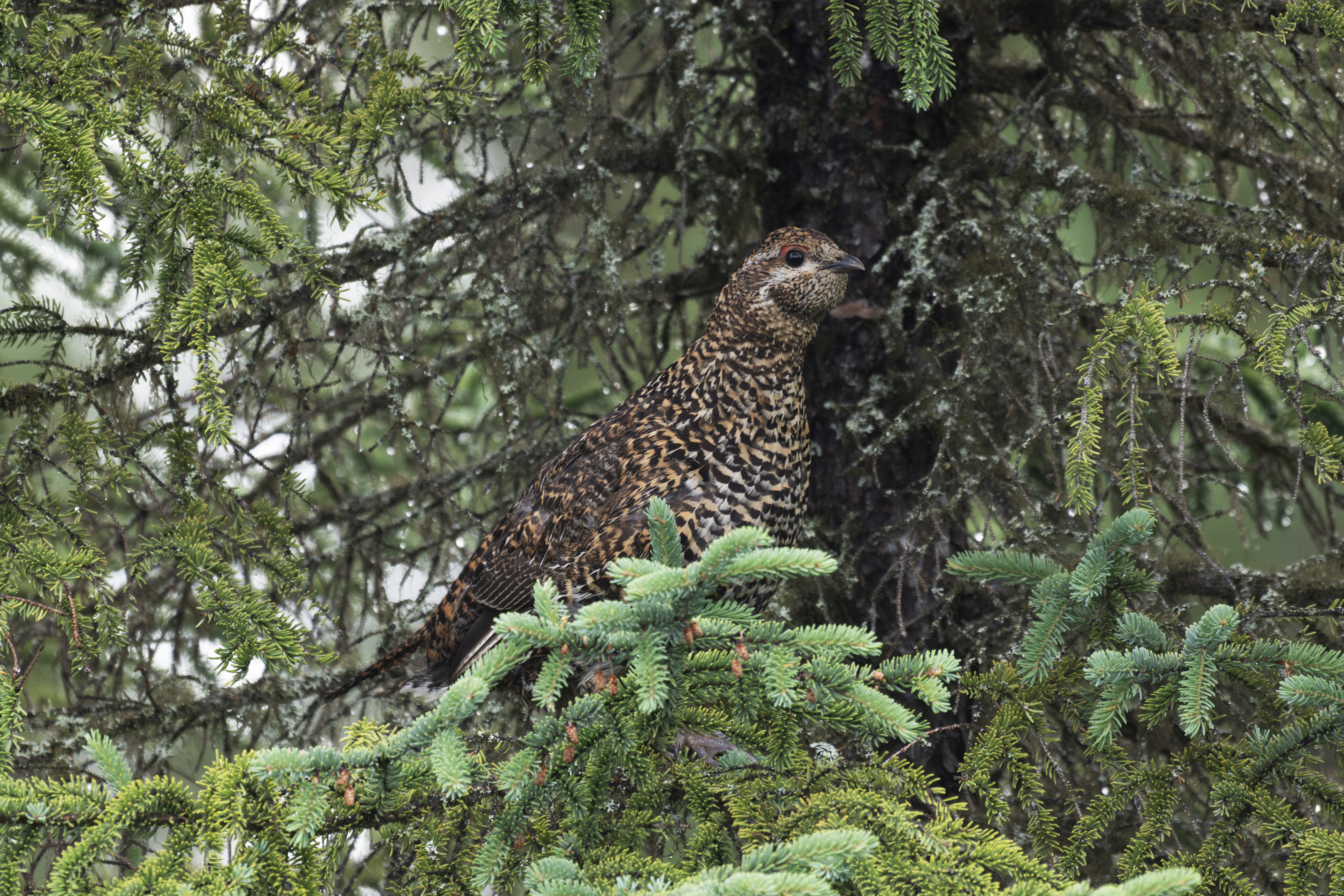
Spooked it into a spruce.
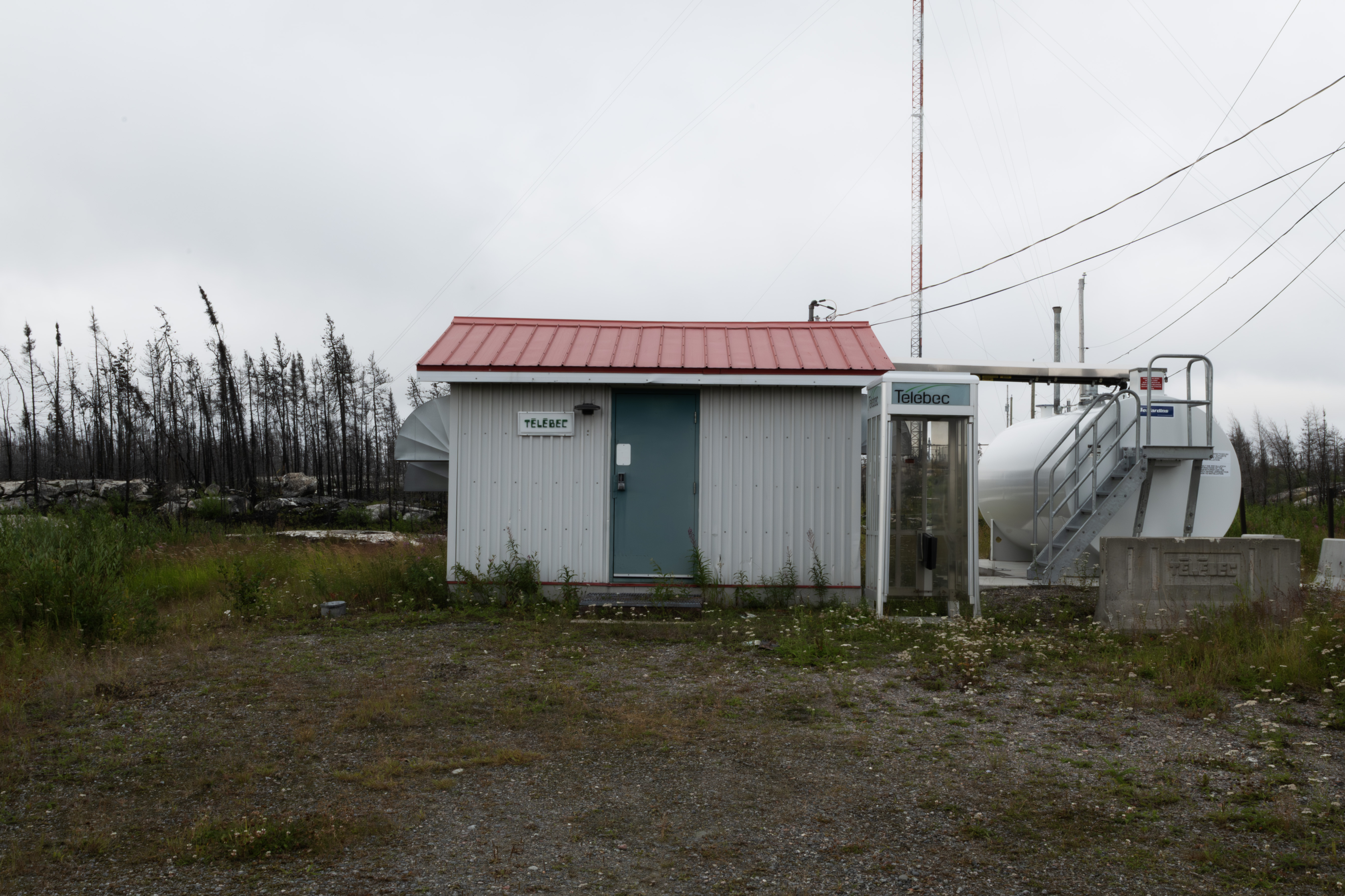
The TTH has active phone booths every 100-150 kms. Here is the first one on the highway.
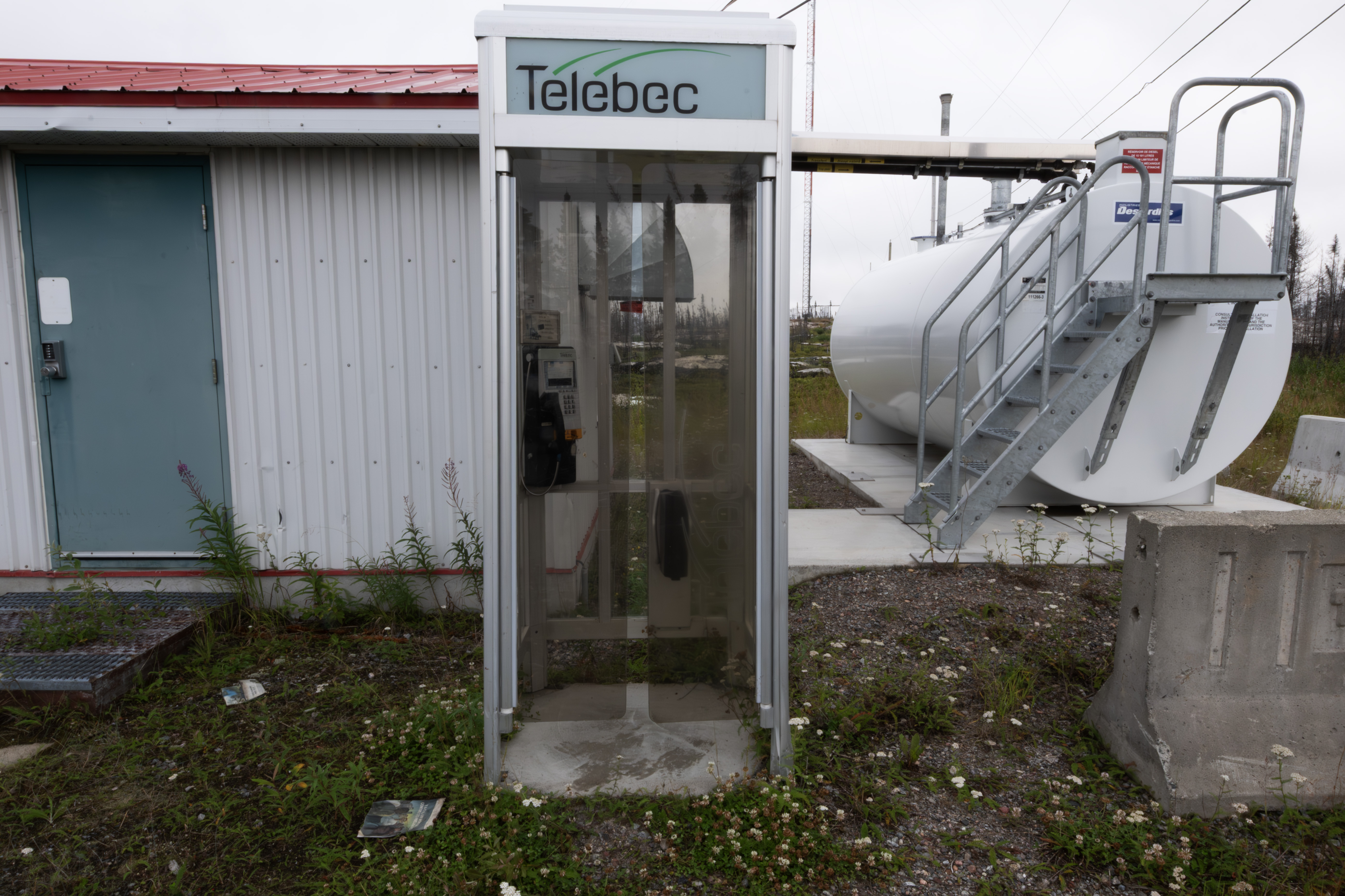
The phone booth.
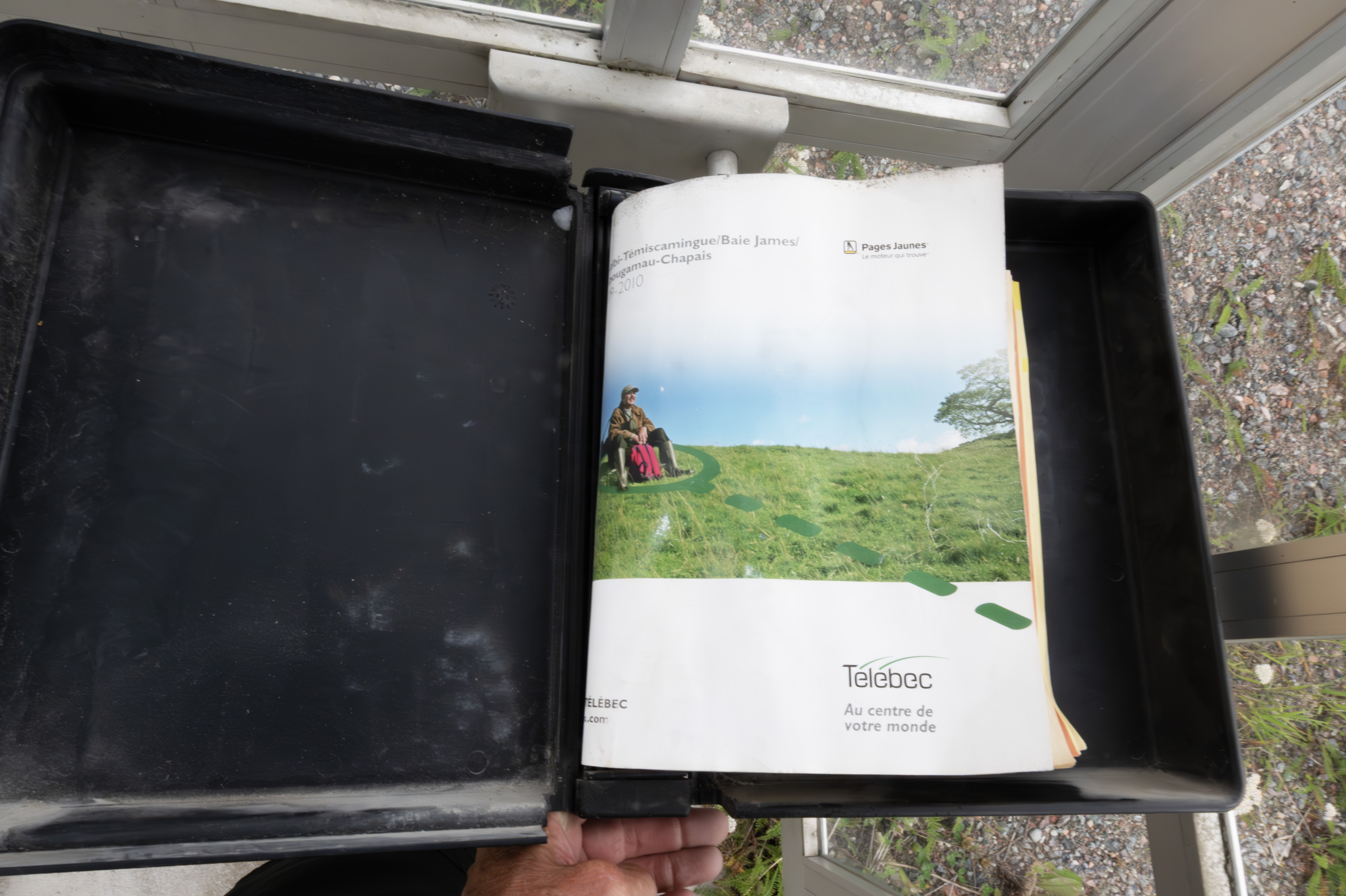
Complete with a current phone book.
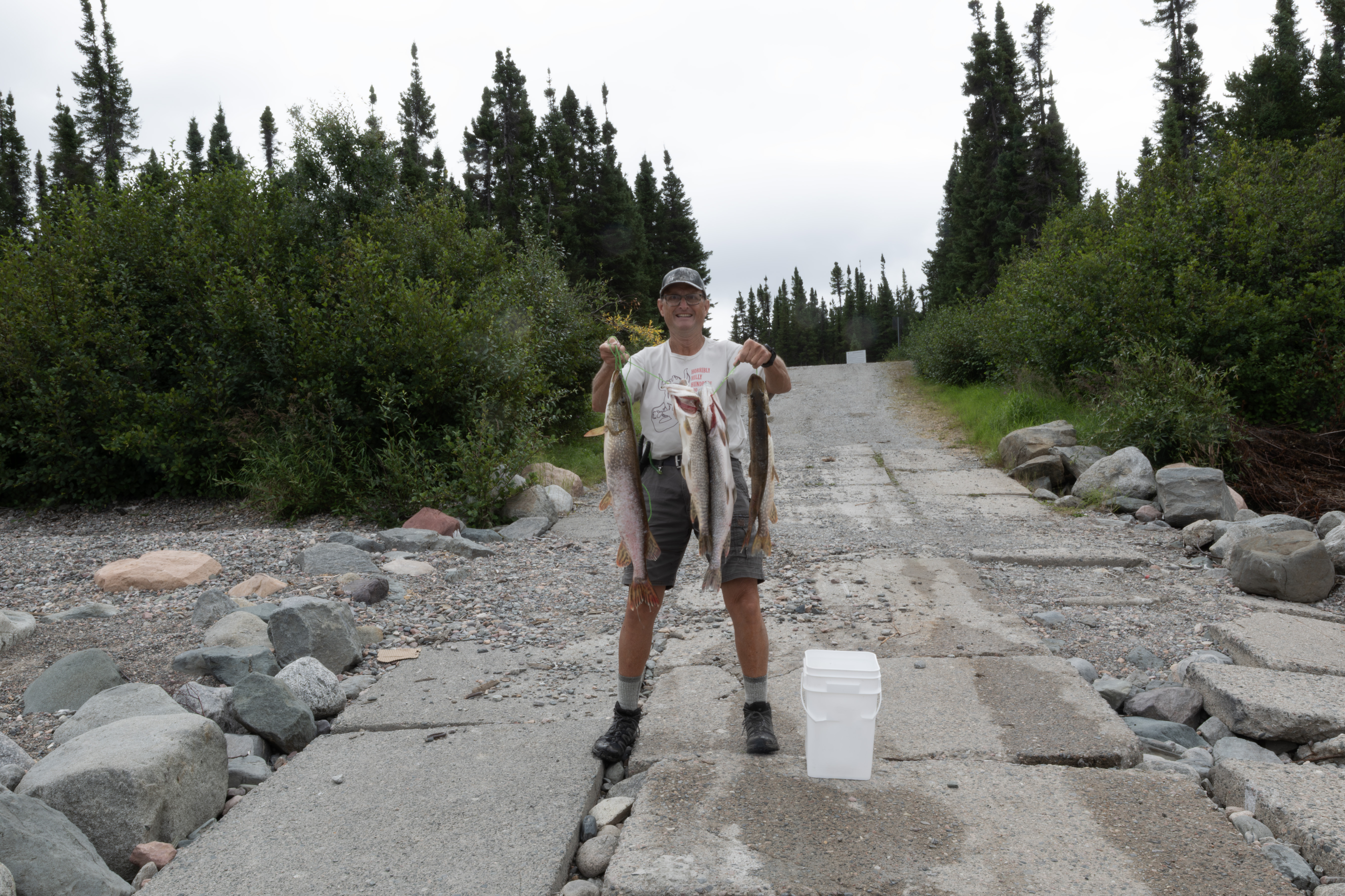
Saturday, August 9th was overcast, perfect for fishing. Caught around 25 northern pike, here are a few from the morning.
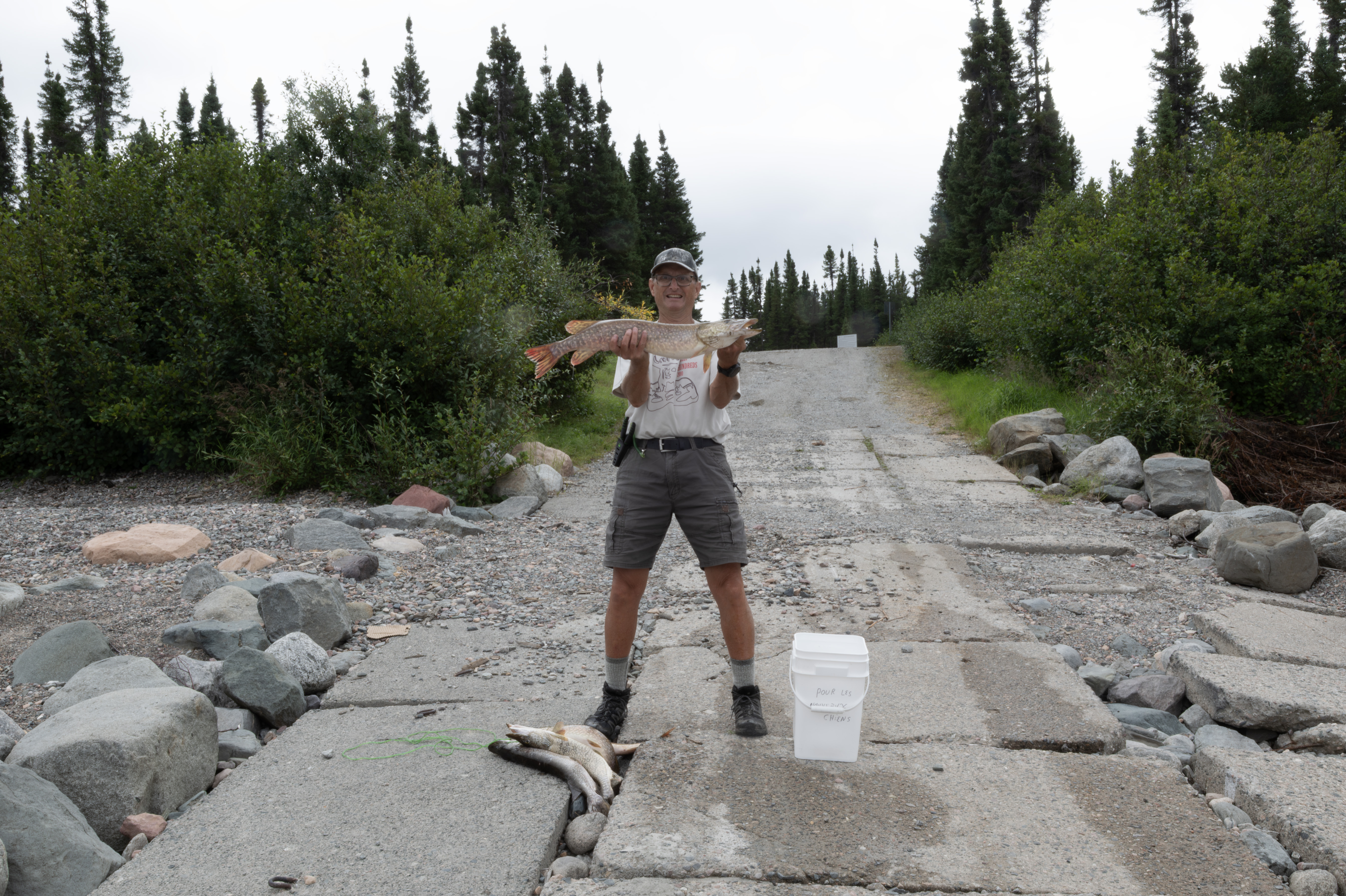
Largest northern that I caught on the trip, 30 inches. Using a light-medium rod with 6 lb test, this one took about 10 minutes to land. Incidentally, when this fish hit the lure, the line went slack. Northern pike sometimes attack from behind so fast that they swallow the lure and the line goes slack. I learned to set the hook when this happened.
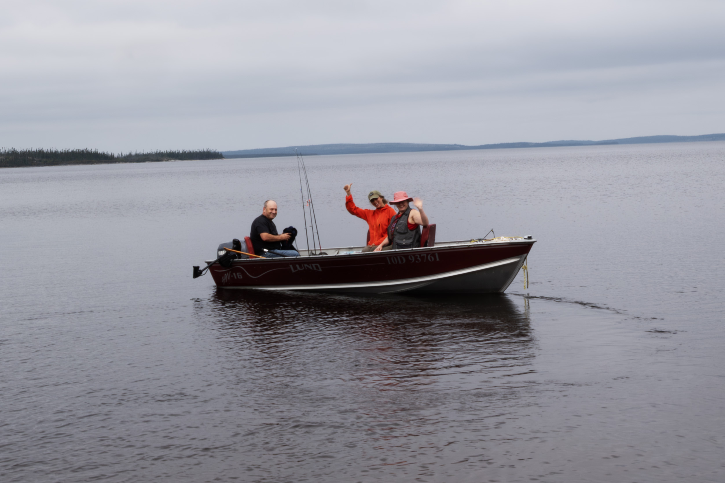
This family left about 10 am to fish. They live in Chisasibi. The woman took several photographs of me.
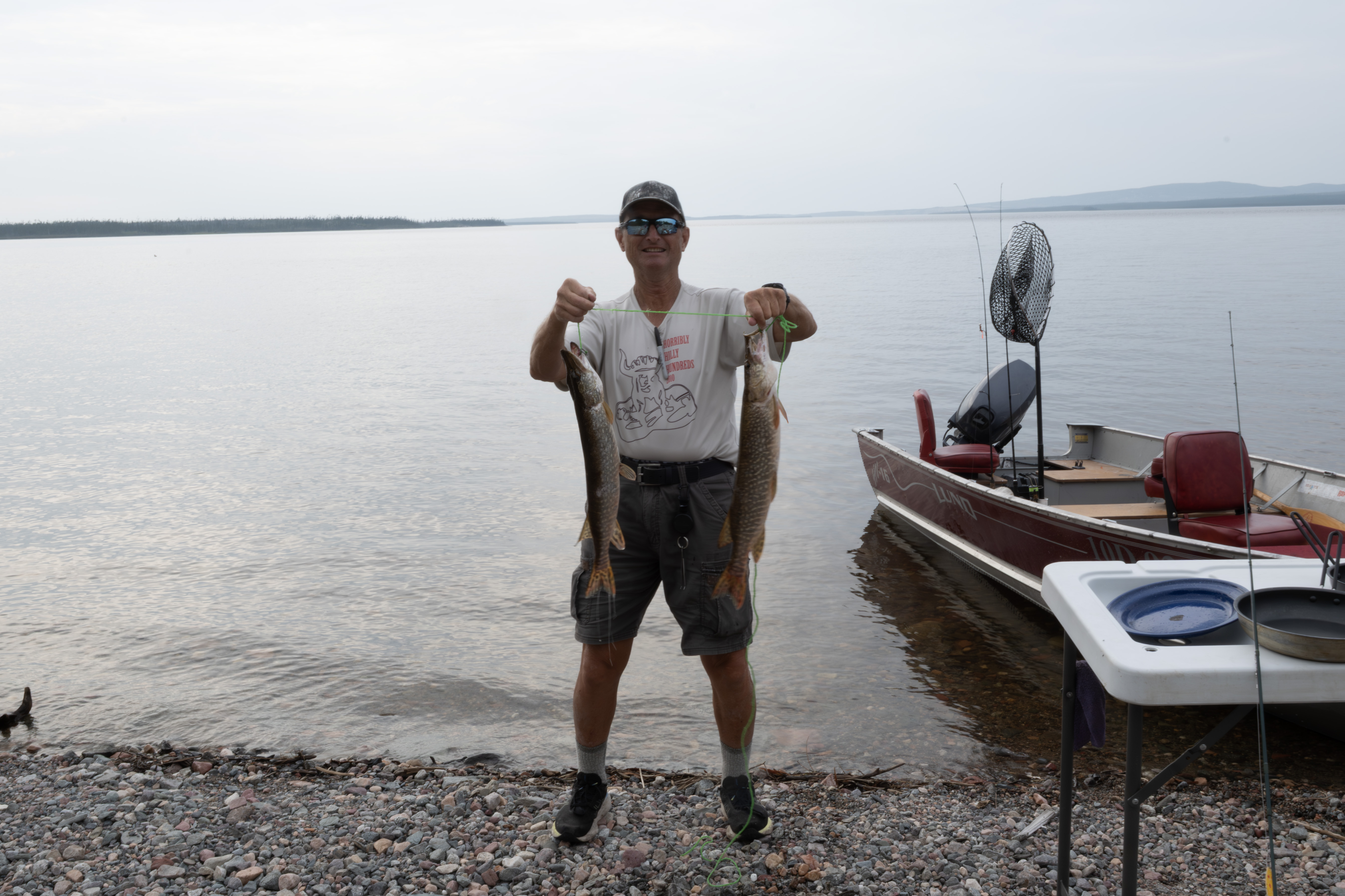
I kept two more in the afternoon.
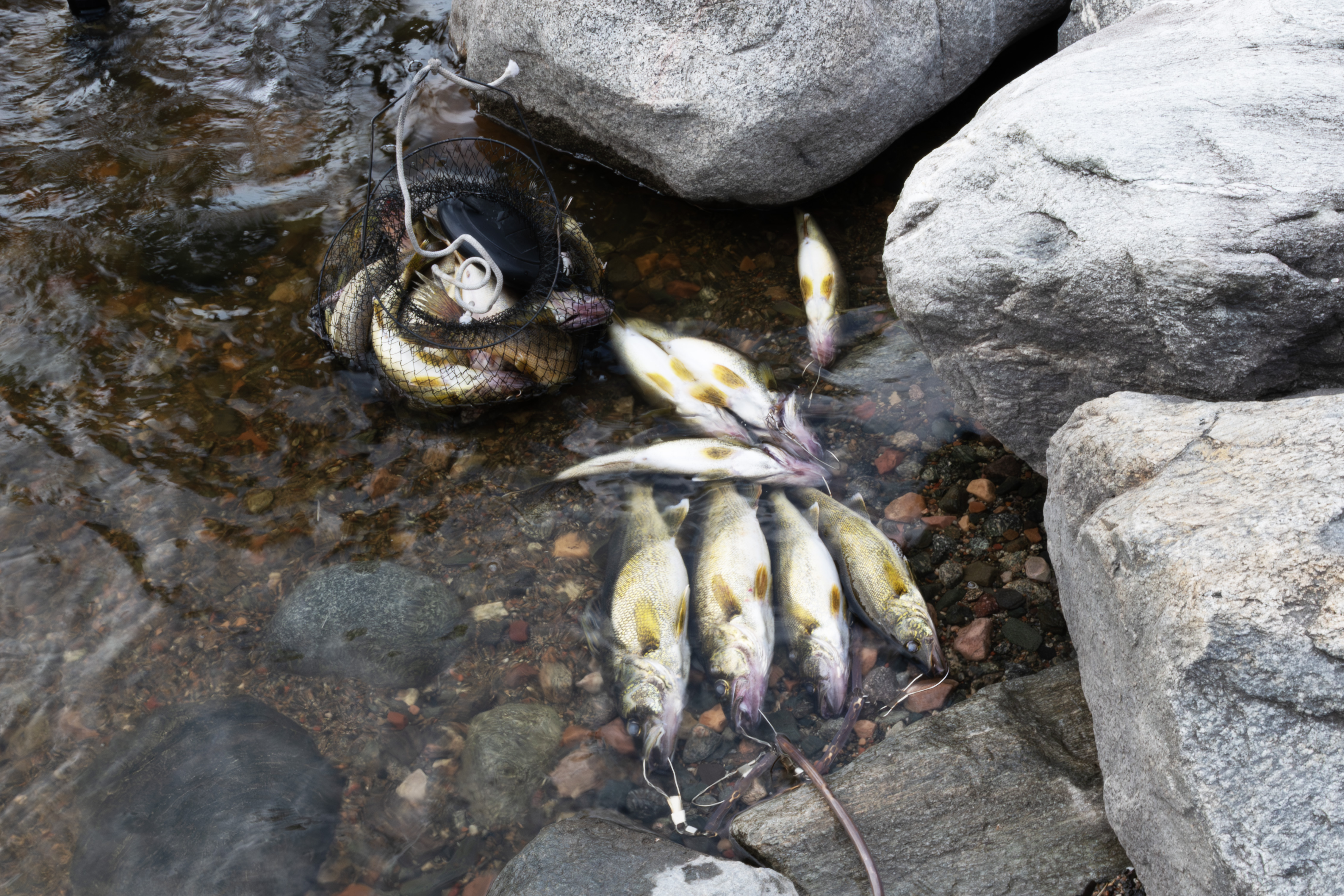
The Chisasibi family returned with a nice bunch of walleye, around 20. The locals call these "Goldens", which I had heard on the drive up but I did not make the connection. Canadians also call northern pike "jackfish" or "Brochet", the latter the French word for pike. Interestingly, the northernmost town on Reindeer Lake in Saskatchewan is named Brochet.
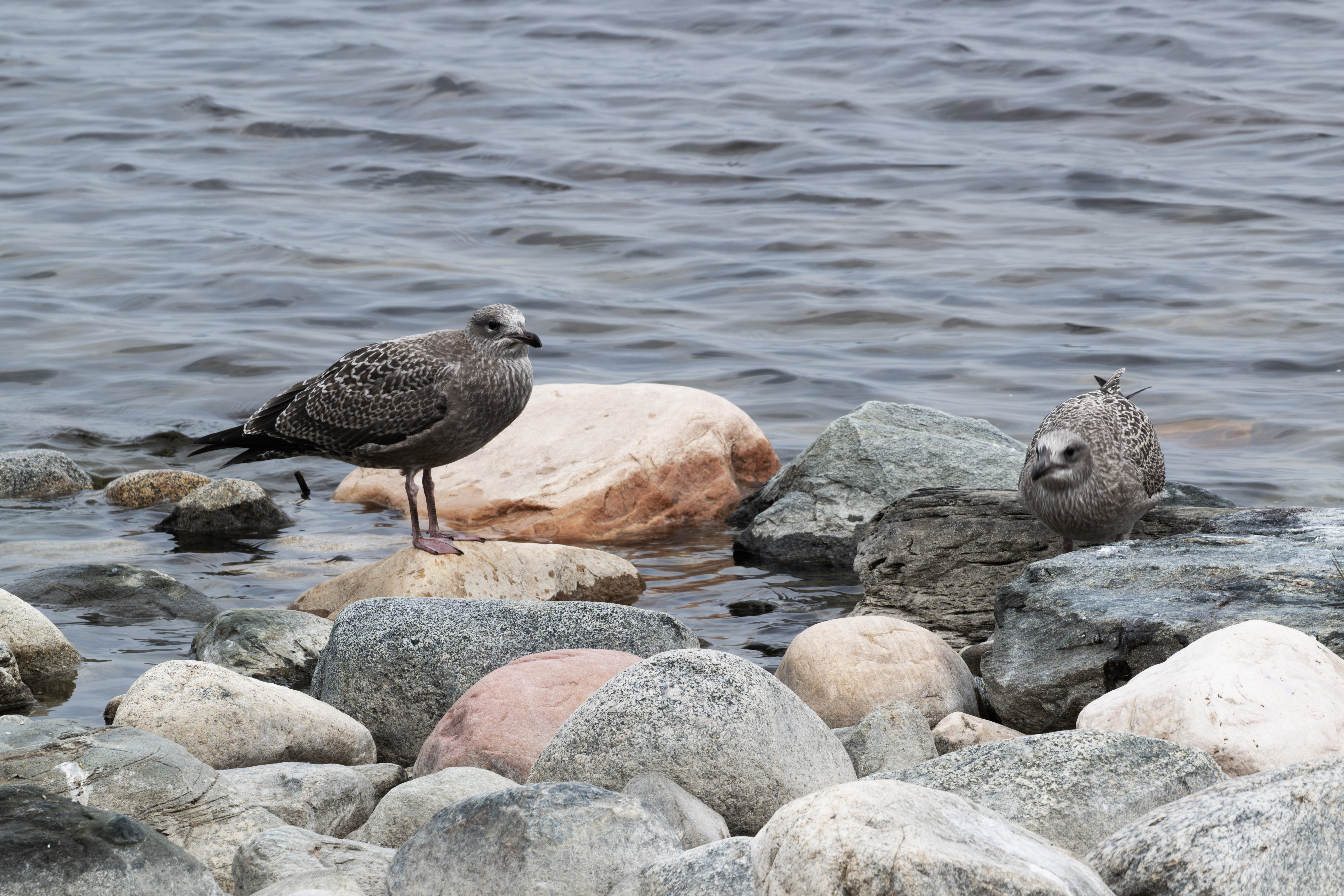
The gulls had quite a feast, with me cleaning the pike and the others gutting the walleye. This is post-feast.
These gulls follow you as you fish, and will steal unattended fish on a stringer. The first two northern that I caught on the trip disappeared. I had tied them to a rock, and I thought that they slipped away. Next fish that I caught, I walked about 50 yards away, and looked back to see a gull pulling the line out of the water! They were damaged near the gills. Gulls will eat the guts of your catch. I was extremely vigilant to protect my catch the remainder of the trip. I wanted to photograph this, but when I returned to the campground on August 5th, 30 mph wings were creating waves that pounded the shoreline and I could not catch fish.
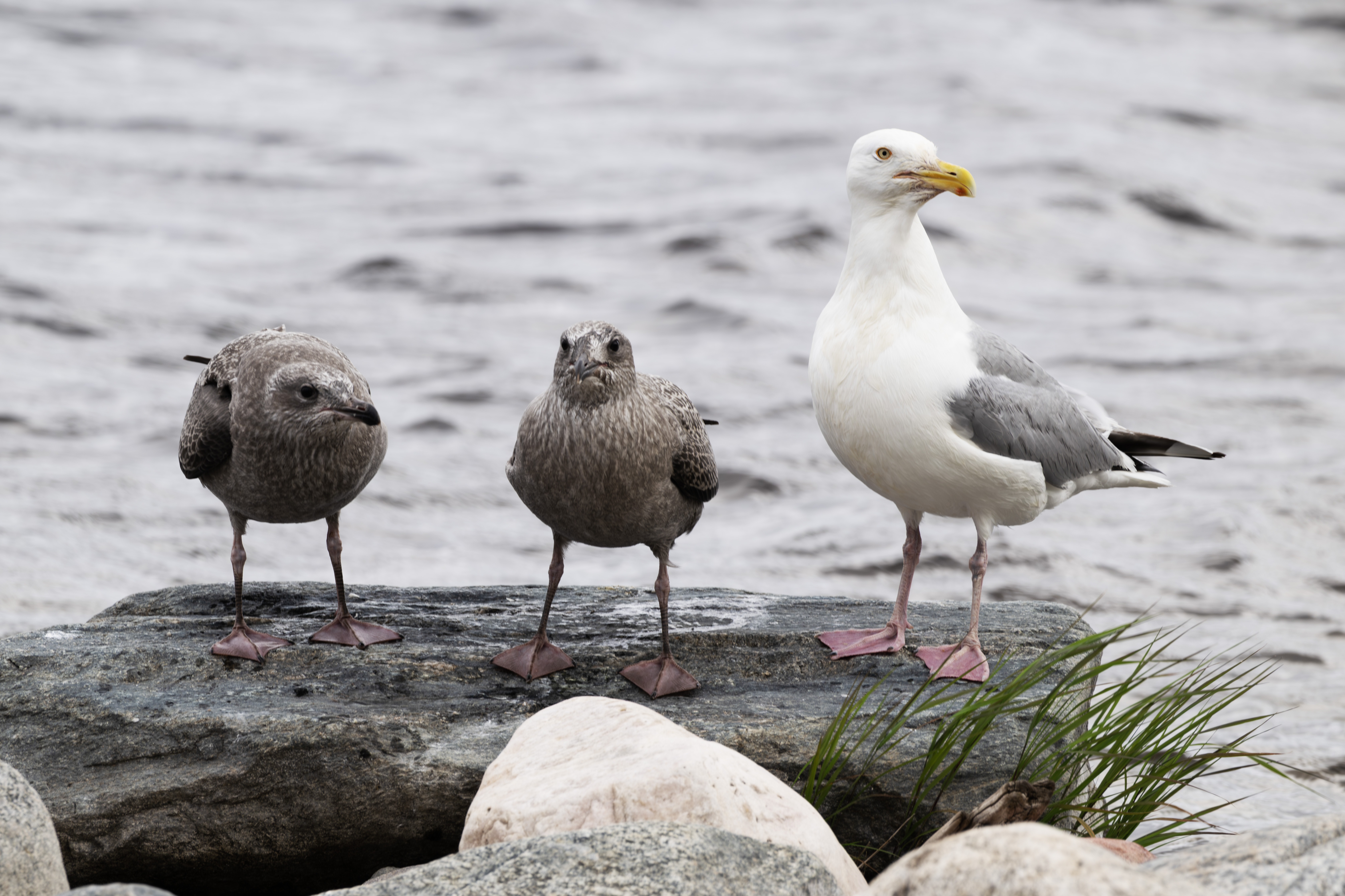
The next few days the gulls scavenged the carcasses. The mom in particular dove into the water to retrieve scraps which she gave to her young. This was the only time the little ones did not squawk!
Another view, with mom in the background.
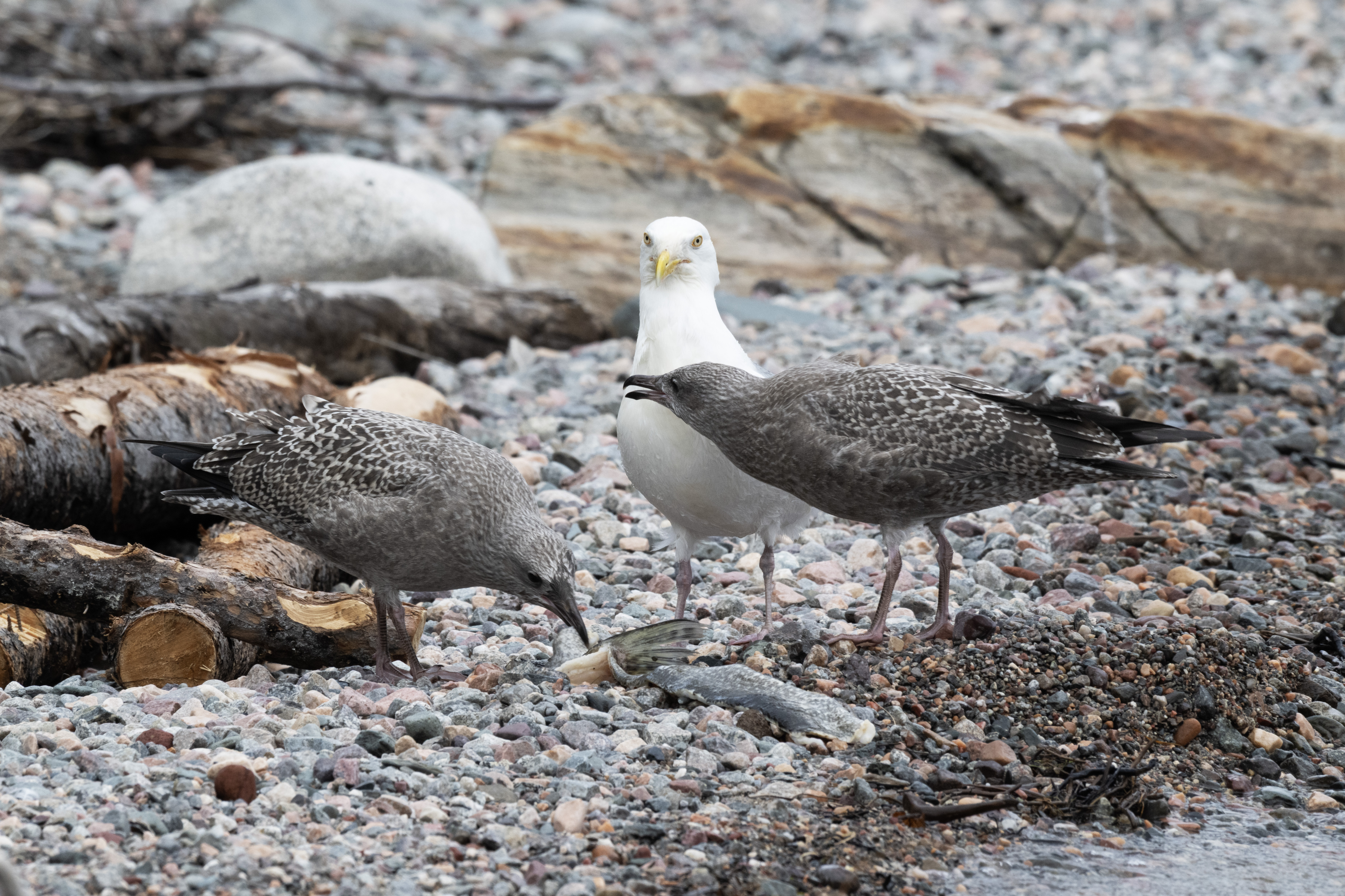
Mom standing guard. When the gulls converged around a fish cleaning, the juveniles kept away, as the older gulls fought viciously.
Waiting for mom with scraps.
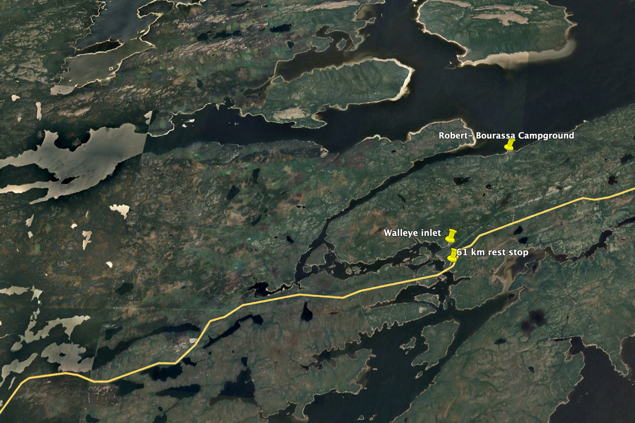
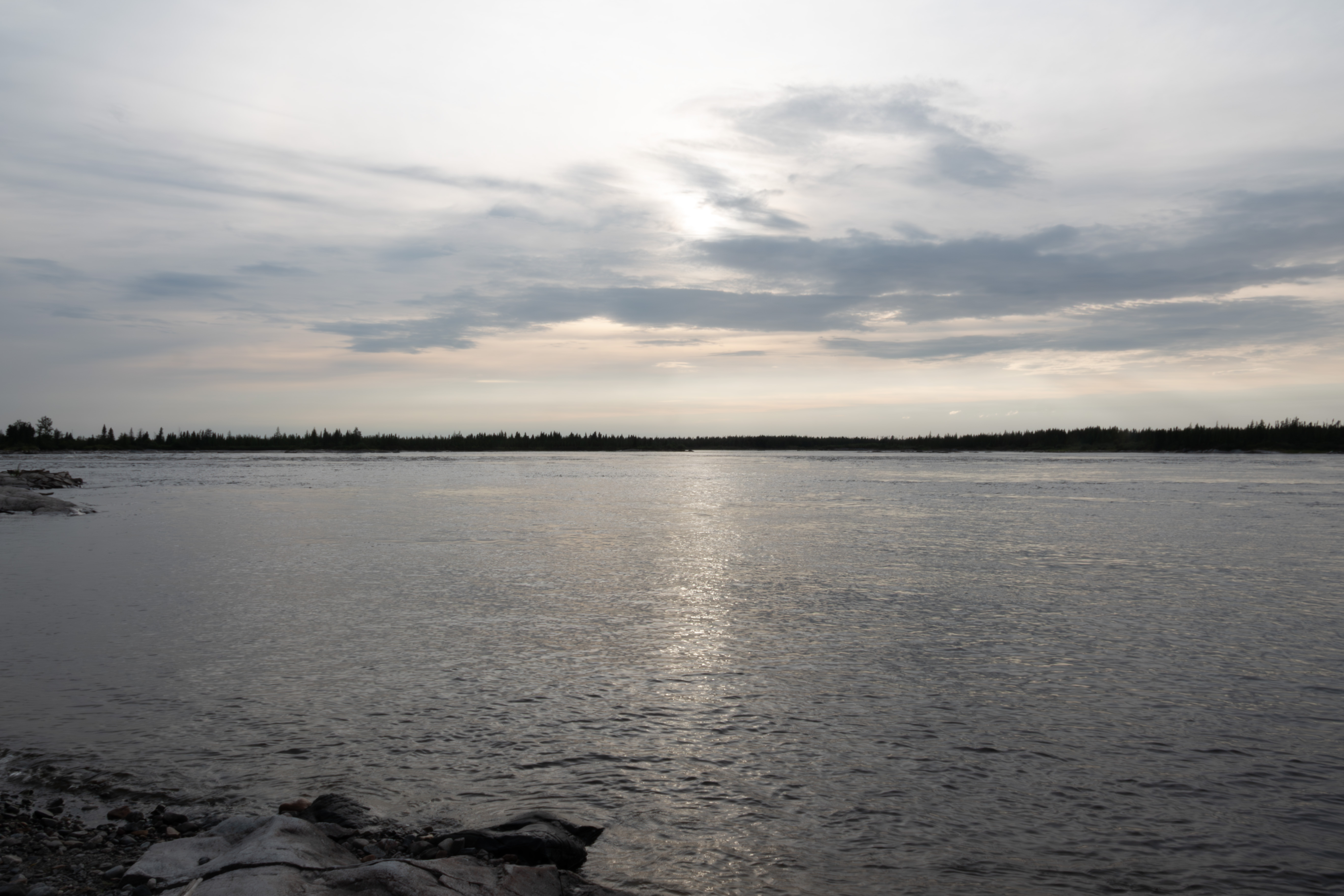
The next few photographs highlight several fishing spots. The first shows an overview of the campground, which sits at the mouth of the Sakami River.
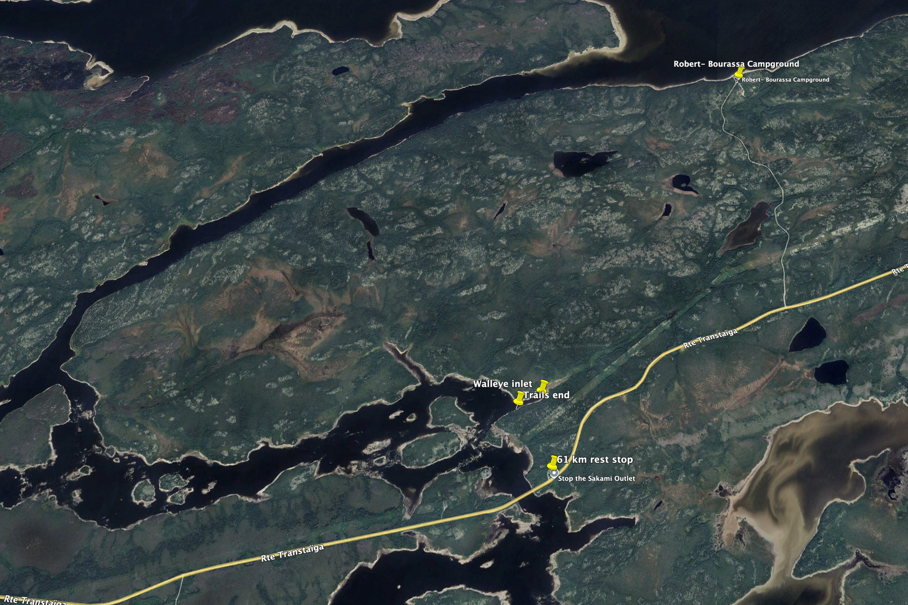
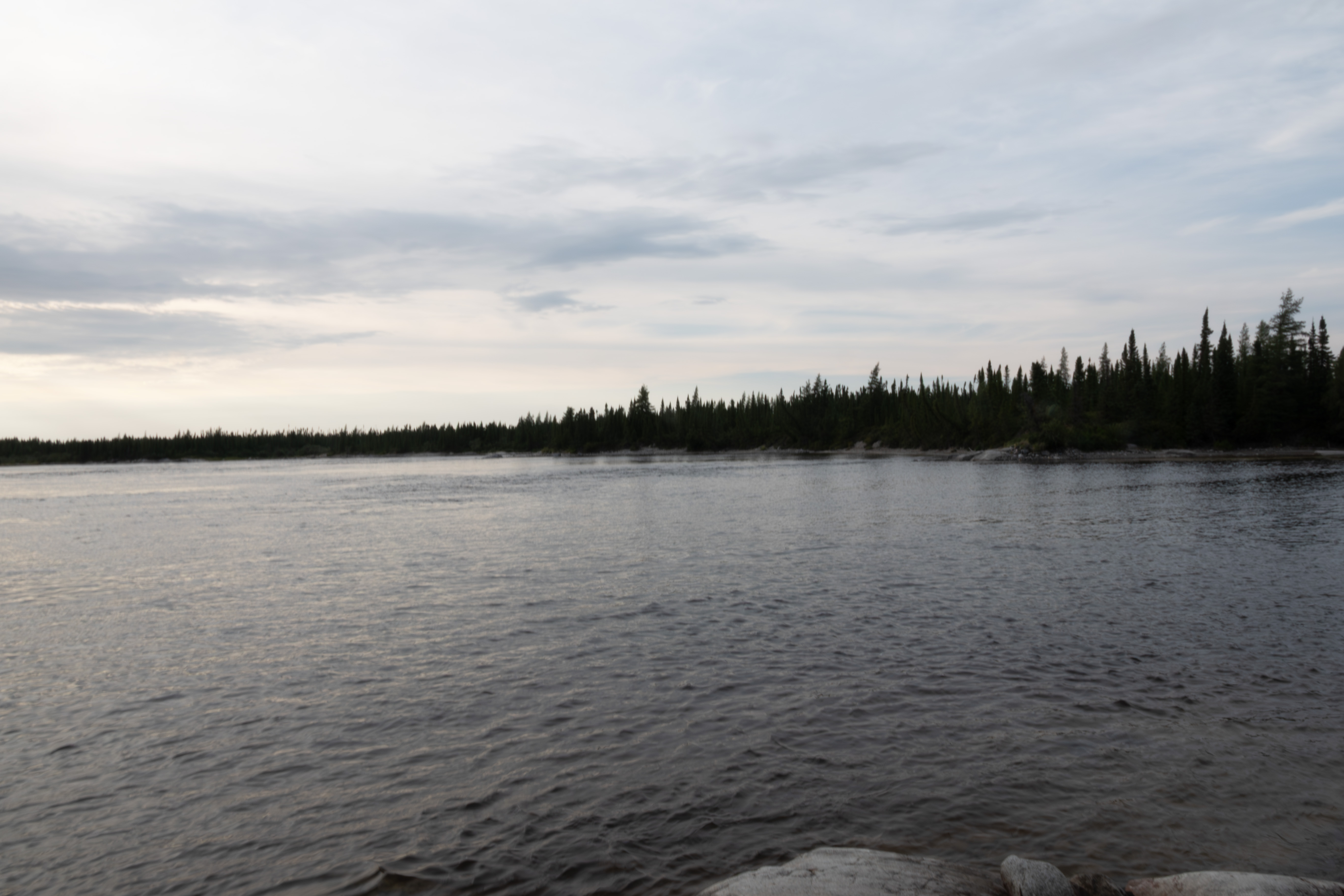
The second zooms in a bit. Now the point that I fished for northern pike is visible, just to the left of the campground. The campground is 3 km from the TTH.
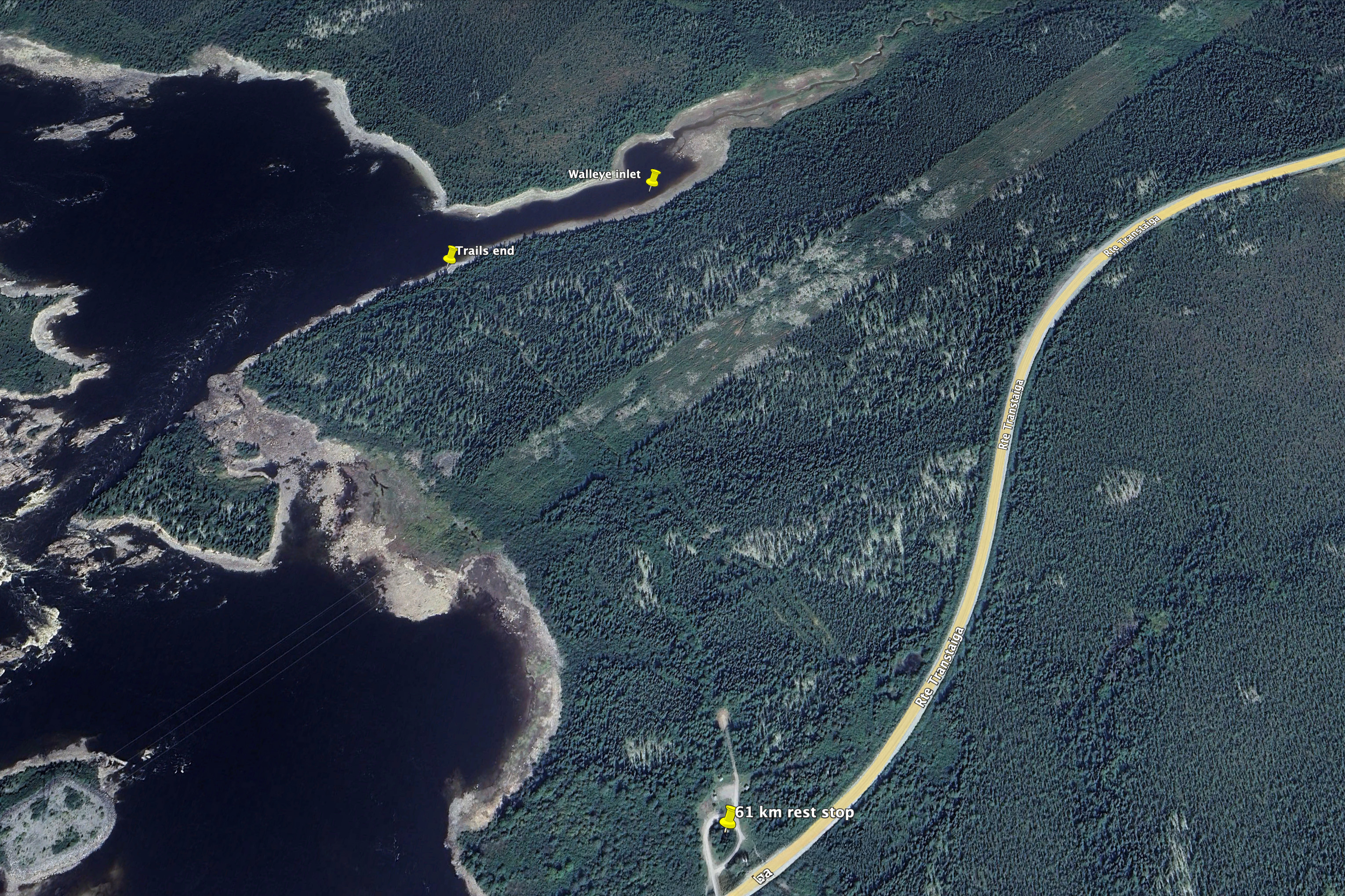
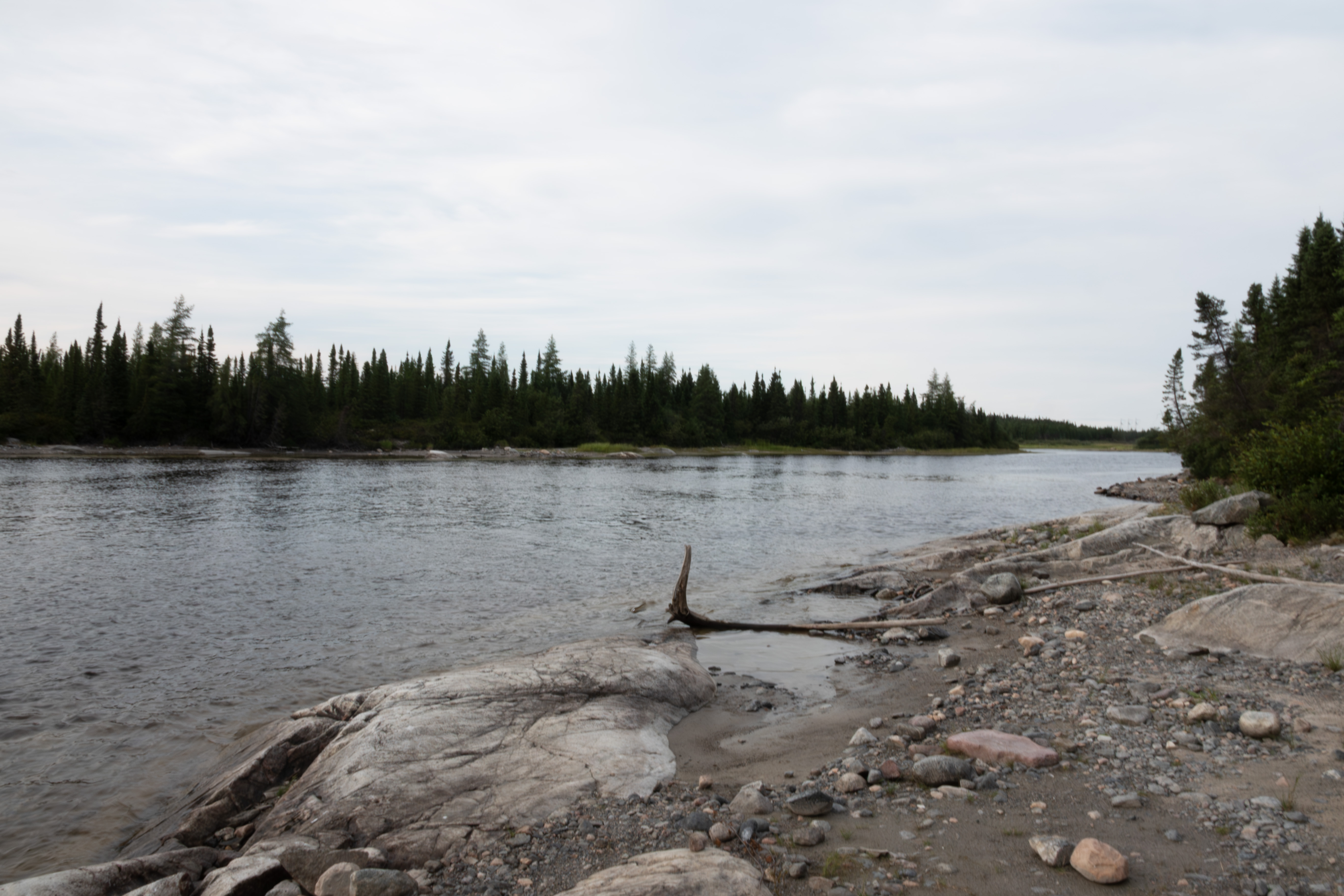
The third zooms in to highlight the 61 km rest stop and the inlet that I fished for walleye. This is the drainage for the fen that the campground road crosses. The hike from the rest stop is 10 minutes and although pretty easy, does get overgrown in the middle. You can see the trail if you focus on the Trails end marker. I named this the walleye inlet, as I caught 17 here over three days. This inlet was an eastuary. As opposed to a salt water esturay, freshwater estuaries form when a river's freshwater meets the distinct waters of a lake or other large freshwater body. They involve the mixing of two freshwater systems with differing chemical compositions, rather than the saltwater-freshwater mix of coastal estuaries. Freshwater estuaries are not affected by tides but experience standing waves called seiches, which are rhythmic sloshing motions of water, and I observed several different currents while fishing, sometimes my lure was pulled to the left, and in other locations pulled to the right, consistent with this. The Terns spent much time here feeding, as did the walleyes. I always hiked to this spot with my pole and camera, and got the best Tern shots here. I fished about 20 yards to the right and 50 yards to the left of the marker, as to the right it got shallow and weedy, and to the left were rapids, visible in this image.
August 11th, my last day on the TTH. I photographed more Terns, trying to capture the dive. Did not get great photographs, partly due to the limitations of the Sony RX10iv camera - I did not want to risk carrying my Nikon Z8 and 9 ($$$) cameras through the brush.
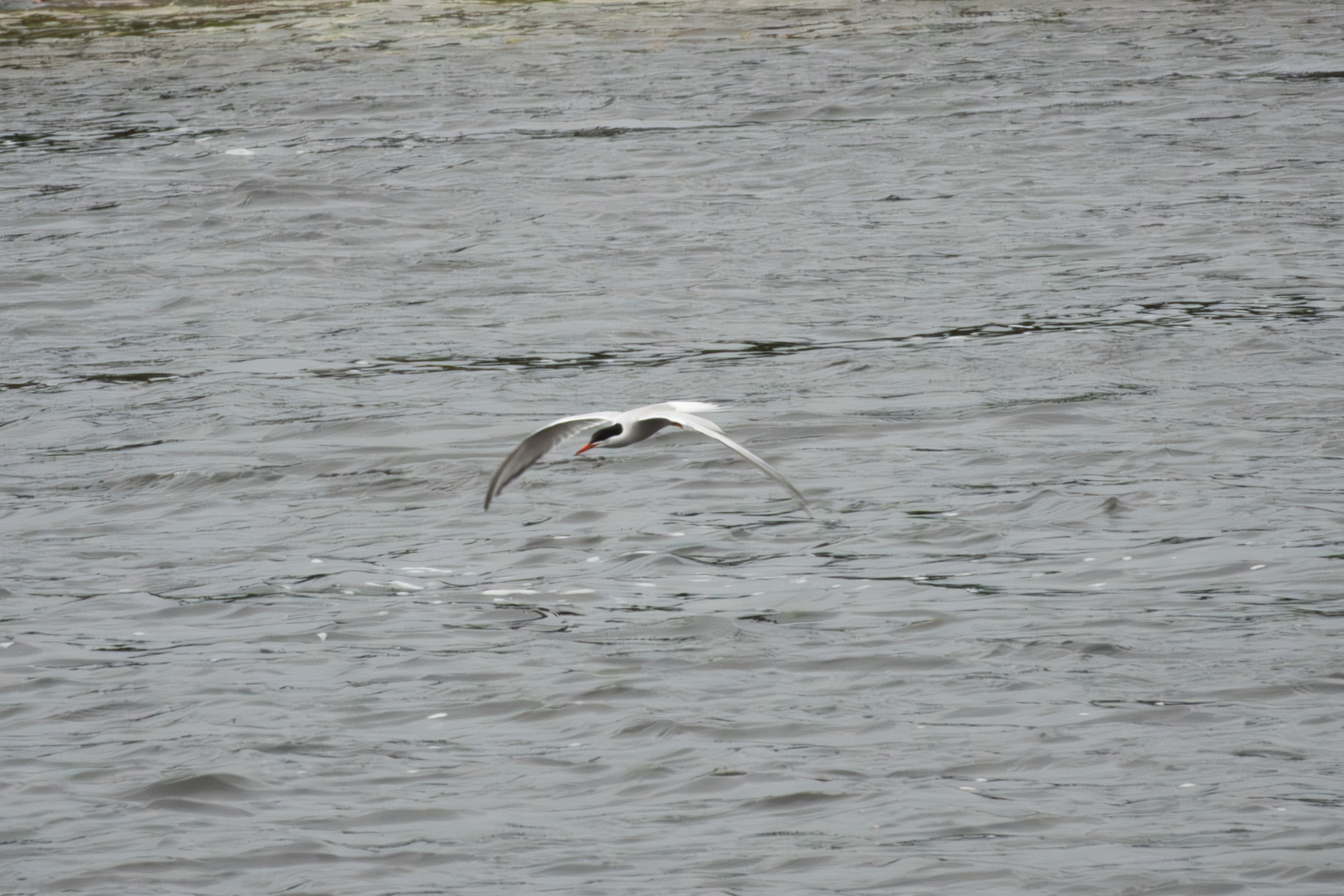
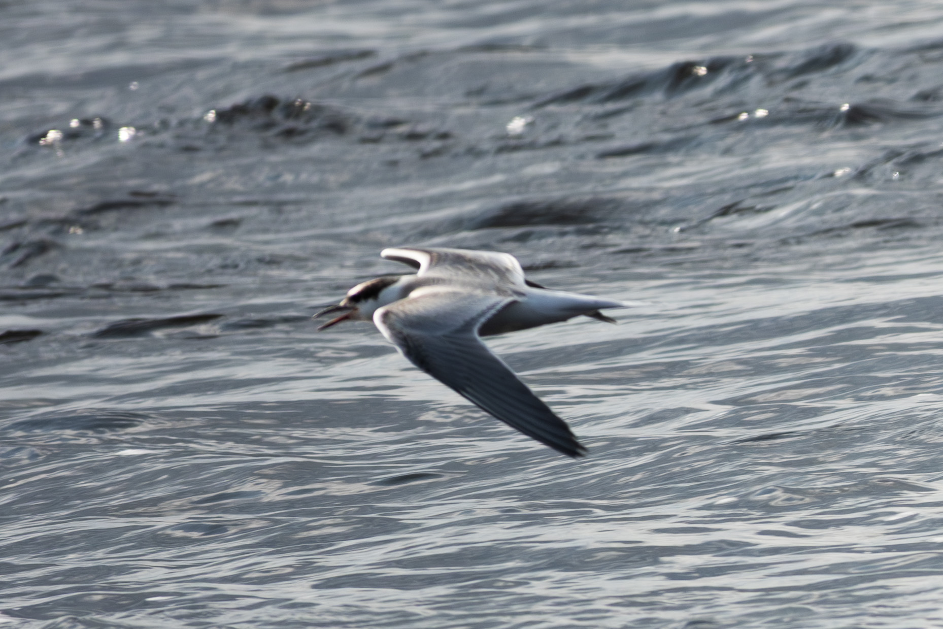
Here is one looking for prey.
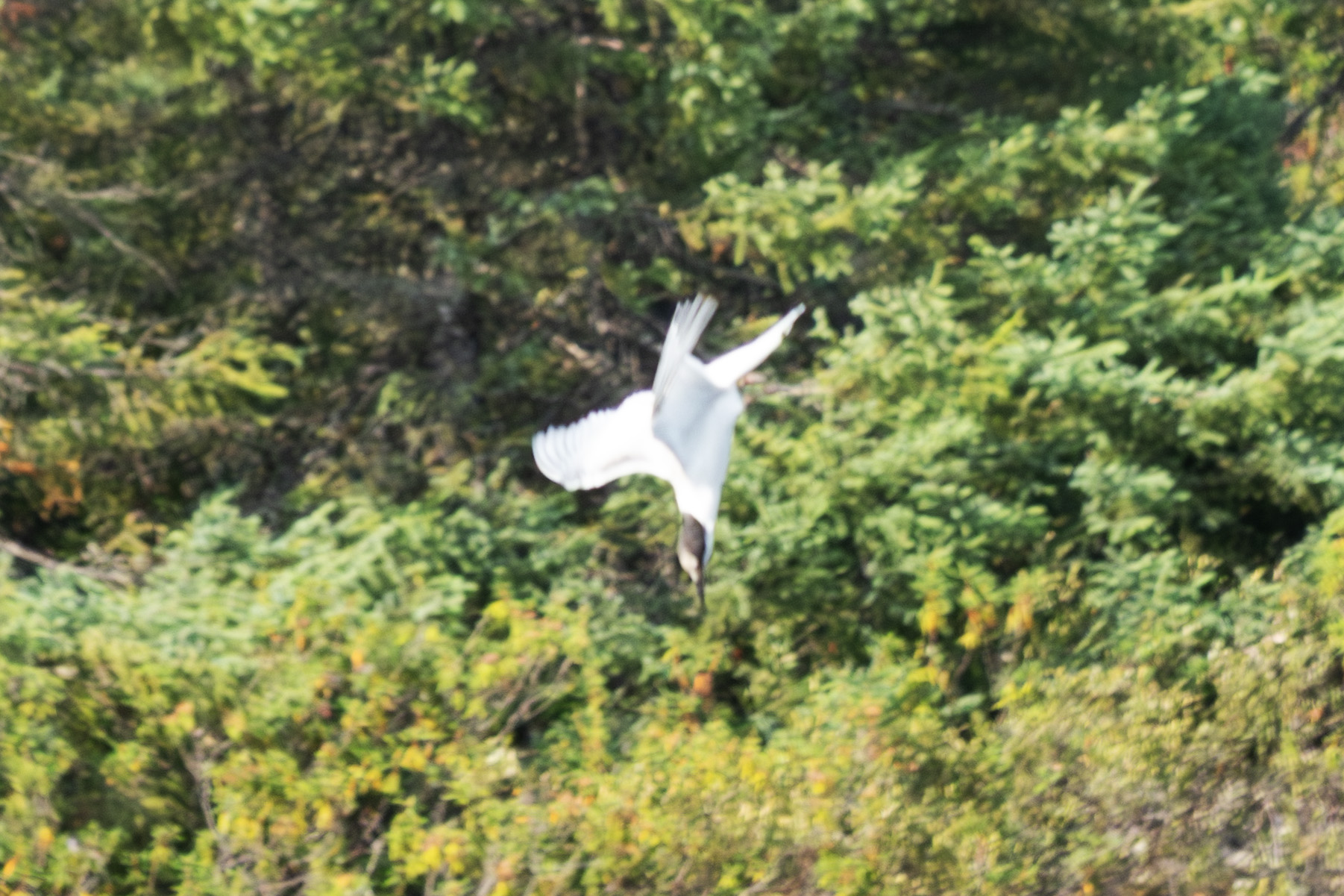
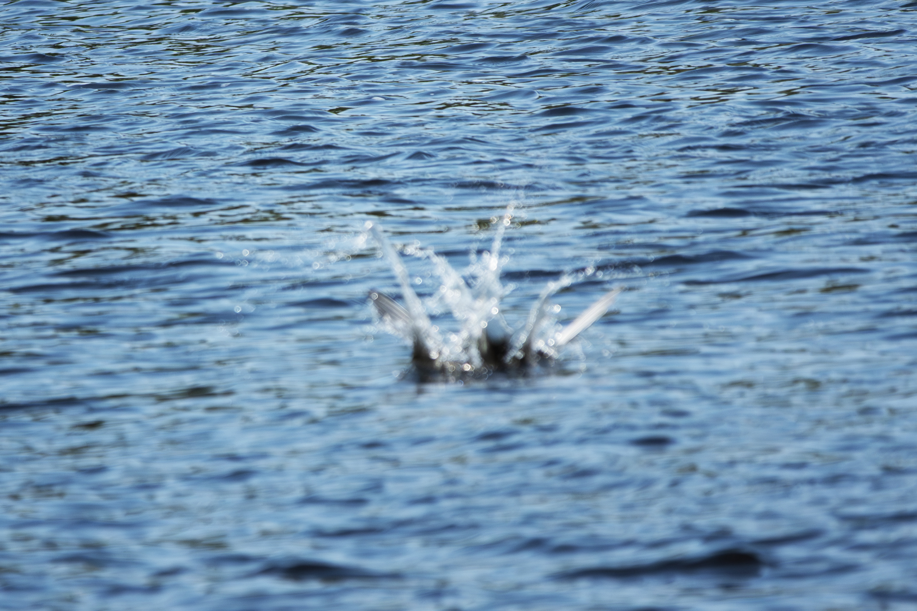
The dive.
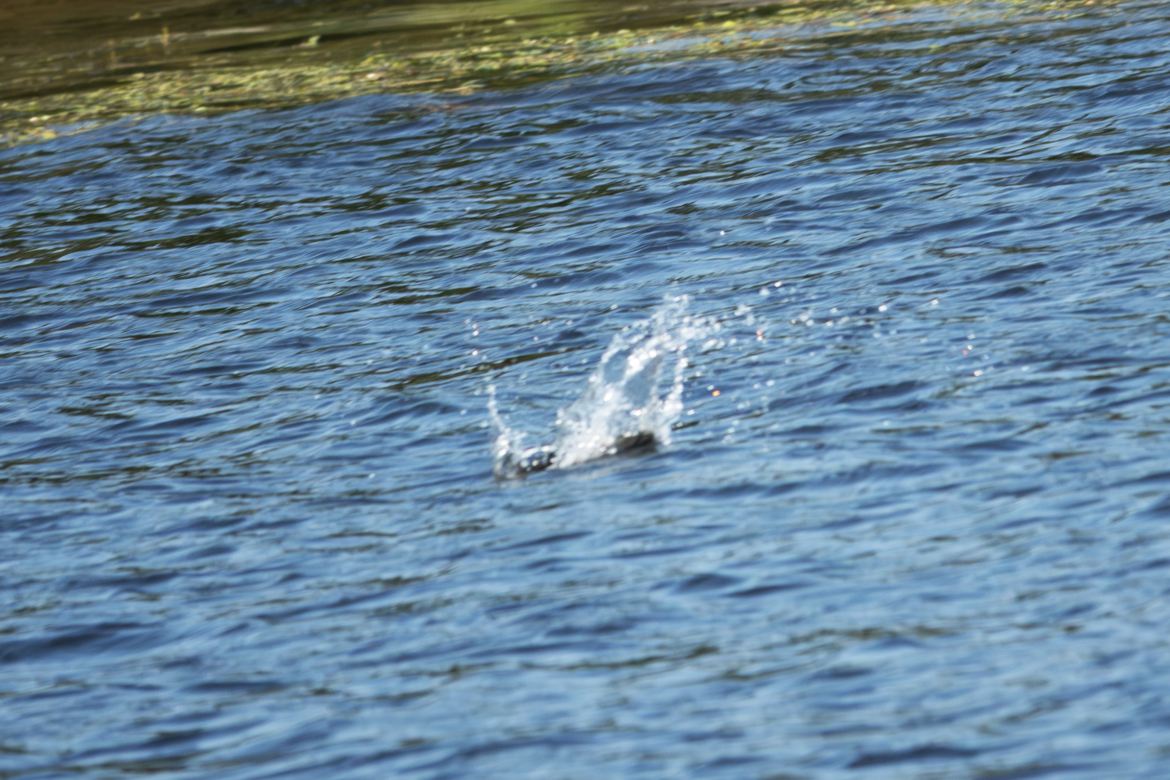
Splash down!
And the recovery.
I first saw the Terns over the big waters of the reservior, usually in groups of 3. Very noisy, almost angry. They did not stay long in any one place over the big waters, but spent hours at the inlet, likely due to lots of prey. These were all shot at shutter speeds of 1/2000, unusual for me.
Another batch of walleye.
An American Toad.
Mom with the youngsters.
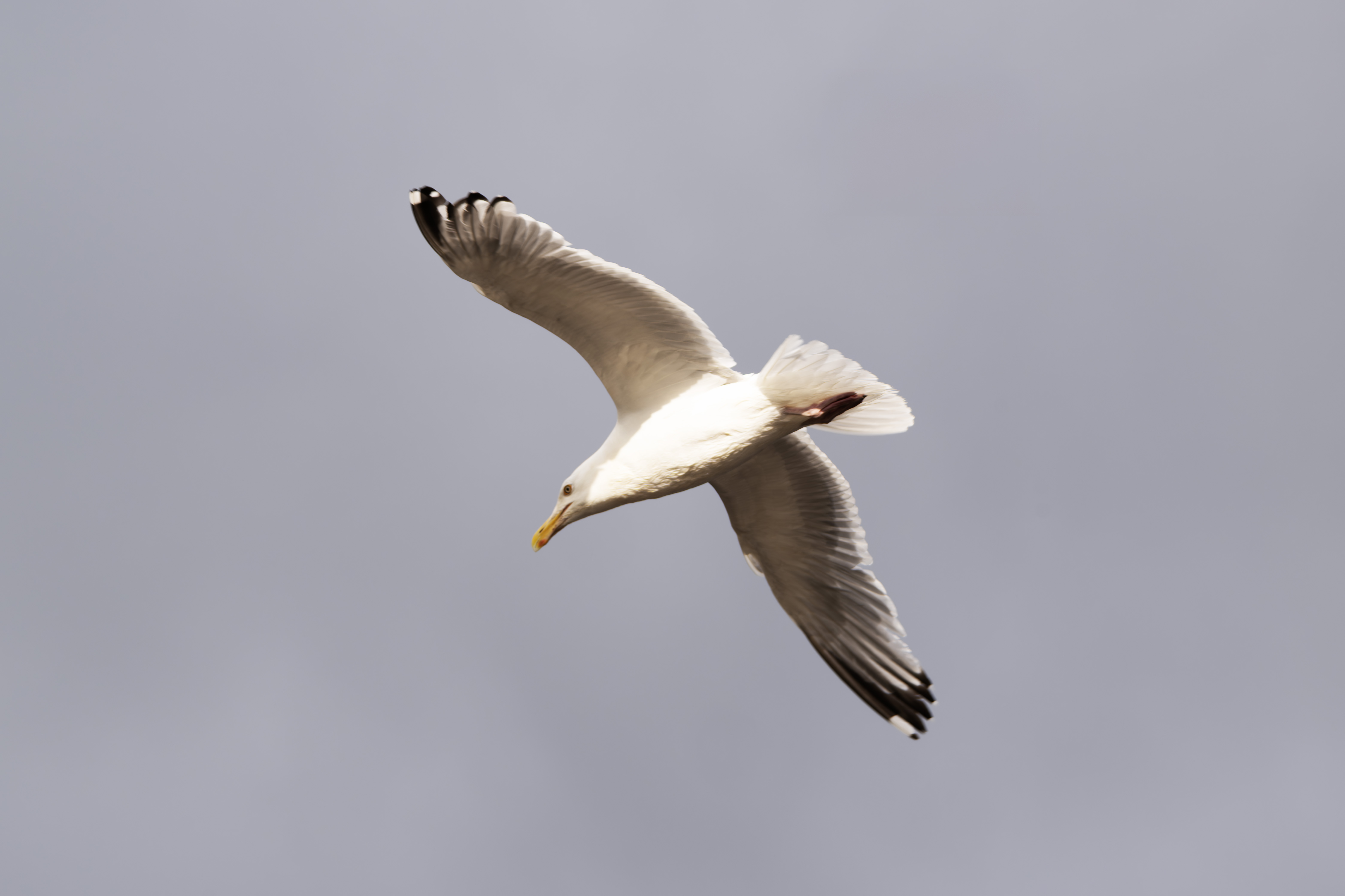
A wing shot. These are all Herring Gulls.
Resting.
Typical squawking youngster. I lost my patience several times and threw rocks to move them.
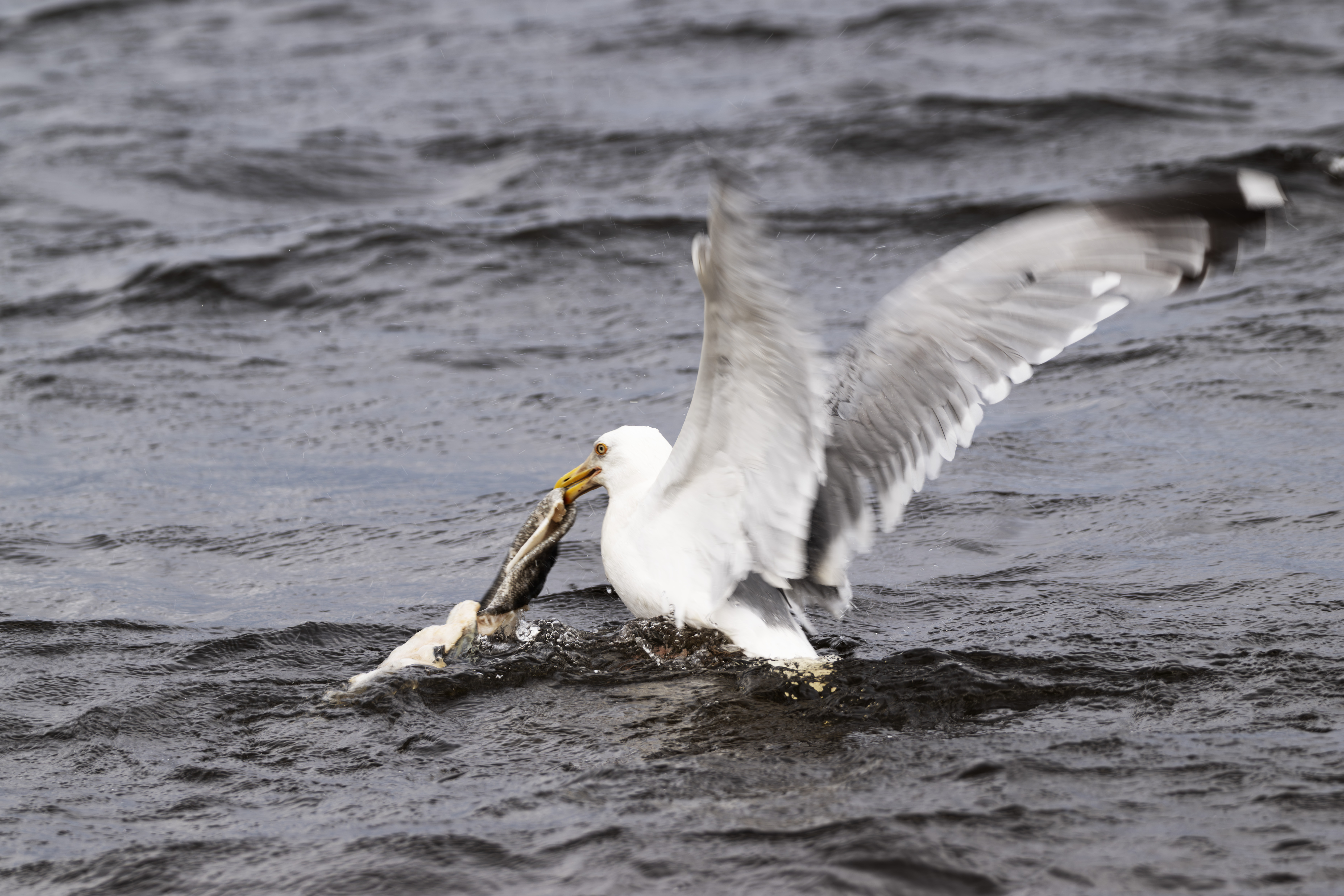
Mom just dove and recovered a northern pike carcass.
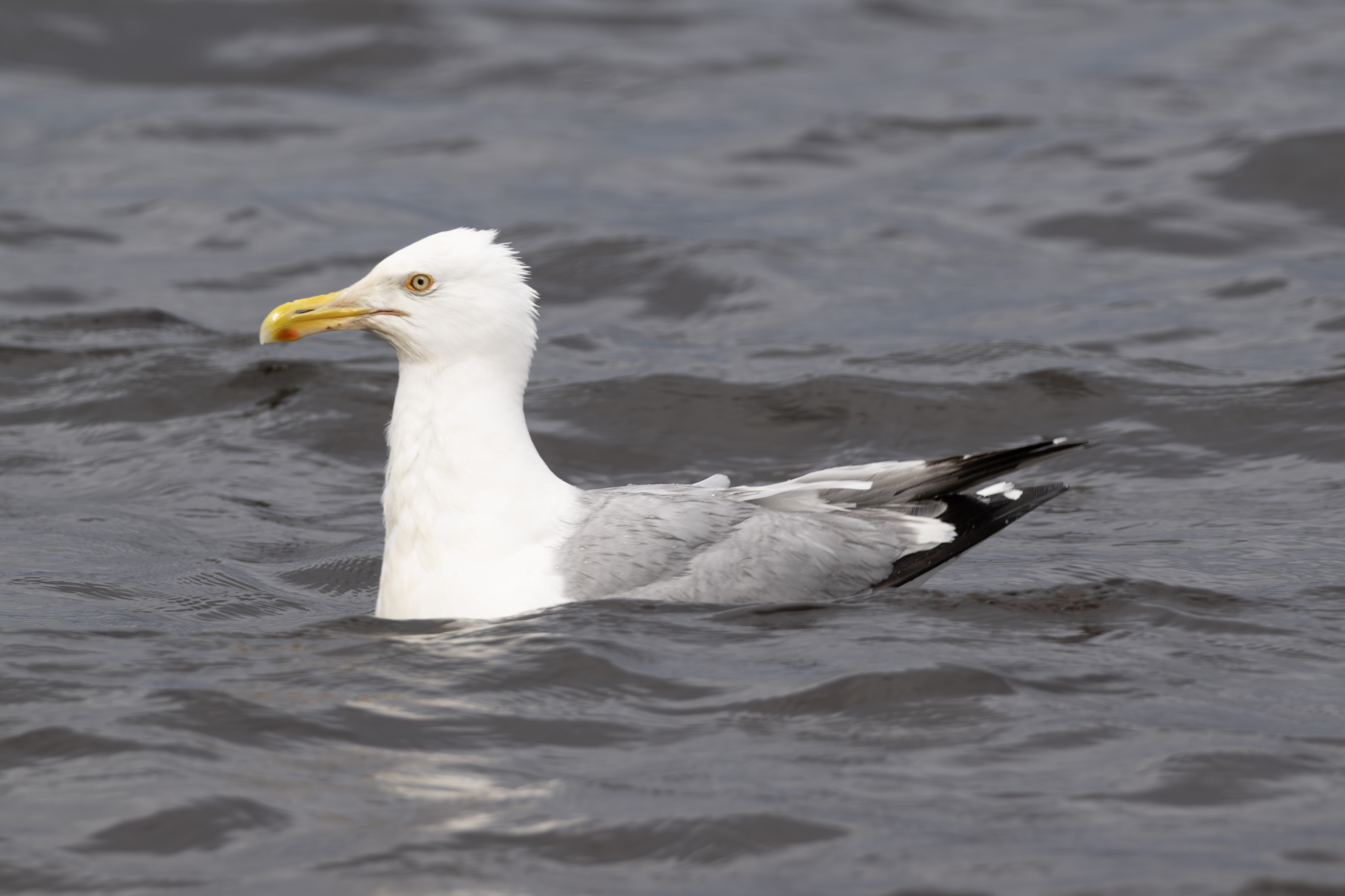
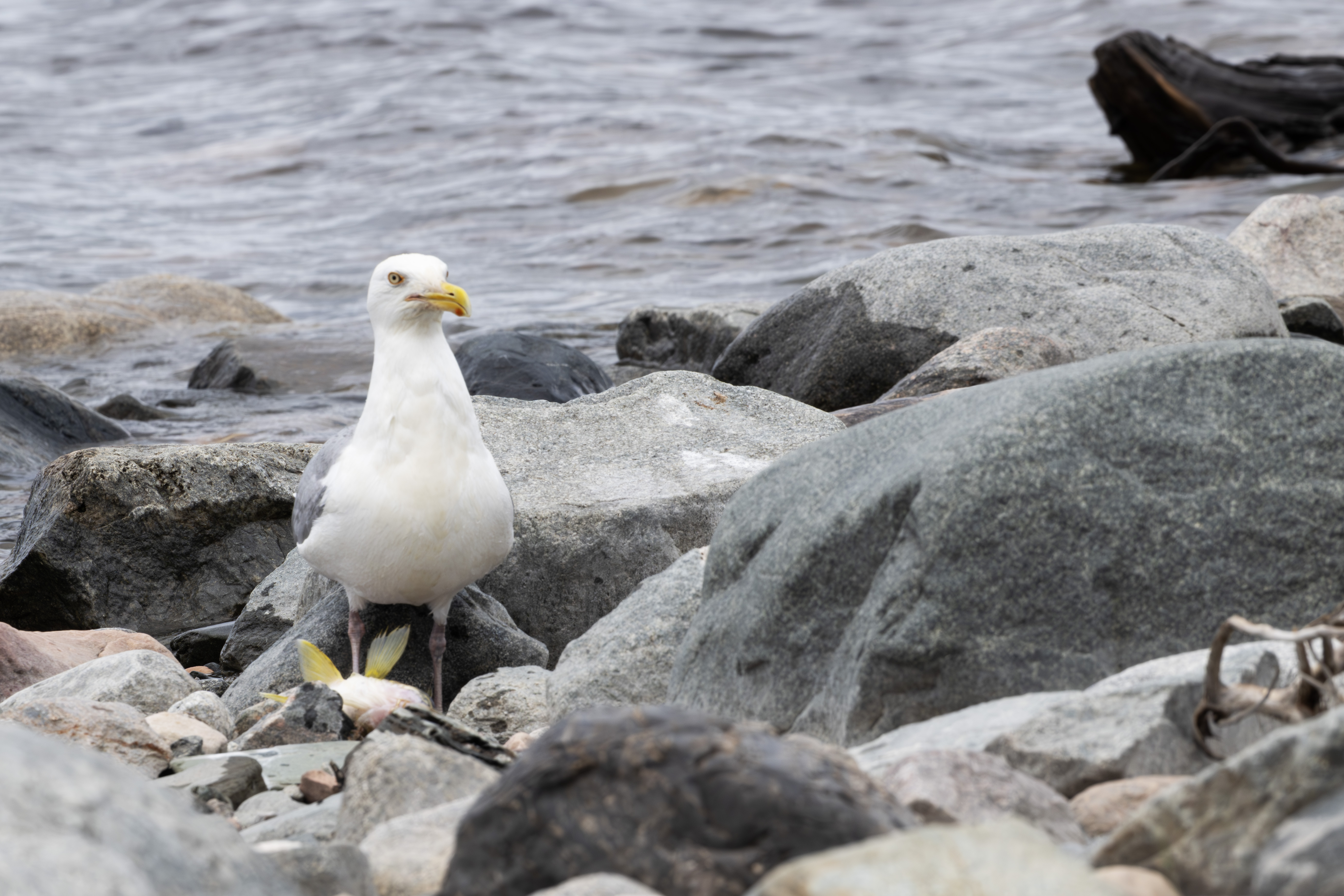
Catching her breath.
And the young benefit.
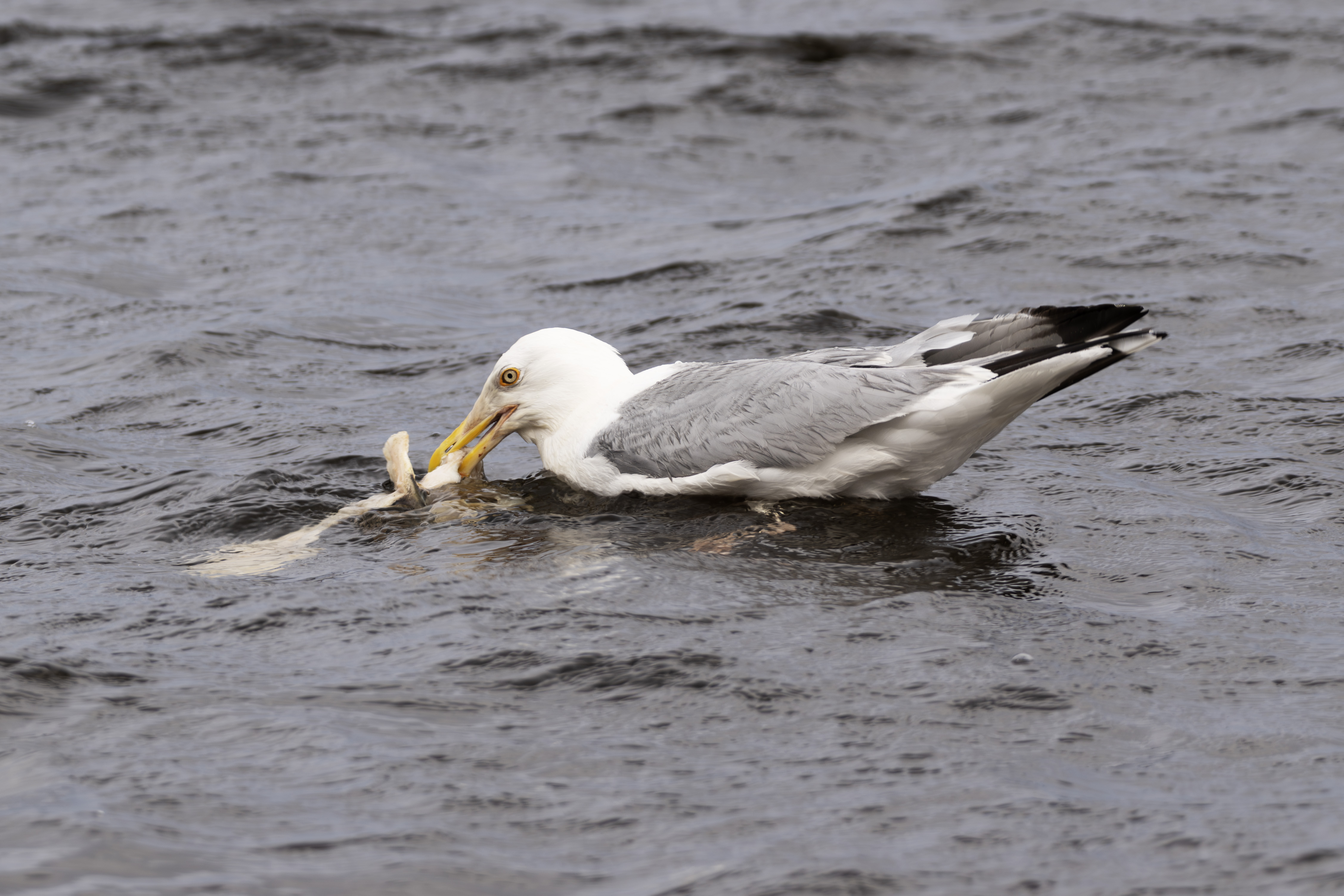
This is another dining on a walleye carcass.
From the shore of the inlet, looking to the rough water, visible in the upper left corner.
Panned to look straight ahead from the shore, ie, to the right of the previous photograph.
And now further to the right, looking at the source of the inlet. The log in the middle was were I usually tied my stringer.
Another four walleye.
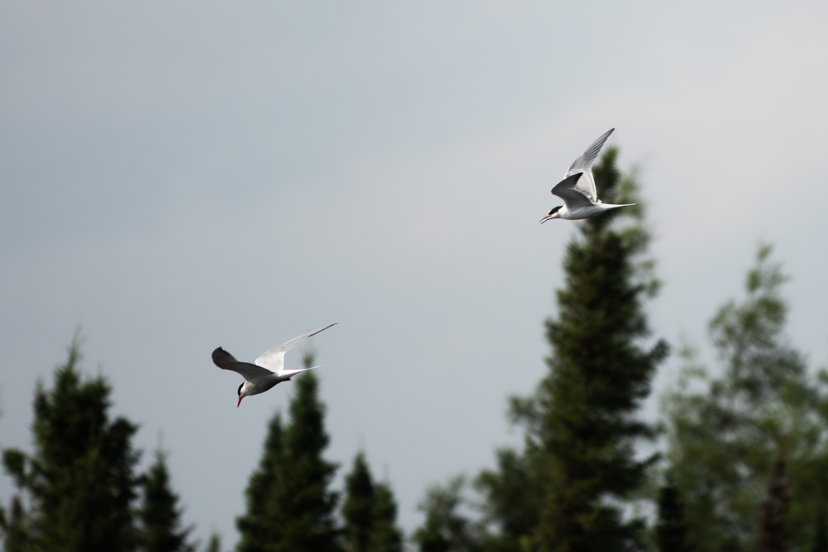
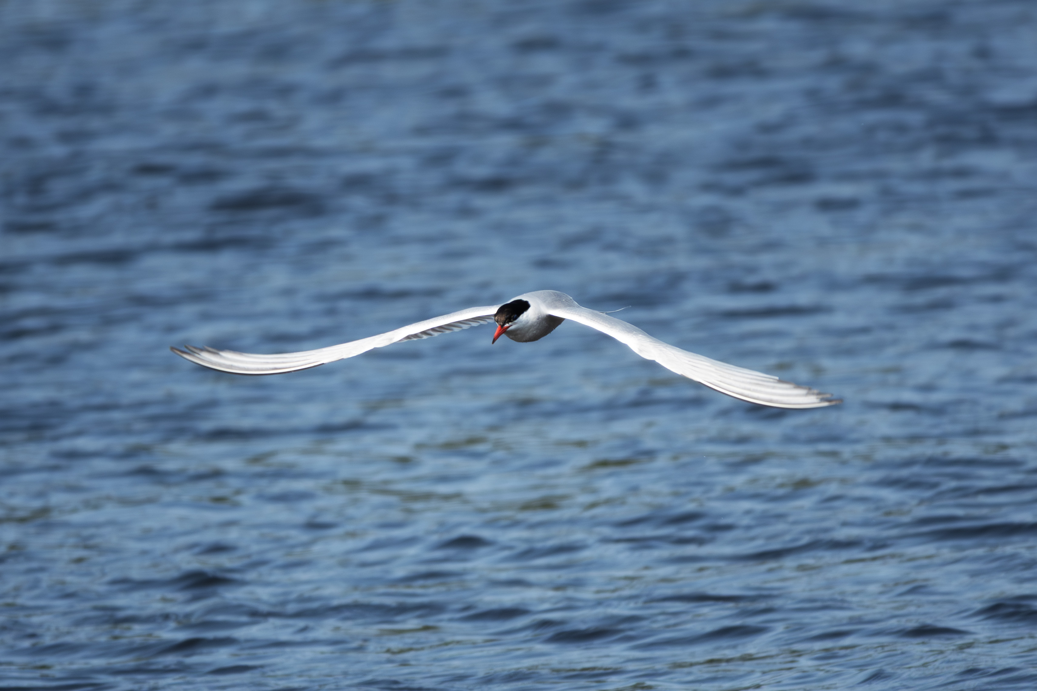
Managed some nice in flight Tern photographs.
Another.
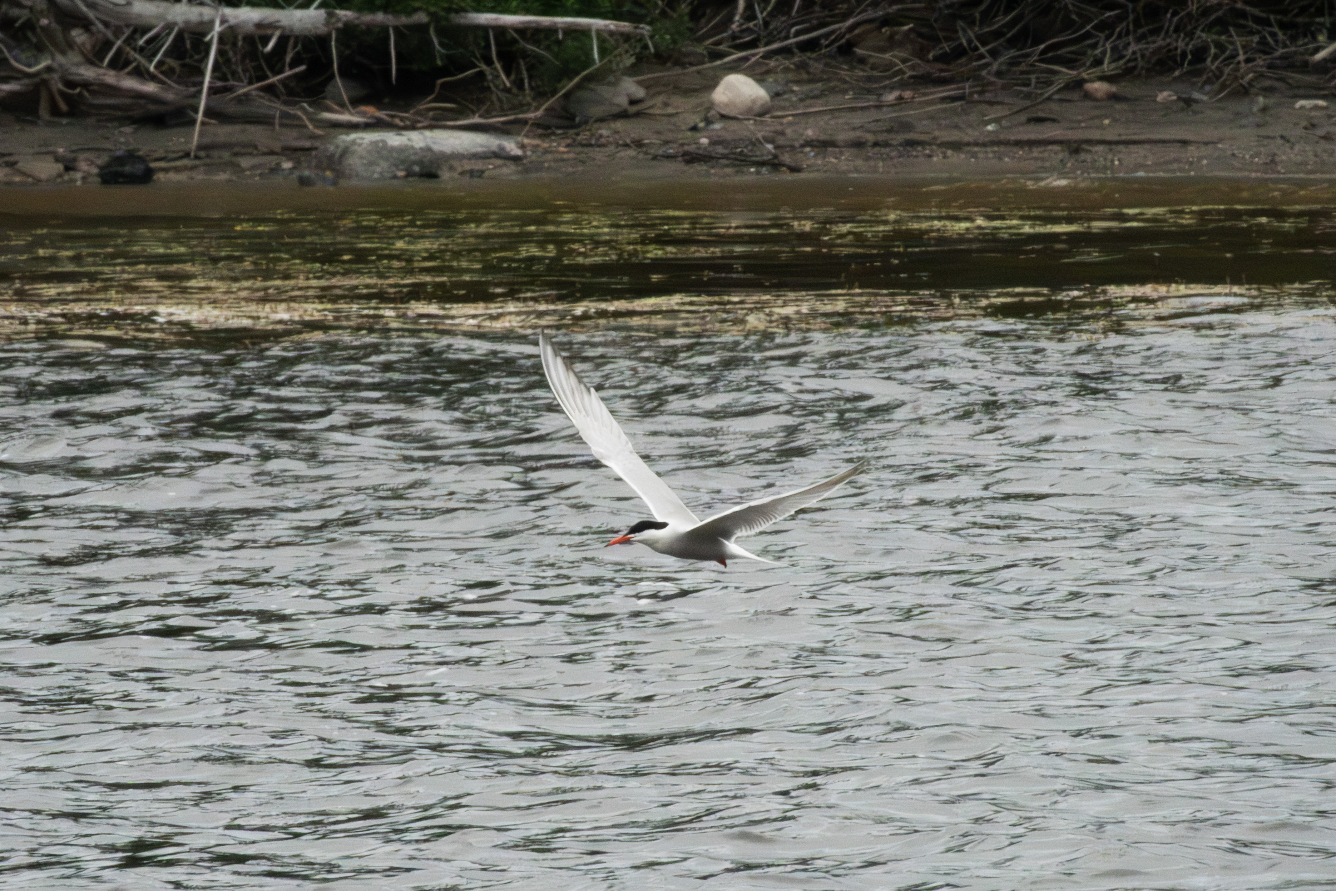
My favorite Tern photograph.
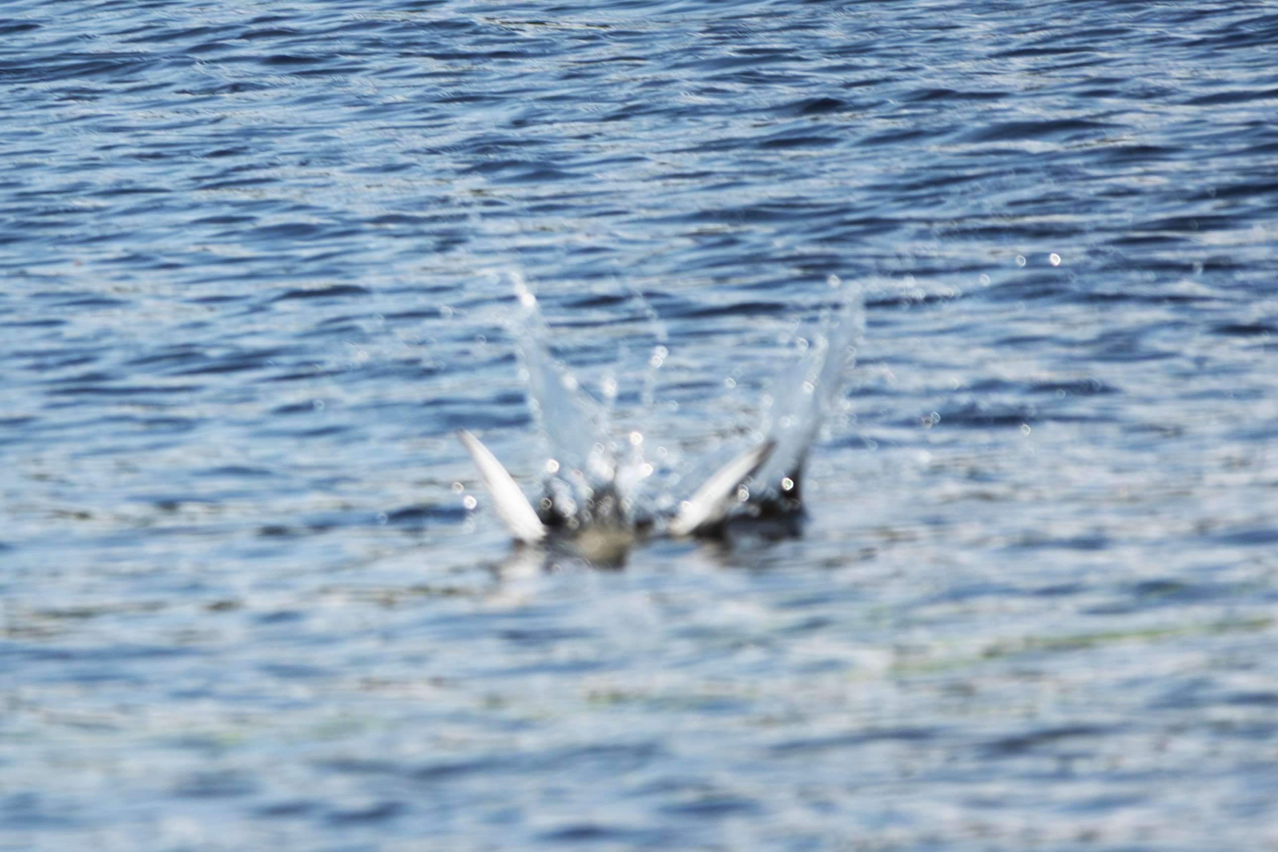
Another splash down, showing feathers.
The last one.
The last six walleye that I caught.
This is the beginning of the fen that feeds into the inlet, photographed from the campground access road.
A typical P. faunus feeding on the road near the fen.
These are the rapids under the bridge that pass to the left of the inlet, which is on the right.
August 13th was a travel day, with a stop at the 381 km truck stop to repair a tire, my second flat. I need to invest in a portable compressor and 10 ply tires. On the way, I photographed this sscene along the James Bay Highway. These look pretty neat, the small stunted spruce and shrubs growing in patches next to a normal spruce bog.
Another of those rock formations so common in Quebec.
The Rupert River was steaming, as today, August 13th, was cool after several warm days.
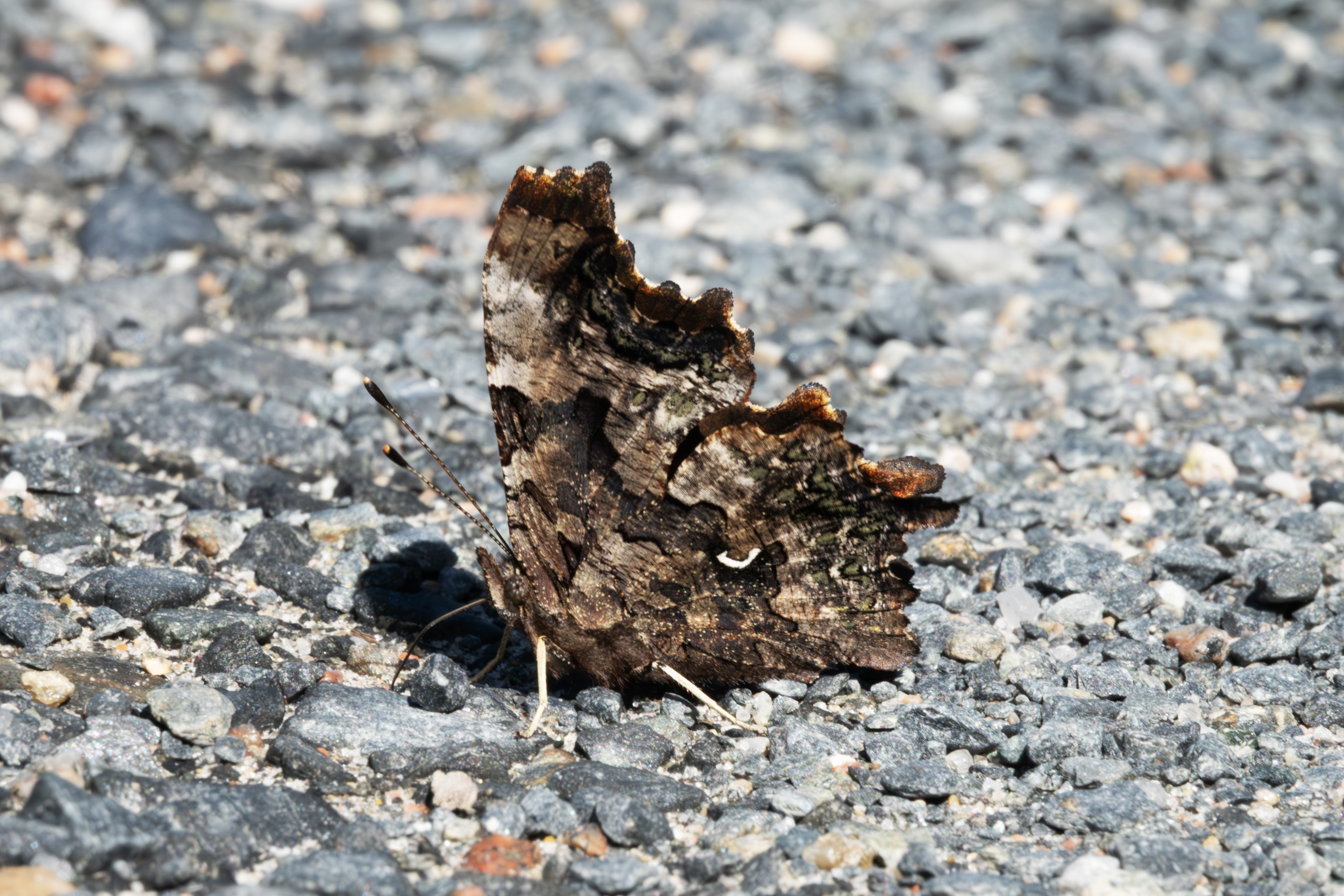
August 14th, I returned to Route 1055 near Matagami and visited the gravel pit. P. faunus was now on the wing.
Another specimen.
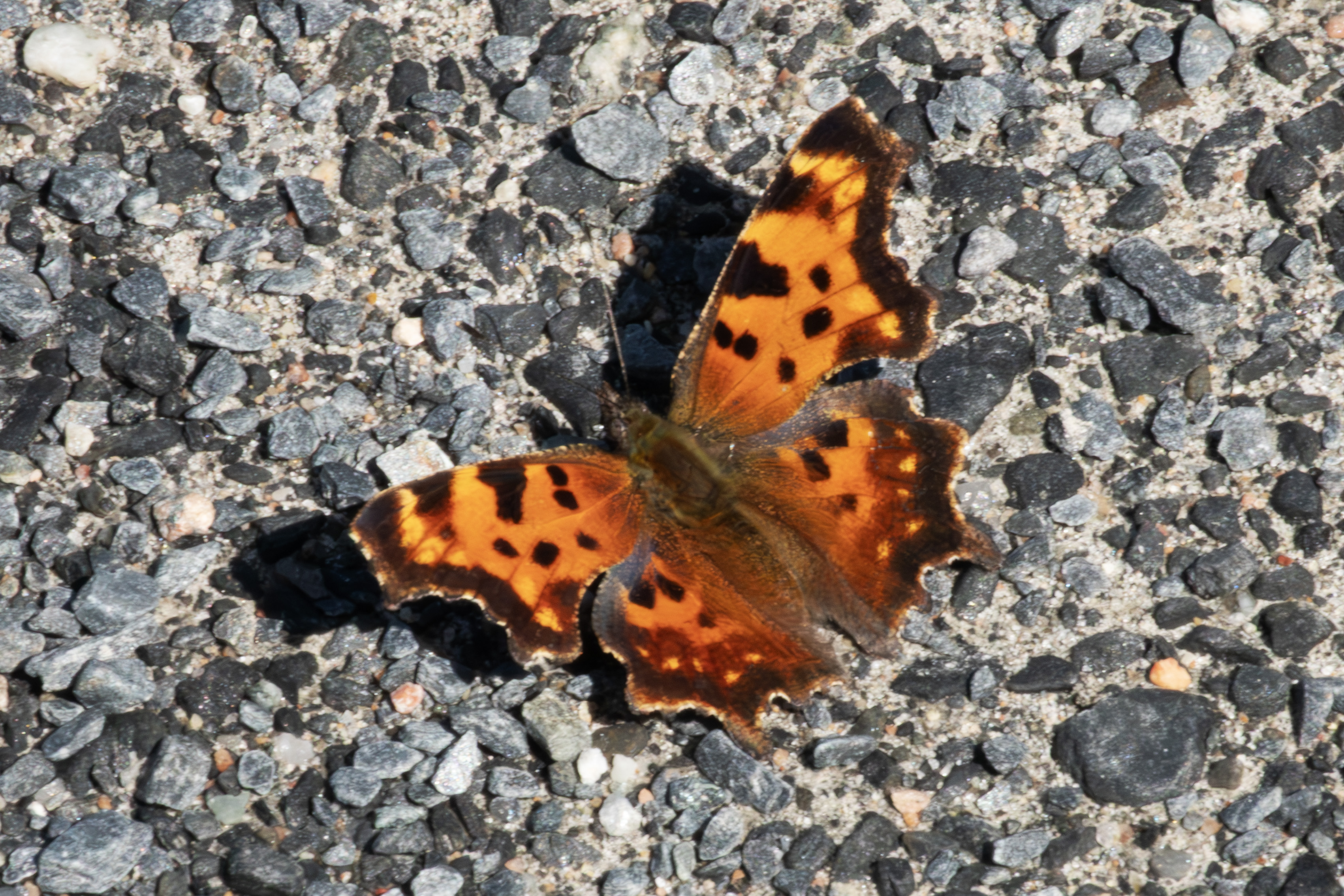
A dorsal photograph.
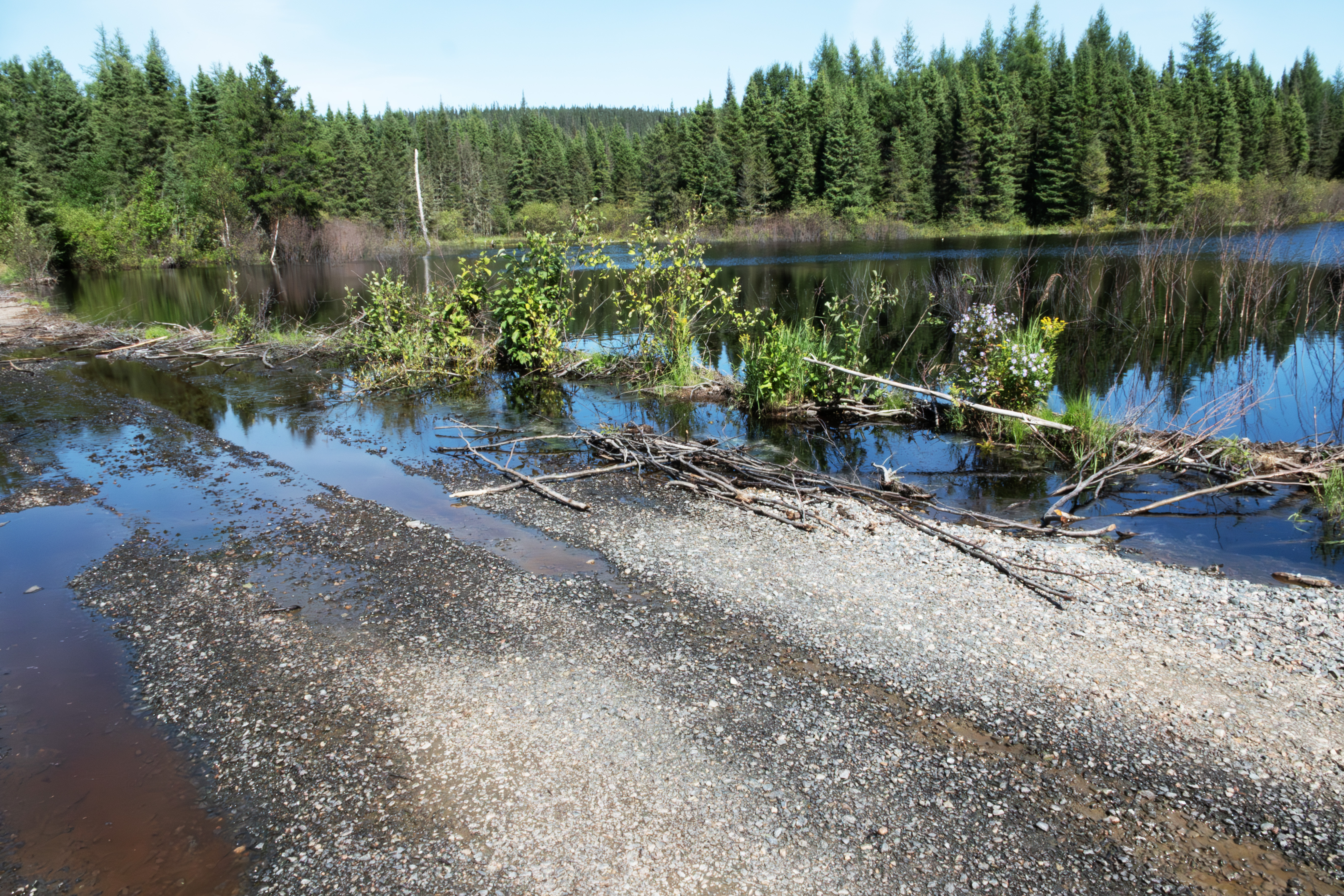
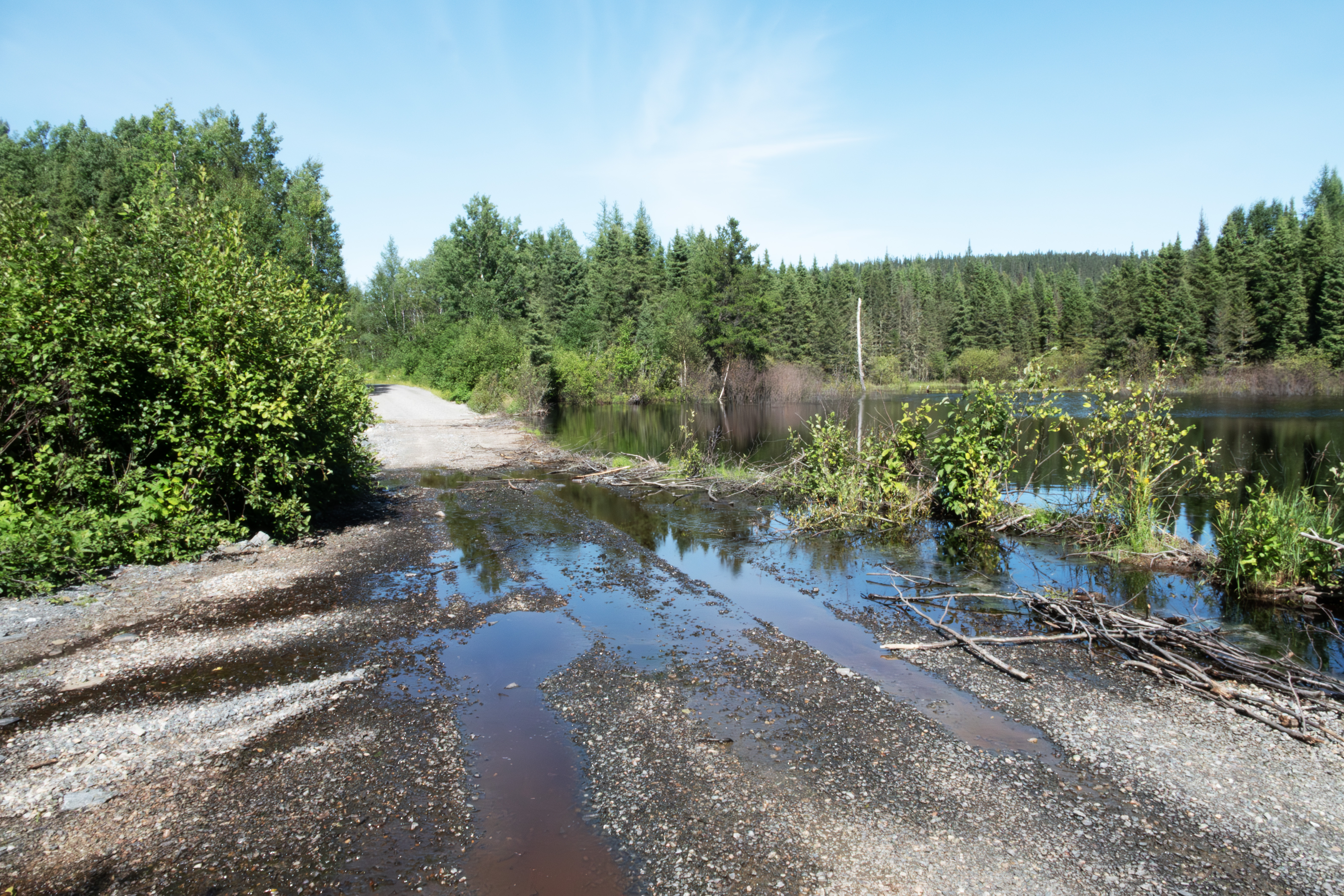
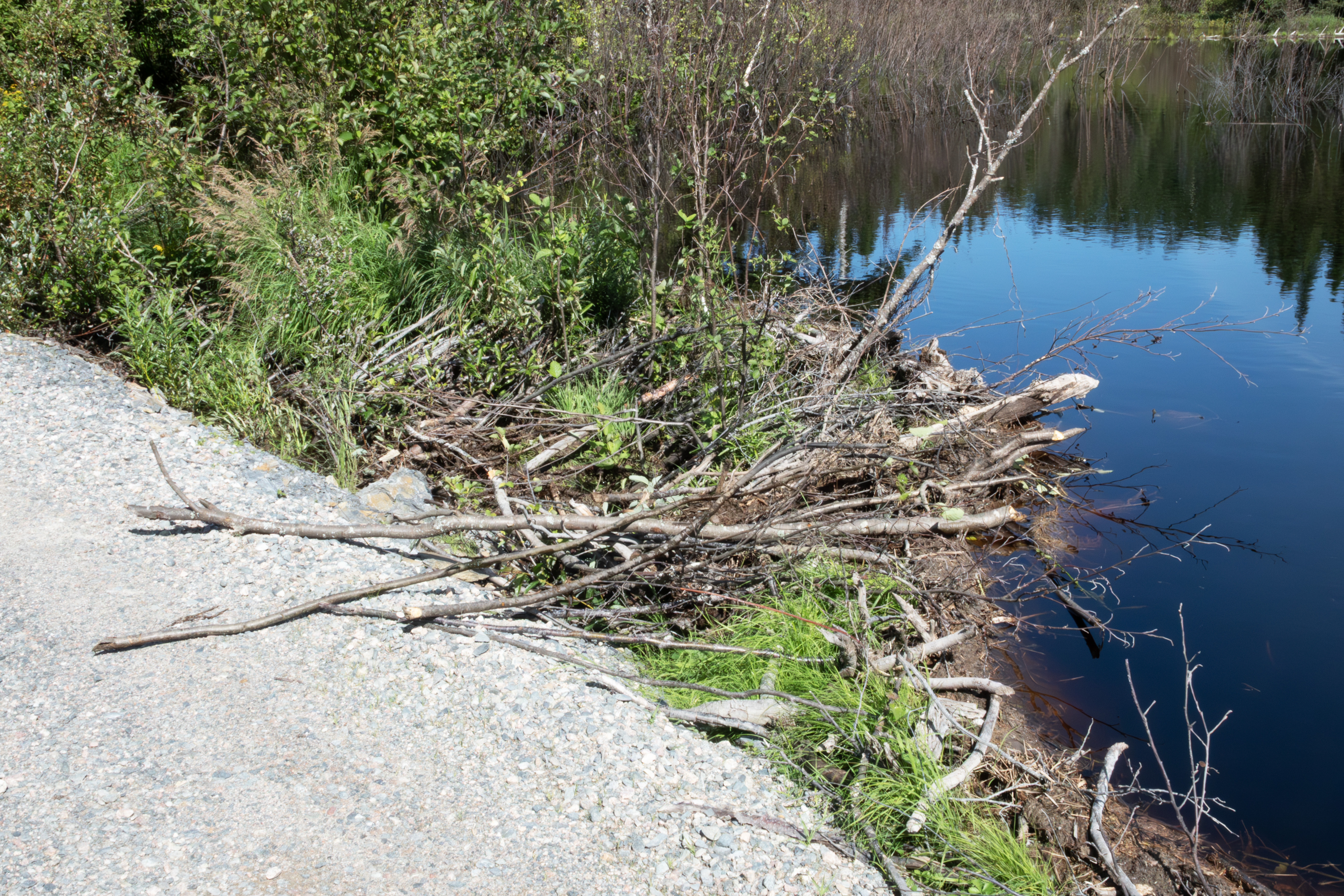
I had an interesting experience at the beaver dam. First, this photograph is looking toward Route 1055 and shows the overflow caused by the dam.
And this is looking toward the dam.
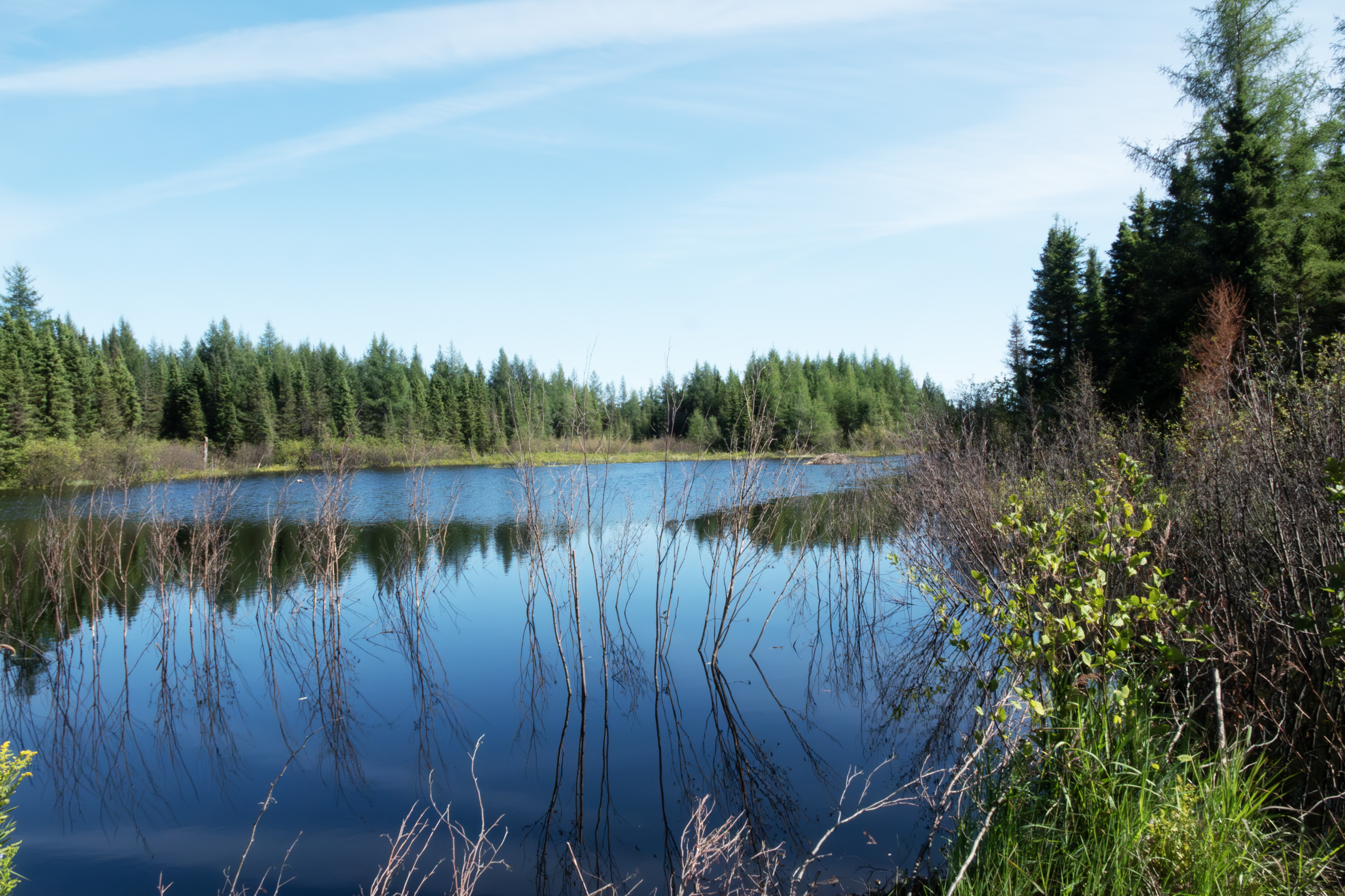
Same view, tweaked.
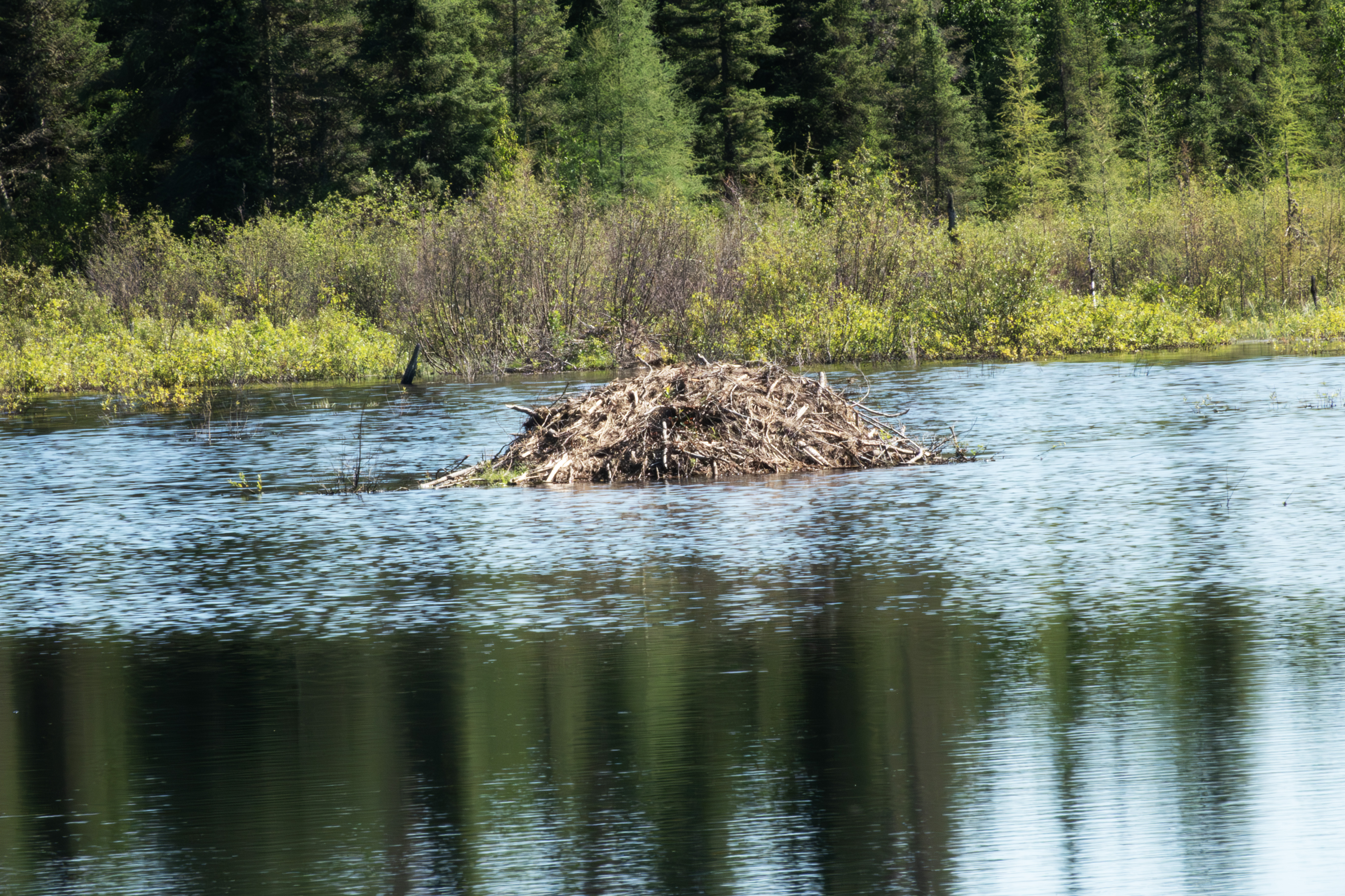
The lodge in the distance.
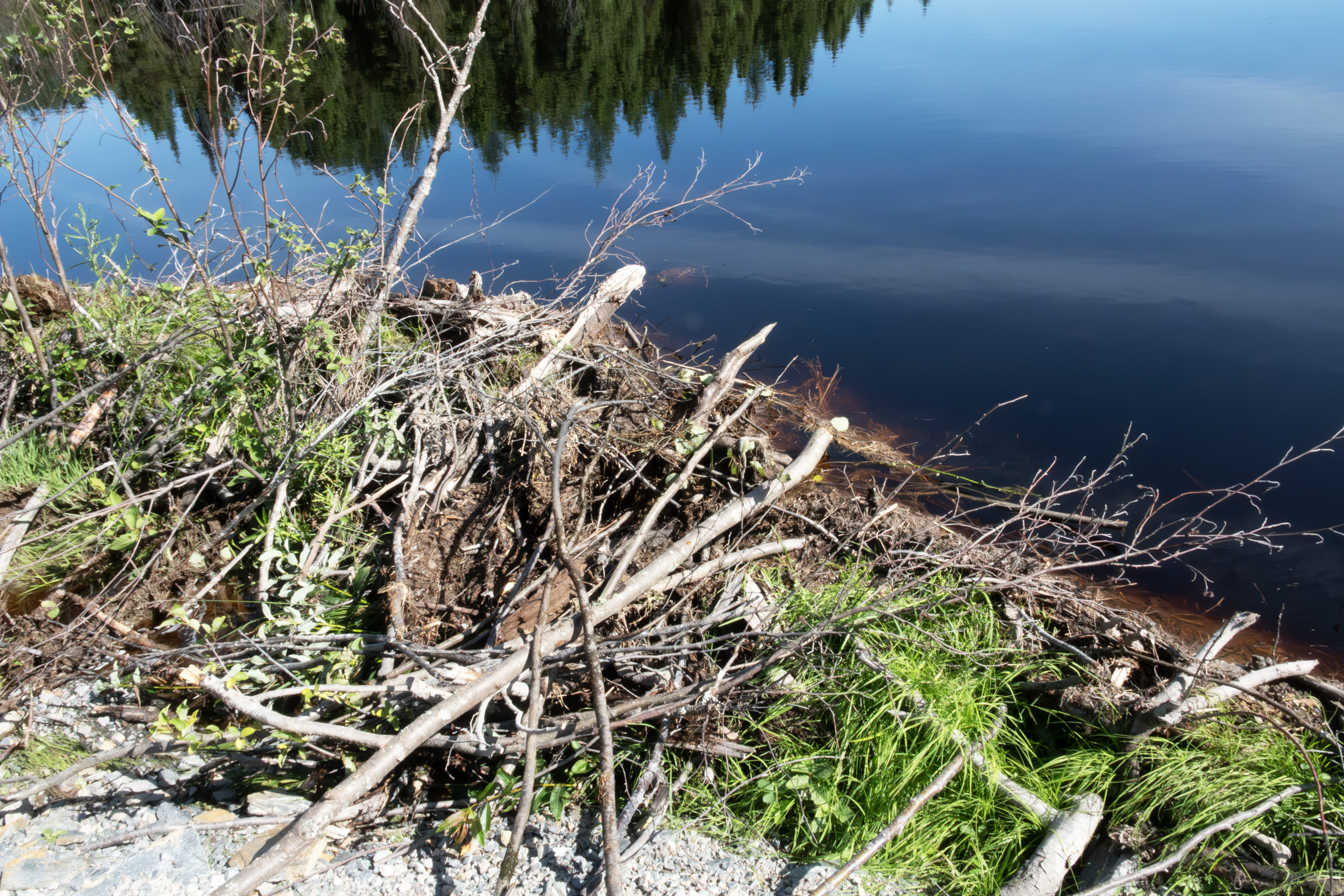
I tried to capture the beaver's efforts in this photograph.
And this shows their engineering skills.
Closer view of the lodge.
Another showcasing the beaver's efforts and skills.
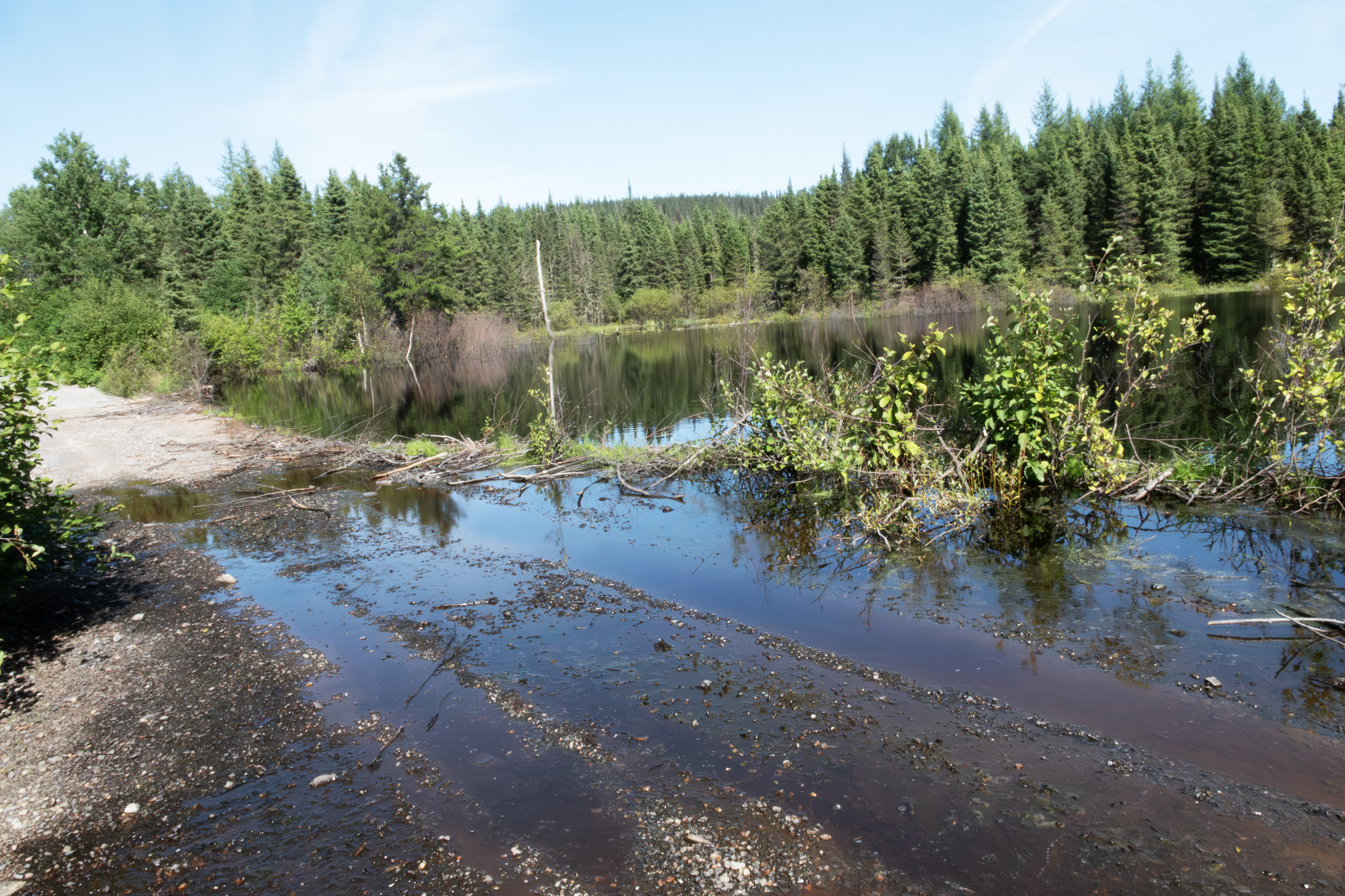
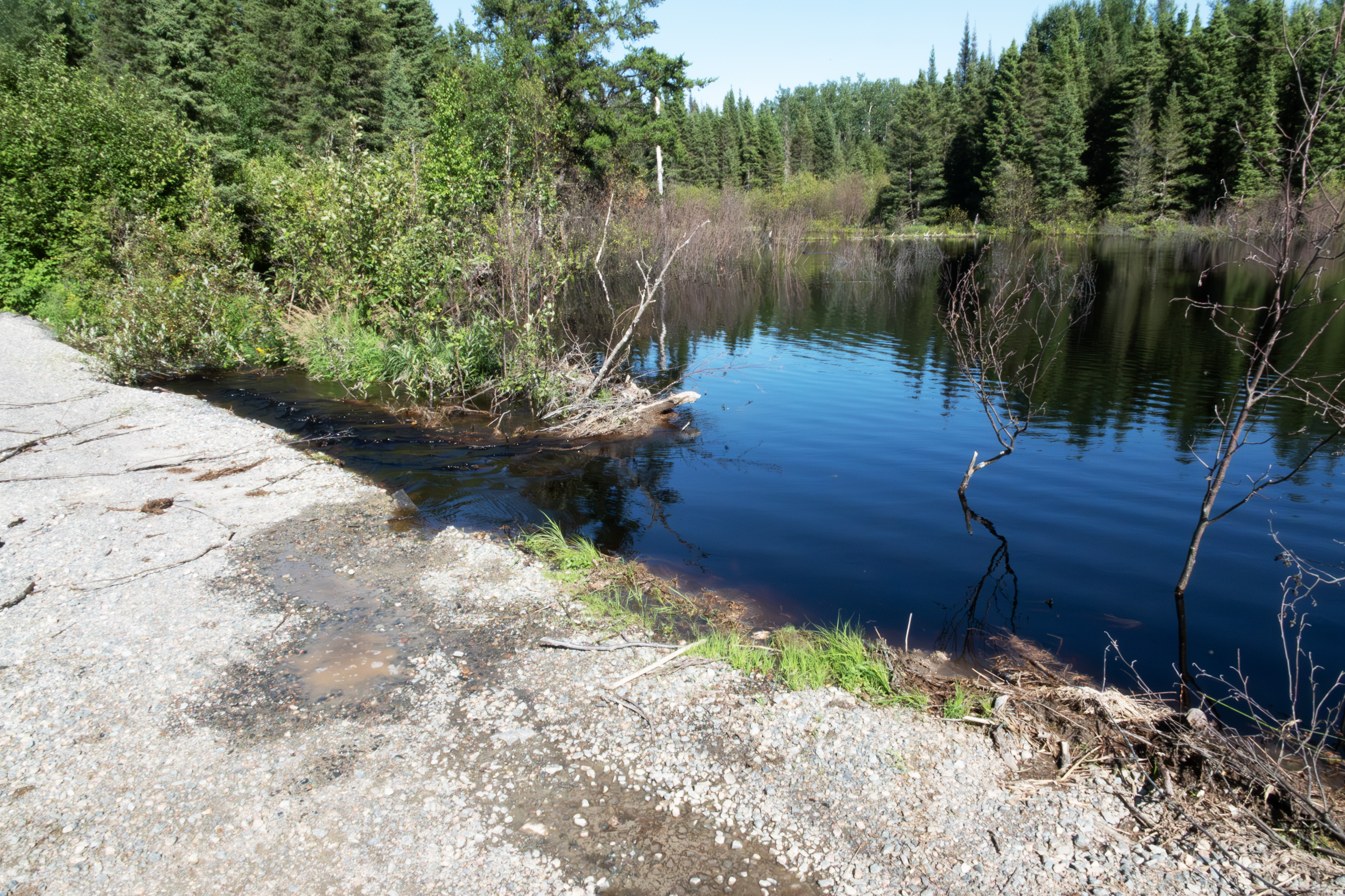
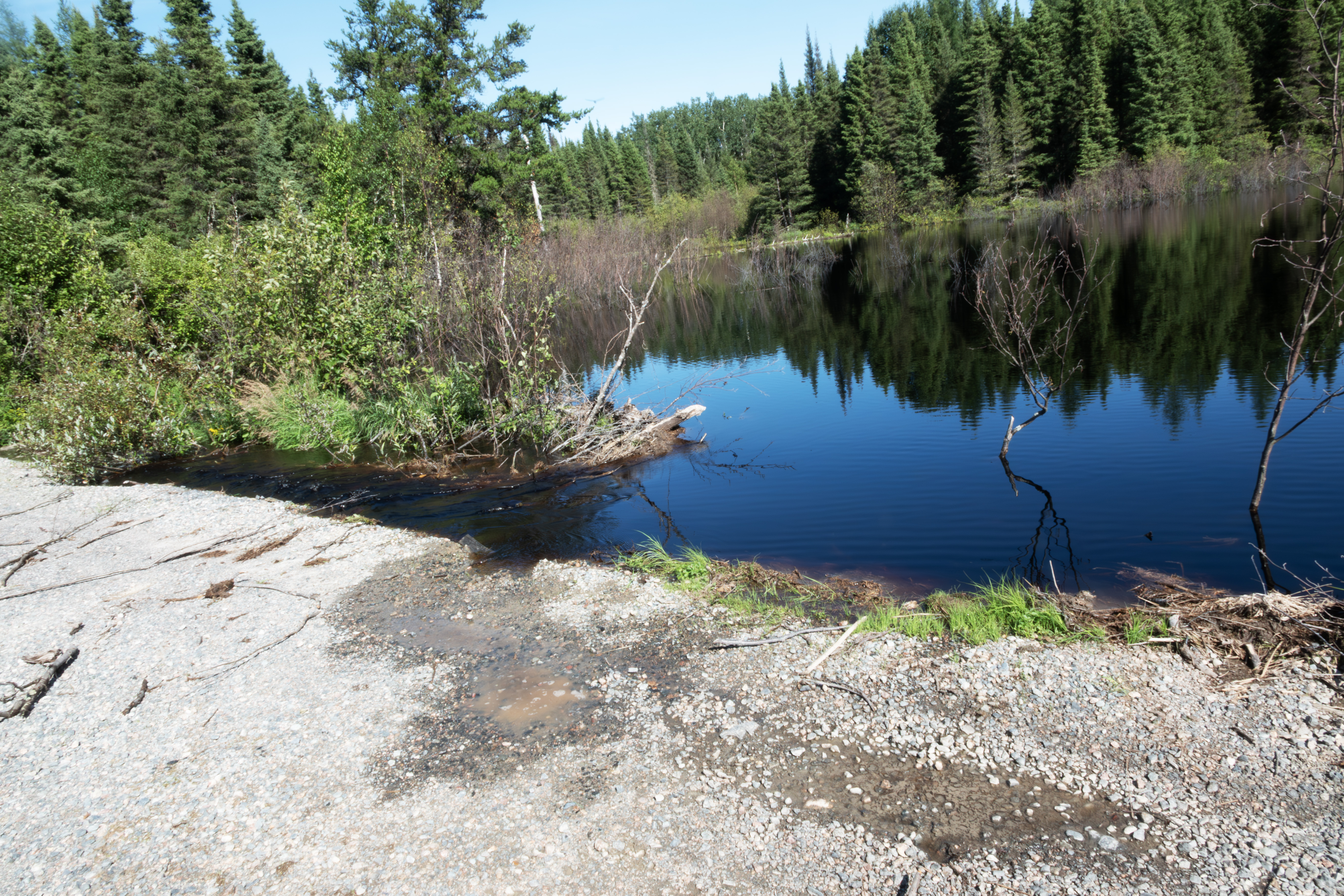
I left the dam and returned later in the afternoon. Workers had removed part of the dam, and water was now flowing freely to the culvert.
Another view.
Spent some time walking Route 1055 to the west of the gravel pit, parking at my favorite spot to camp.
Another dorsal P. faunus photograph.
A ventral shot.
And another, both of these on the gravel pit access road.
Done for the day. I stopped to photograph the start of the James Bay Highway and Route 1055, both at the same point. This is the James Bay Highway entrance. They have a checkpoint at which they ask folks to stop and report.
To the right, Route 1055 starts. Route 109 ends here.
I drove Route 109 and took Route Authier Nord Joutel toward Ontario. This was an improved primitive road with little traffic and very scenic on a nice evening. Found one snow shoe hare that cooperated for a photograph. Others would dash whenever I opened the door to take a photograph. I speculate that more predators are common here, maybe coyotes?
August 15th, after camping in the town of Normetal near the border, I arrived at the start of the Translimit Road, a forest road from eastern Quebec to Cochrane, ON. I had driven this several years ago in the evening and found the road a little dicey, as roads kept forking off and I was following directions on my iphone, which somehow kept working despite the lack of an internet connection. Today's journey would not be so eventful. This is the border of Quebec and Ontario, and the pavement ends.
Looking toward Quebec.
The road transgression from dirt to pavement.
The Translimit Road is 95 km long until pavement is reached in Ontario, and I took this photograph as a reminder.
This is the end of Part C. Click here for Part D. Click here for Part B.
Now looks to the hare.
Thinking.
One last look.
The hare never flinched.
The marten calls off the hunt.
A little later, a small groundhog crossed the road.
Late in the afternoon, another Grouse, on the TTH near the 381 km rest stop.
Spooked it into a spruce.
The TTH has active phone booths every 100-150 kms. Here is the first one on the highway.
The phone booth.
Complete with a current phone book.
Saturday, August 9th was overcast, perfect for fishing. Caught around 25 northern pike, here are a few from the morning.
Largest northern that I caught on the trip, 30 inches. Using a light-medium rod with 6 lb test, this one took about 10 minutes to land. Incidentally, when this fish hit the lure, the line went slack. Northern pike sometimes attack from behind so fast that they swallow the lure and the line goes slack. I learned to set the hook when this happened.
This family left about 10 am to fish. They live in Chisasibi. The woman took several photographs of me.
I kept two more in the afternoon.
The Chisasibi family returned with a nice bunch of walleye, around 20. The locals call these "Goldens", which I had heard on the drive up but I did not make the connection. Canadians also call northern pike "jackfish" or "Brochet", the latter the French word for pike. Interestingly, the northernmost town on Reindeer Lake in Saskatchewan is named Brochet.
The gulls had quite a feast, with me cleaning the pike and the others gutting the walleye. This is post-feast.
These gulls follow you as you fish, and will steal unattended fish on a stringer. The first two northern that I caught on the trip disappeared. I had tied them to a rock, and I thought that they slipped away. Next fish that I caught, I walked about 50 yards away, and looked back to see a gull pulling the line out of the water! They were damaged near the gills. Gulls will eat the guts of your catch. I was extremely vigilant to protect my catch the remainder of the trip. I wanted to photograph this, but when I returned to the campground on August 5th, 30 mph wings were creating waves that pounded the shoreline and I could not catch fish.
The next few days the gulls scavenged the carcasses. The mom in particular dove into the water to retrieve scraps which she gave to her young. This was the only time the little ones did not squawk!
Another view, with mom in the background.
Mom standing guard. When the gulls converged around a fish cleaning, the juveniles kept away, as the older gulls fought viciously.
Waiting for mom with scraps.
The next few photographs highlight several fishing spots. The first shows an overview of the campground, which sits at the mouth of the Sakami River.
The second zooms in a bit. Now the point that I fished for northern pike is visible, just to the left of the campground. The campground is 3 km from the TTH.
The third zooms in to highlight the 61 km rest stop and the inlet that I fished for walleye. This is the drainage for the fen that the campground road crosses. The hike from the rest stop is 10 minutes and although pretty easy, does get overgrown in the middle. You can see the trail if you focus on the Trails end marker. I named this the walleye inlet, as I caught 17 here over three days. This inlet was an eastuary. As opposed to a salt water esturay, freshwater estuaries form when a river's freshwater meets the distinct waters of a lake or other large freshwater body. They involve the mixing of two freshwater systems with differing chemical compositions, rather than the saltwater-freshwater mix of coastal estuaries. Freshwater estuaries are not affected by tides but experience standing waves called seiches, which are rhythmic sloshing motions of water, and I observed several different currents while fishing, sometimes my lure was pulled to the left, and in other locations pulled to the right, consistent with this. The Terns spent much time here feeding, as did the walleyes. I always hiked to this spot with my pole and camera, and got the best Tern shots here. I fished about 20 yards to the right and 50 yards to the left of the marker, as to the right it got shallow and weedy, and to the left were rapids, visible in this image.
August 11th, my last day on the TTH. I photographed more Terns, trying to capture the dive. Did not get great photographs, partly due to the limitations of the Sony RX10iv camera - I did not want to risk carrying my Nikon Z8 and 9 ($$$) cameras through the brush.
Here is one looking for prey.
The dive.
Splash down!
And the recovery.
I first saw the Terns over the big waters of the reservior, usually in groups of 3. Very noisy, almost angry. They did not stay long in any one place over the big waters, but spent hours at the inlet, likely due to lots of prey. These were all shot at shutter speeds of 1/2000, unusual for me.
Another batch of walleye.
An American Toad.
Mom with the youngsters.
A wing shot. These are all Herring Gulls.
Resting.
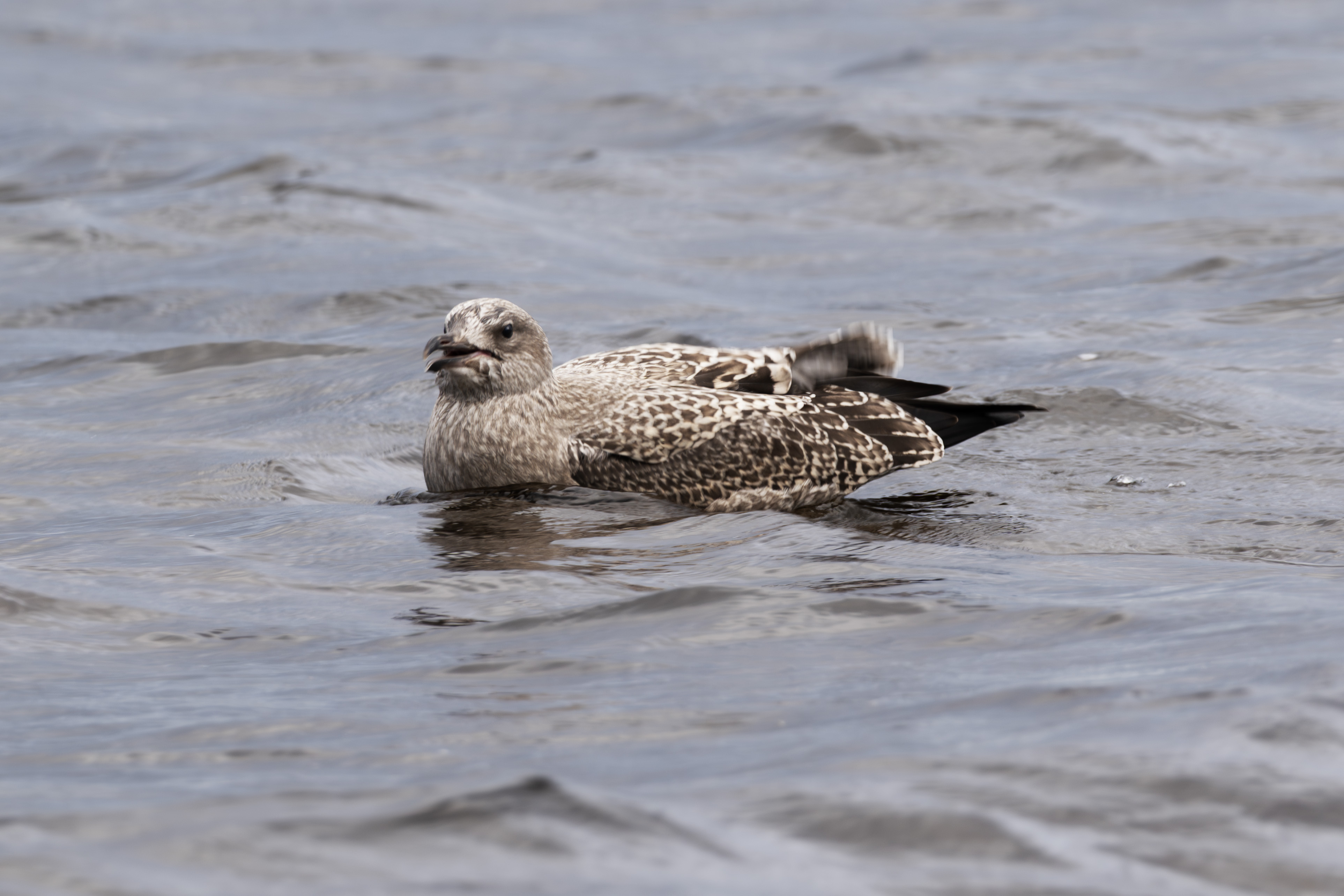
Typical squawking youngster. I lost my patience several times and threw rocks to move them.
Mom just dove and recovered a northern pike carcass.
Catching her breath.
And the young benefit.
This is another dining on a walleye carcass.
From the shore of the inlet, looking to the rough water, visible in the upper left corner.
Panned to look straight ahead from the shore, ie, to the right of the previous photograph.
And now further to the right, looking at the source of the inlet. The log in the middle was were I usually tied my stringer.
Another four walleye.
Managed some nice in flight Tern photographs.
Another.
My favorite Tern photograph.
Another splash down, showing feathers.
The last one.
The last six walleye that I caught.
This is the beginning of the fen that feeds into the inlet, photographed from the campground access road.
A typical P. faunus feeding on the road near the fen.
These are the rapids under the bridge that pass to the left of the inlet, which is on the right.
August 13th was a travel day, with a stop at the 381 km truck stop to repair a tire, my second flat. I need to invest in a portable compressor and 10 ply tires. On the way, I photographed this sscene along the James Bay Highway. These look pretty neat, the small stunted spruce and shrubs growing in patches next to a normal spruce bog.
Another of those rock formations so common in Quebec.
The Rupert River was steaming, as today, August 13th, was cool after several warm days.
August 14th, I returned to Route 1055 near Matagami and visited the gravel pit. P. faunus was now on the wing.
Another specimen.
A dorsal photograph.
I had an interesting experience at the beaver dam. First, this photograph is looking toward Route 1055 and shows the overflow caused by the dam.
And this is looking toward the dam.
Same view, tweaked.
The lodge in the distance.
I tried to capture the beaver's efforts in this photograph.
And this shows their engineering skills.
Closer view of the lodge.
Another showcasing the beaver's efforts and skills.
I left the dam and returned later in the afternoon. Workers had removed part of the dam, and water was now flowing freely to the culvert.
Another view.
Spent some time walking Route 1055 to the west of the gravel pit, parking at my favorite spot to camp.
Another dorsal P. faunus photograph.
A ventral shot.
And another, both of these on the gravel pit access road.
Done for the day. I stopped to photograph the start of the James Bay Highway and Route 1055, both at the same point. This is the James Bay Highway entrance. They have a checkpoint at which they ask folks to stop and report.
To the right, Route 1055 starts. Route 109 ends here.
I drove Route 109 and took Route Authier Nord Joutel toward Ontario. This was an improved primitive road with little traffic and very scenic on a nice evening. Found one snow shoe hare that cooperated for a photograph. Others would dash whenever I opened the door to take a photograph. I speculate that more predators are common here, maybe coyotes?
August 15th, after camping in the town of Normetal near the border, I arrived at the start of the Translimit Road, a forest road from eastern Quebec to Cochrane, ON. I had driven this several years ago in the evening and found the road a little dicey, as roads kept forking off and I was following directions on my iphone, which somehow kept working despite the lack of an internet connection. Today's journey would not be so eventful. This is the border of Quebec and Ontario, and the pavement ends.
Looking toward Quebec.
The road transgression from dirt to pavement.
The Translimit Road is 95 km long until pavement is reached in Ontario, and I took this photograph as a reminder.
This is the end of Part C. Click here for Part D. Click here for Part B.