- 2016 Vacation photographs
Part 1
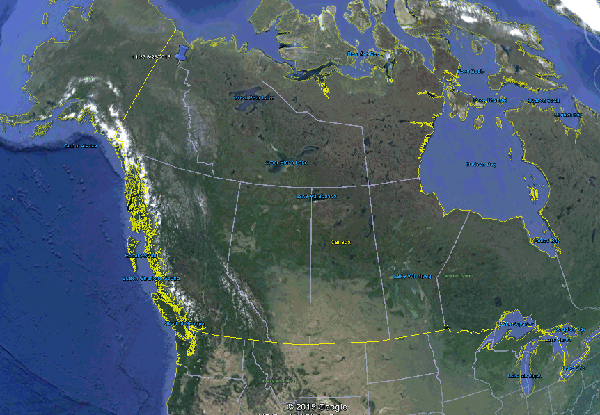
An overview of the destination - the upper left mark, in
perspective to Chicago.
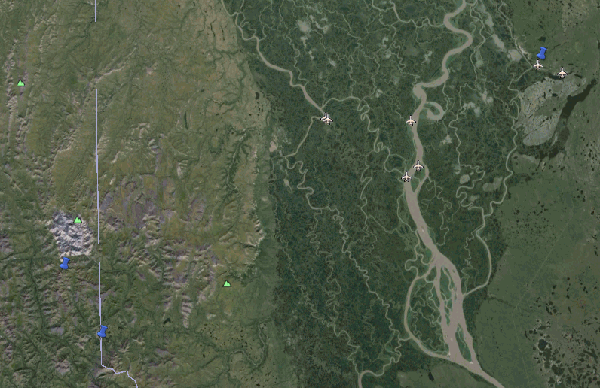
The float plane airport is the upper right mark, Summit Lake is the lower left mark.
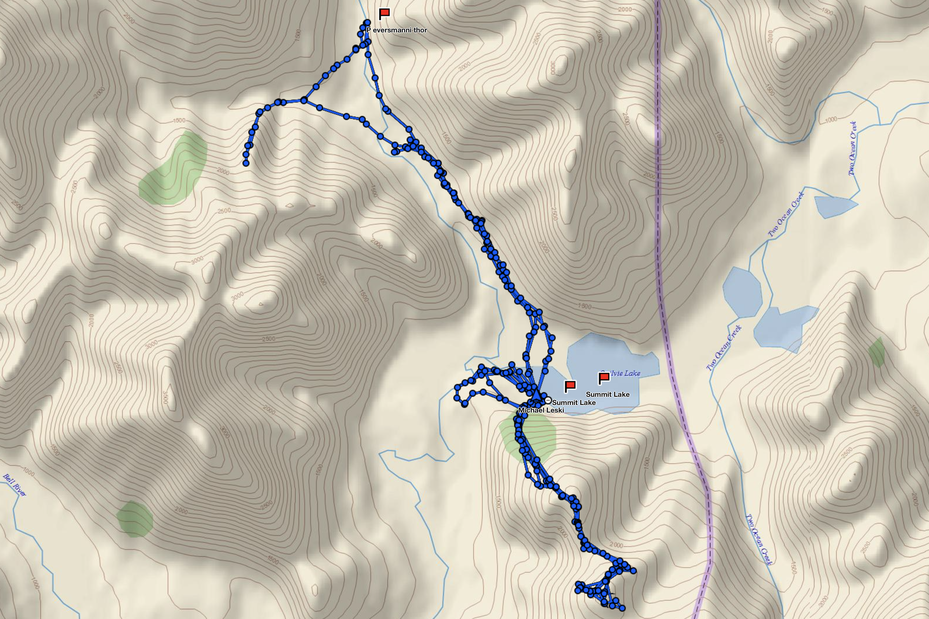
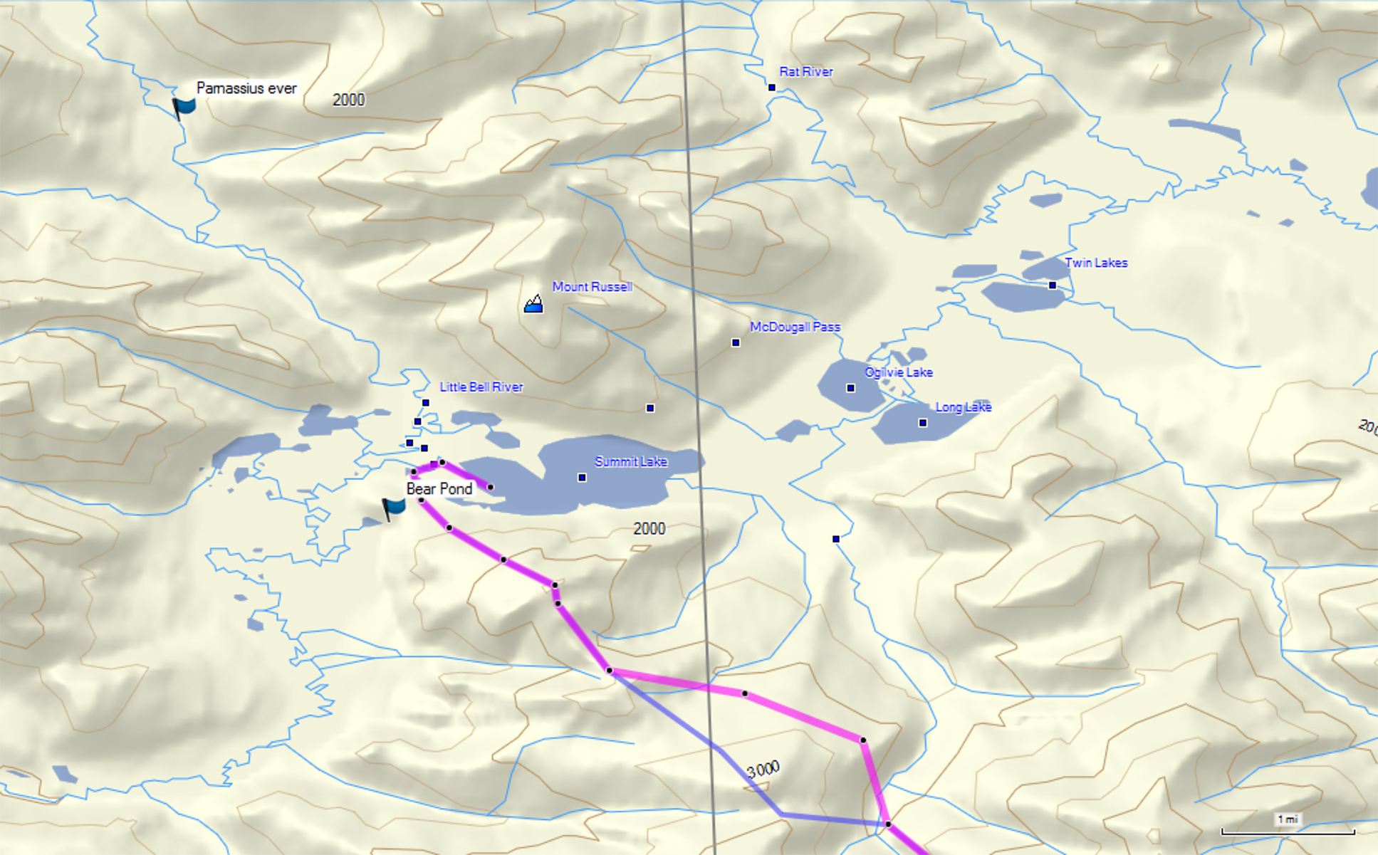
A topographic map of the area I hiked. The 'Parnassius ever' mark is the destination for my 3 day hike. Dennis Creek is the first stream below this mark that veers west. The purple and lines are my planned routes to crest Ocean Peak. The point where they split is the farthest I hiked on this trip. Bear Pond is just to the left of the marker.
Robert, my pilot, at the unloading site near my tent site on the west end of Summit Lake.
Robert taxing away before take-off.
Just before lift-off.
I'll see Robert in two weeks. Not to worry, as I carry a satellite safety device which can text him, others, and send Tweets!
This figure shows my tracks over the two weeks. I spent the first Tue-Thur north of Summit Lake, and the last 3 good weather days (Sun-Tue) south of the lake. That's about 3 miles to the north and 1.5 or so to the south. The north hike was mainly in a river valley - Little Bell River, with a side trip to a ridge to the west. The south hike takes me to 2300 feet in elevation - the lake is about 1000 feet. That's Mount Dennis on the left side of the figure, and the Yukon/NWT border in purple. Summit Lake is in the Yukon.
Scenery shots around Summit Lake. This is at my tent site looking east. That mountain left of the tree on the right is just into Northwest Territory - I am in Yukon Territory.
This is the peak just on the east side of the Little Bell River, to the east.
Mount Dennis, to the northwest. That slope in the left foreground is the far western side of Oceans Peak. This is right behind my tent and Summit Lake.
Now the Little Bell River valley is visible, due north of the tent site.
Just to the left of the above photo. That small nob about a third of the way from the right is at the top of the hillside I would climb when I headed south. That nob is about 1500 feet.
Closer shot of the nob. I would hike just below this to crest the first ridge.
To the left of the above photo. Still at the lake tent site.
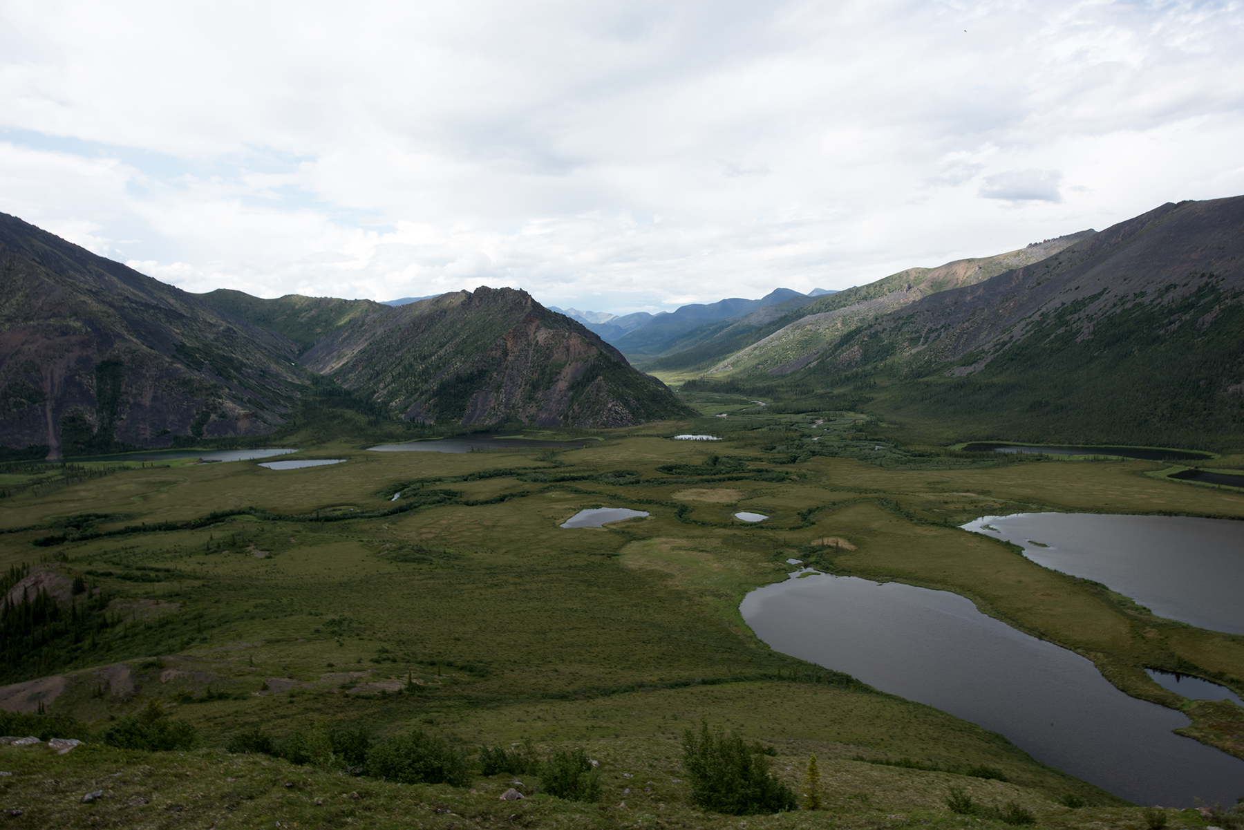
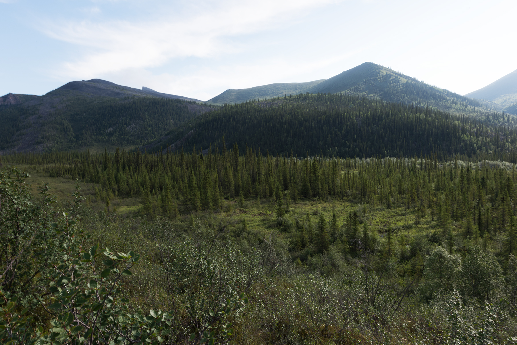
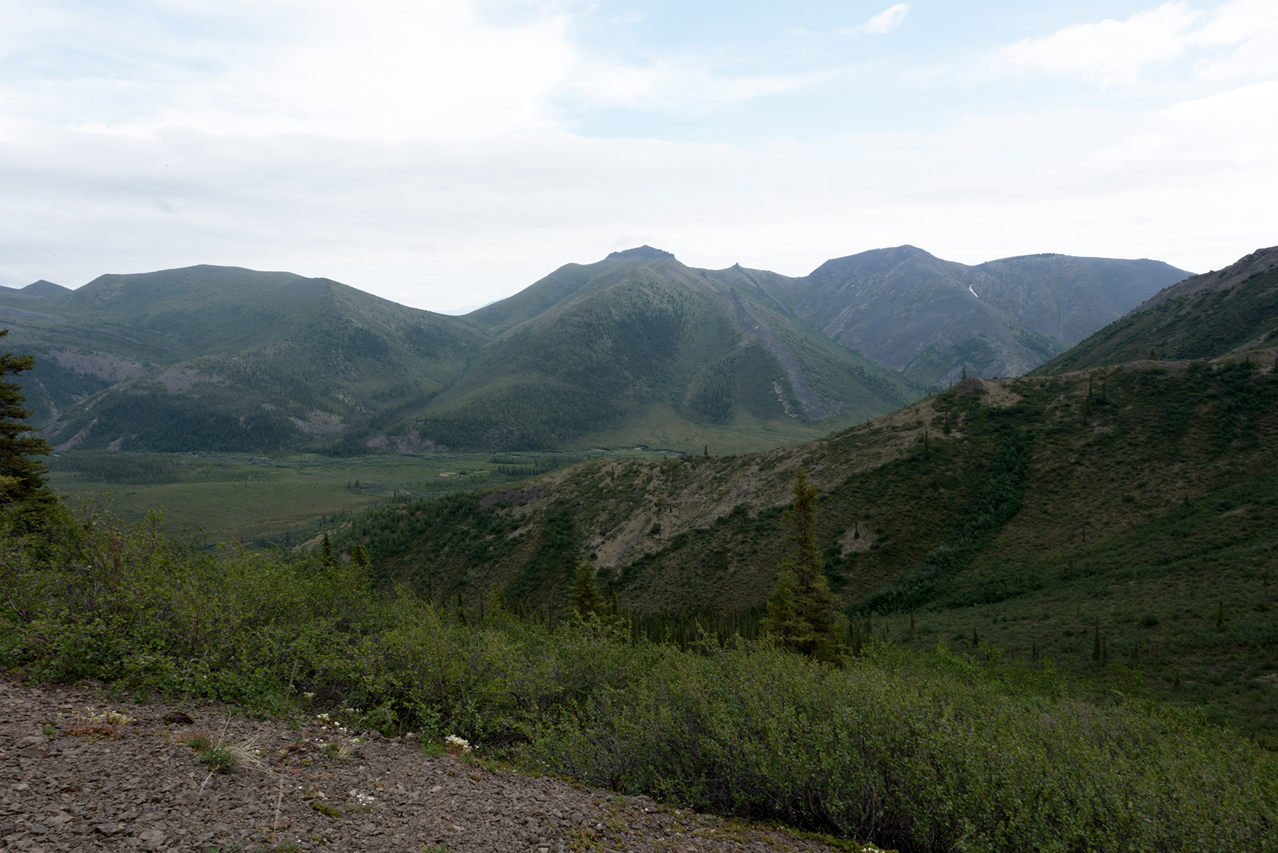
Nice shot of the Little Bell River valley.
Mount Dennis, south face. I'll hike partway up the north side later.
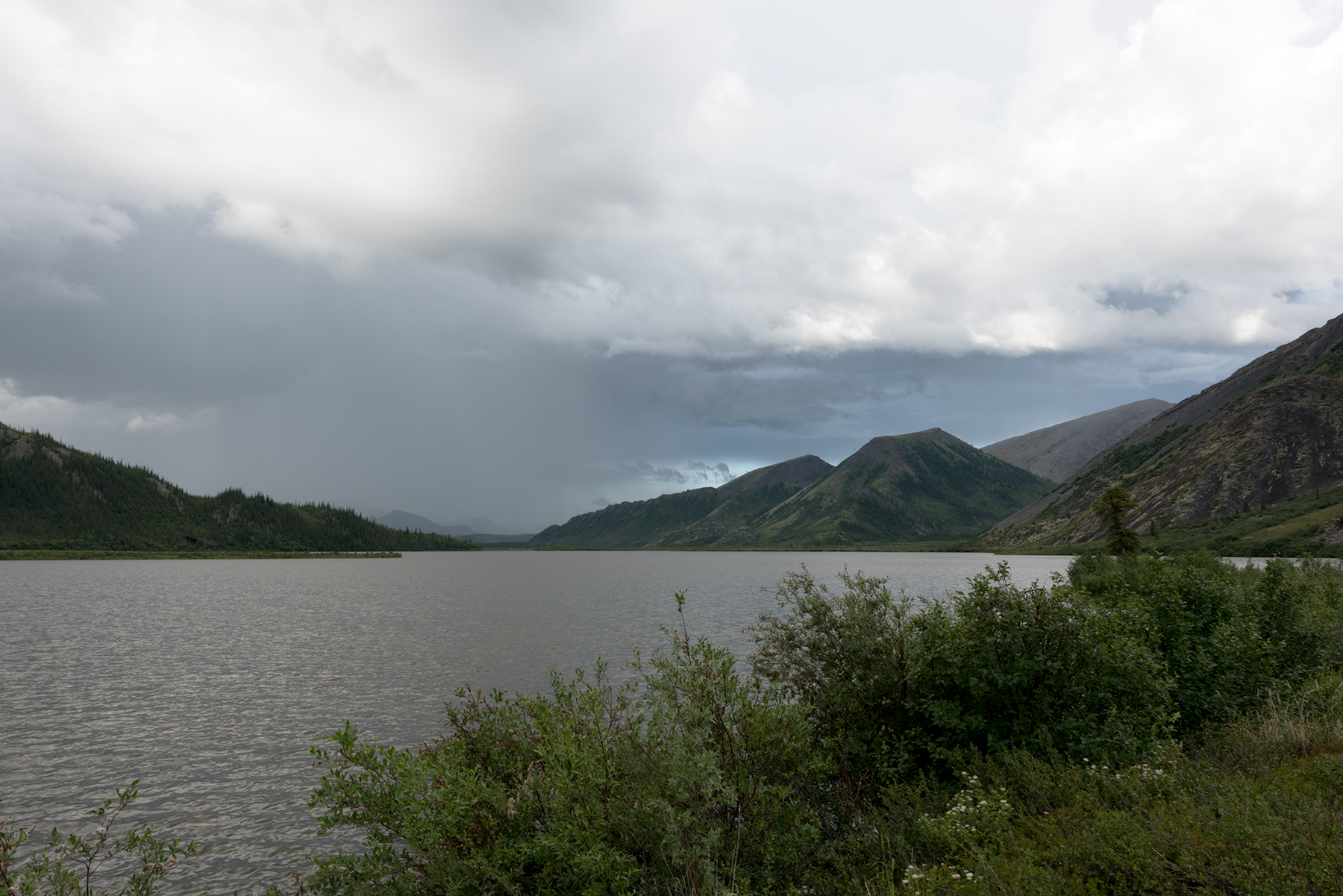
Stormy weather this day.
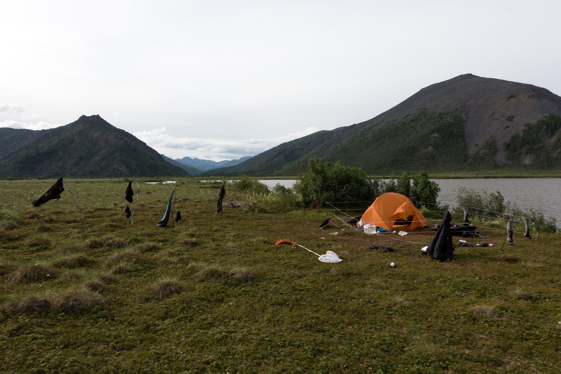
My campsite. The orange tent is for storage. The fence discharges 5,000 V every second to discourage bears. I was drying items soaked from a good drenching.
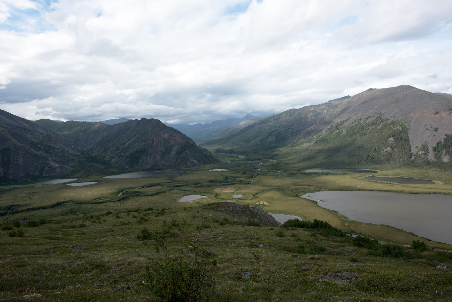
A view of the tundra just west of Summit Lake, taken from the hillside I hike to access the trail over Ocean Peak. The Little Bell River is visible in the center of the photo.
Another view, from a lower elevation. My tent is visible in the lower right - look for the orange.
This shot was taken from the nob. The peninsula on which I camp is now visible. Animals rarely venture to this site, but the downside is I have about 30 minutes extra to hike to get around the water. On this trip, I used an inflatable kayak to either go south to the base of the nob, or north, landing on the shore near those two little specks in the water. This saved a lot of time.
Another view. Note the outlet creek from Summit Lake, which runs into the Little Bell River. Although it looks simple to cross, this creek is 10 feet below the nearby tundra and lined with thick, large willow bushes. Almost impossible to cross, especially with a pack.
First thing I did Saturday was attempt to hike over the far south ridge, just west of Ocean Peak, which at 5000 feet creates it own weather. This shows what I call the Saddle, a dip in the ridge just south of the lake.
A better view of the trail over the Saddle. At higher elevations, the animal trails are firmer and more obvious than at lower elevations, and is one of the reasons I like it here, besides the scenery.
At the south end of the Saddle lies this obstacle. I hike to the left (east) to access higher ground. I have more photos of the west face of this feature.
A view to the west. These flower covered slopes are good for alpine butterflies.
And looking due north of the obstacle. The trail is just visible in the right corner.
Looking south from atop one of the ends of the Saddle.
This is the trail around the obstacle, shown in the center of the photo. The trail is on a 35 degree slope and is not as firm as the others I have shown. One slip here and you can slide a good way. Still, this was pretty easy to hike.
Same spot, but looking north toward Ocean Peak.
Looking east from the same spot. That is Ogilvie and Long Lake, just east of Summit Lake in NWT.
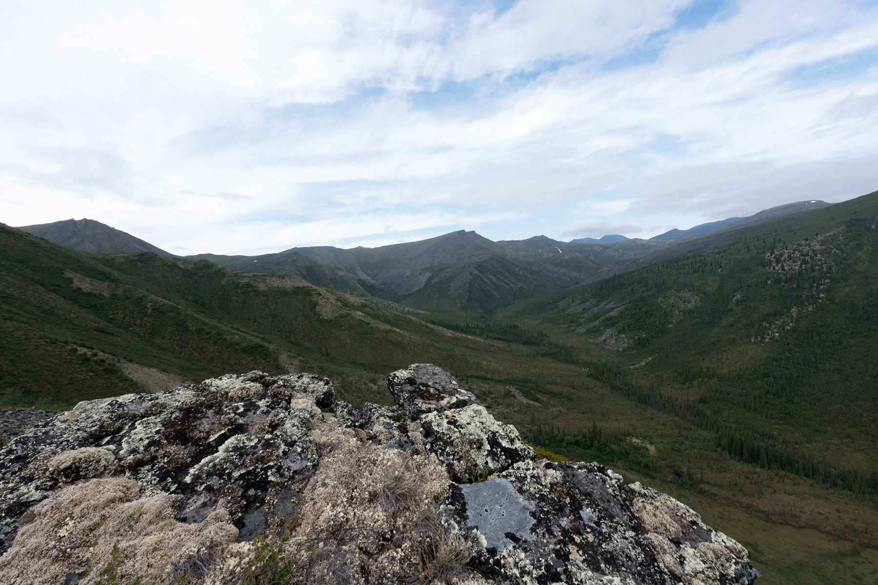
I hiked 10 more minutes and scrambled onto the ridge. The ground is now firm, like walking on your lawn, and the base is very rocky. So easy to hike!
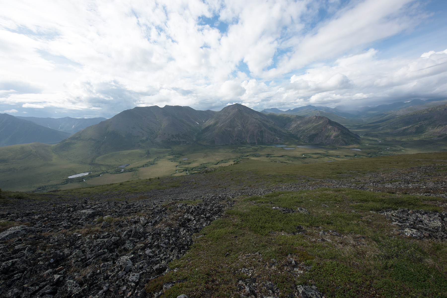
Looking to the south. My route over the ridge is toward the upper right corner, but I would never get there. On this day, I carried too much weight and ran out of water, and had to turn back well before I got here. These photos were taken a week later. I was carrying 50 pounds, 10 of which was camera equipment. Next year, with 40 lbs I will crest the ridge
This is just to the north of the previous photo. This little creek has water, the last I would have seen for 5-6 miles if I had continued. I may camp here next year, using this as a satellite camp. Lots of bear sightings here!
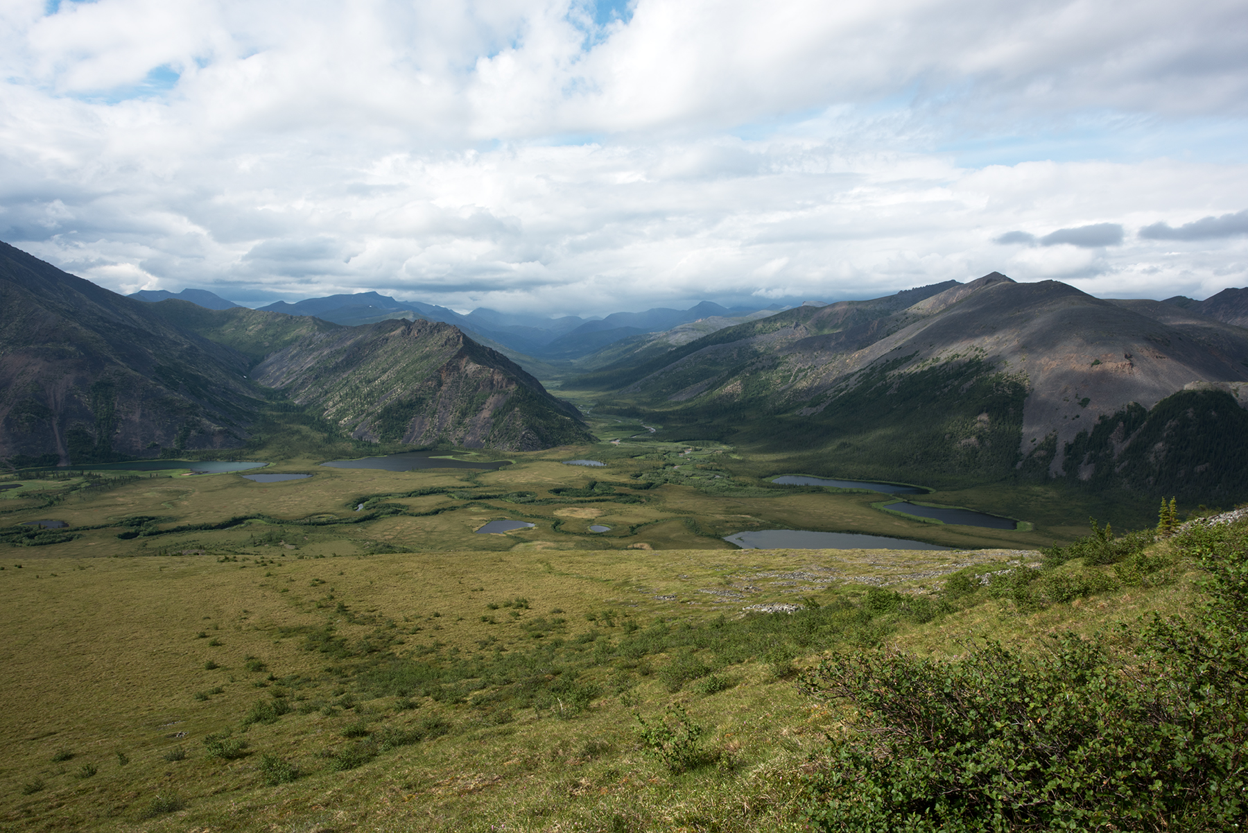
This nicely shows the route over the ridge. After the grassy ridge runs the creek, and then the path veers right, just to the left of that snow. The creek is about 2200 feet, and the ridge is 5000 feet, but the 2800 or so feet elevation gain is steady, about 800 feet per mile, so this is doable.
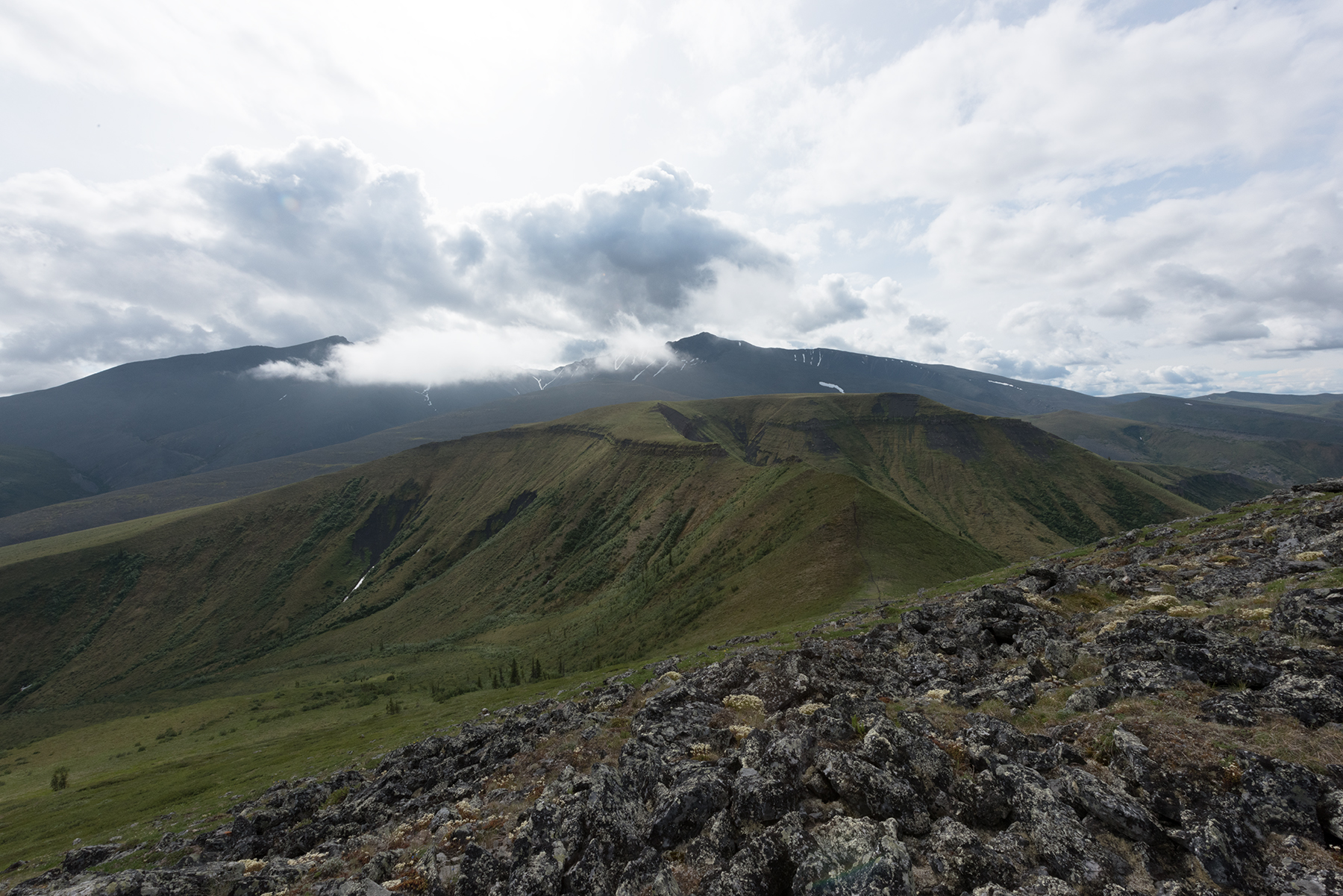
Another view.
And another. I took Gynaephora rossi toward the bottom left of this photo.
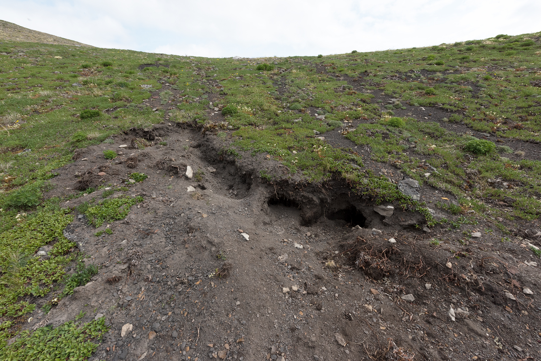
I returned to Summit Lake, having to regroup. On the way back, just below the Saddle, I found this spot where a bear had dug, looking for ground squirrels. These are new for 2016, as I did not see these in 2015.
Another view of the bear dig.
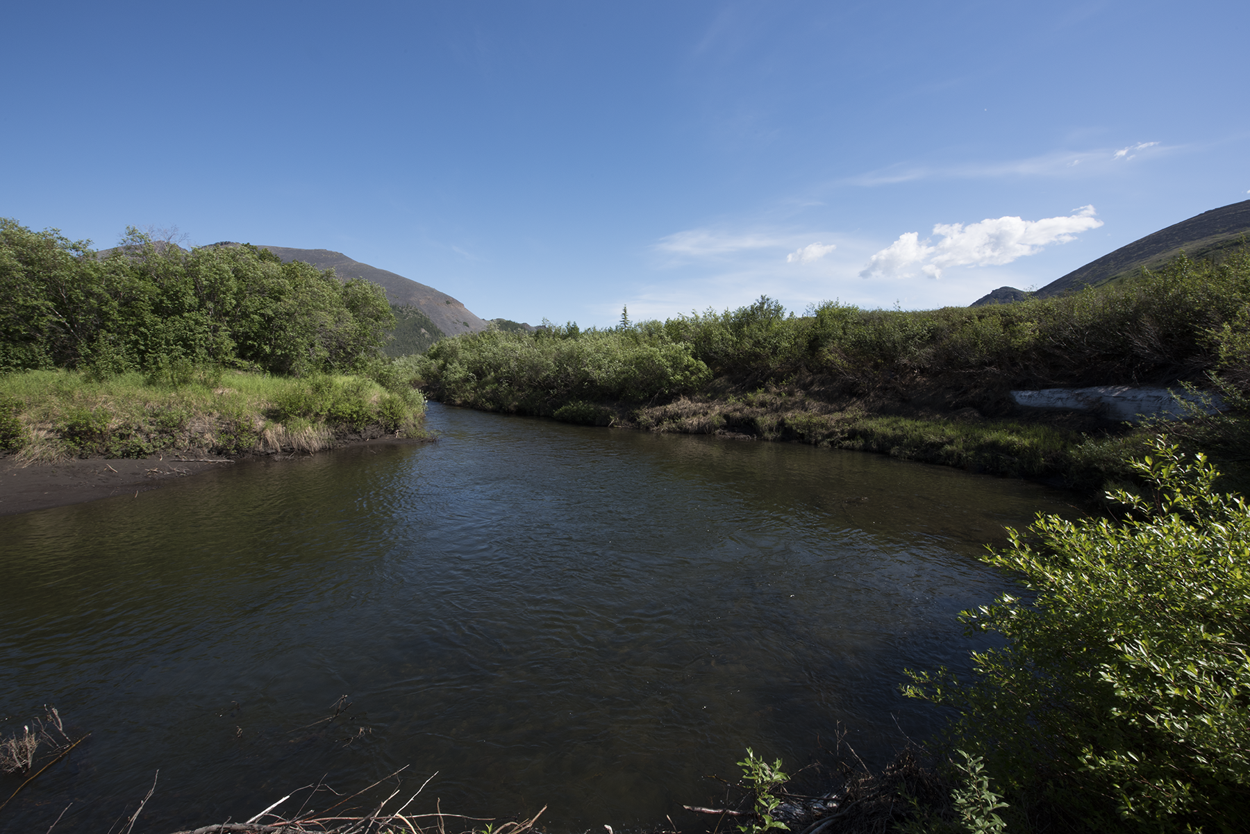
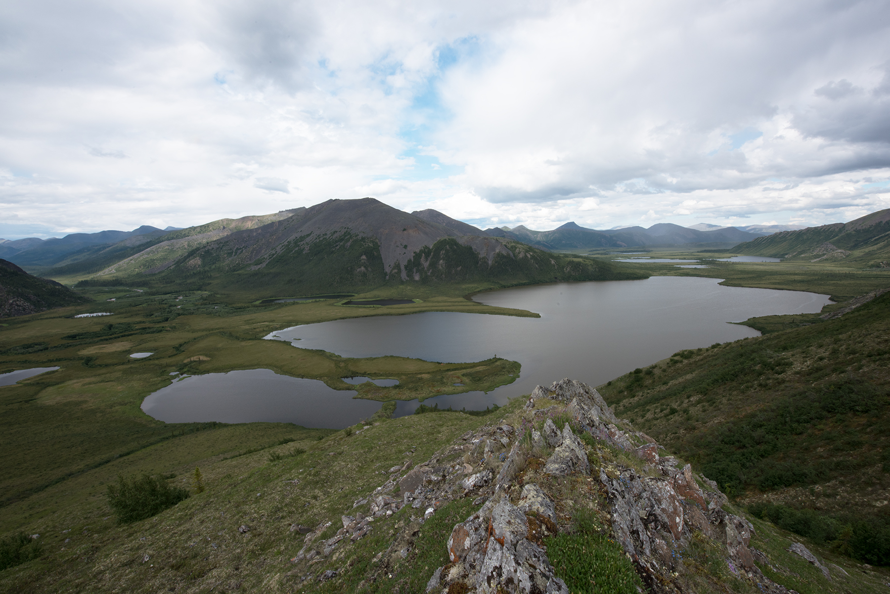
Here is a nice view of Little Bell River, just west of the lake.
One last photo before I returned to the lake on Saturday.
Sunday was again gorgeous, and I hiked west of the lake. Around 1 pm I stopped for water at Little Bell River.
A really pretty little lake, about a mile west of camp. I named this Bear Pond. This is at the base of the drainage from the saddle. I thought about camping here, but the next photo shows why I did not.
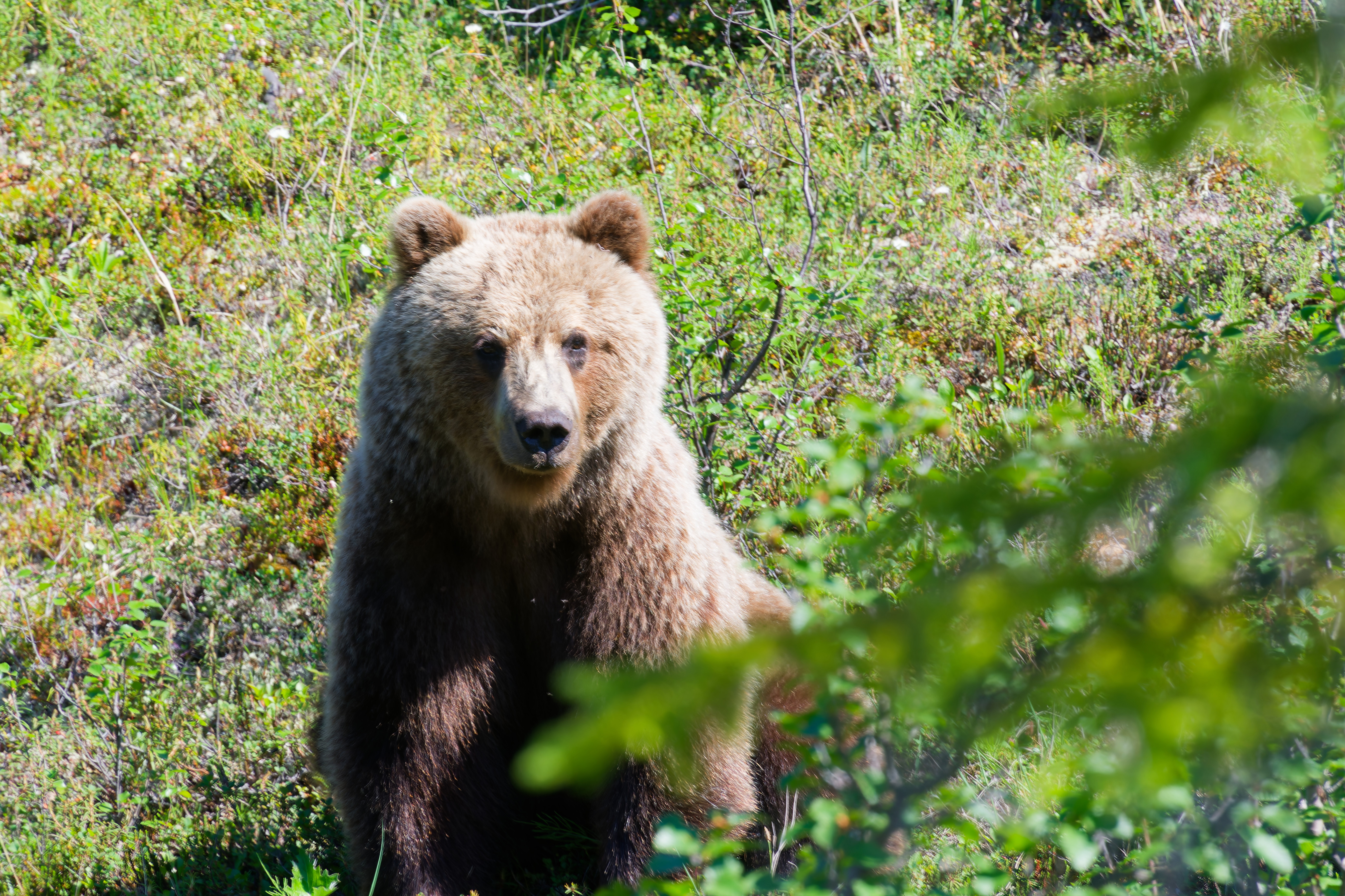
I was seeking Boloria freija on this day, and therefore kept looking for suitable habitat. I ventured into a wooded area, just west of Bear Pond, when I heard a crashing above me. It was a very large bear, running at an angle to get ahead of me. I started yelling and she stopped, sitting down like a dog. I kept saying 'hey', very firmly, with one hand on my bear spray. Bear just sat still, so I snapped these photos and backed away very slowly. She was only 90 feet away. After I had walked for 20 seconds, I looked back and saw her standing erect, peering over bushes to watch me.
Very curious but cautious.
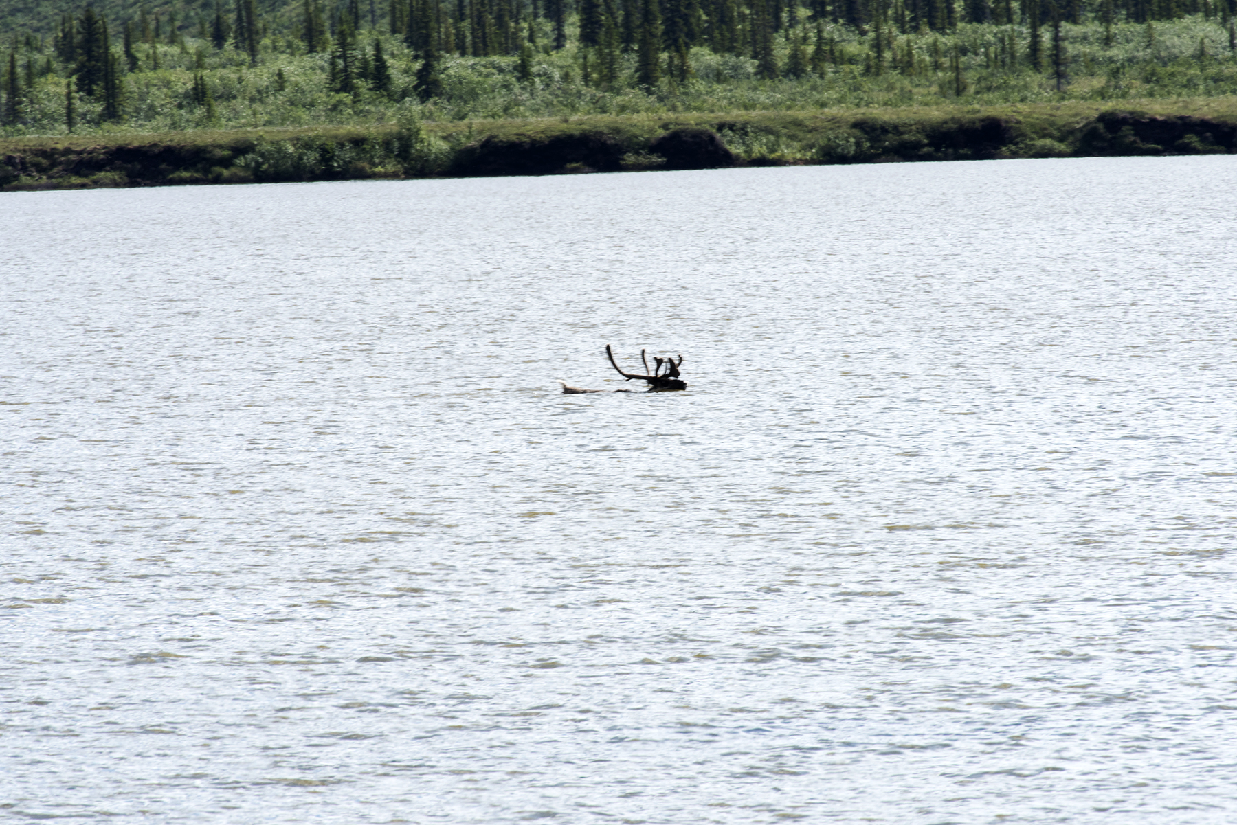
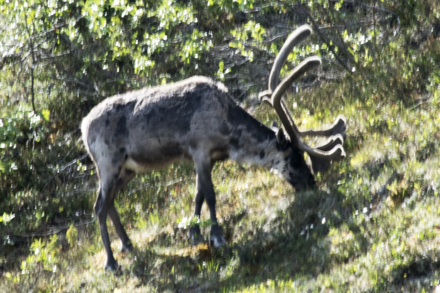
On Tuesday (June 29), I planned to hike 3 miles north along the Little Bell River. As I prepared the kayak, I saw an large animal swimming across the lake. A caribou.
The lake is bordered by mountains on the north and south which slope into the water. I have never tried to hike around the lake. So, the caribou is taking the direct route.
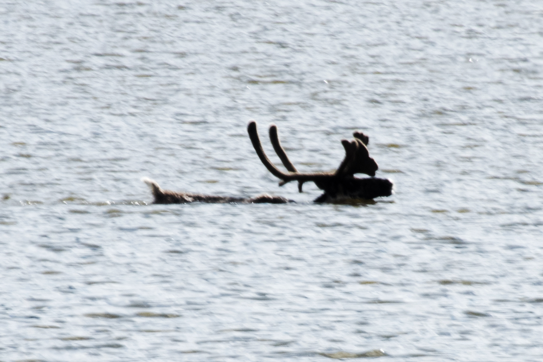
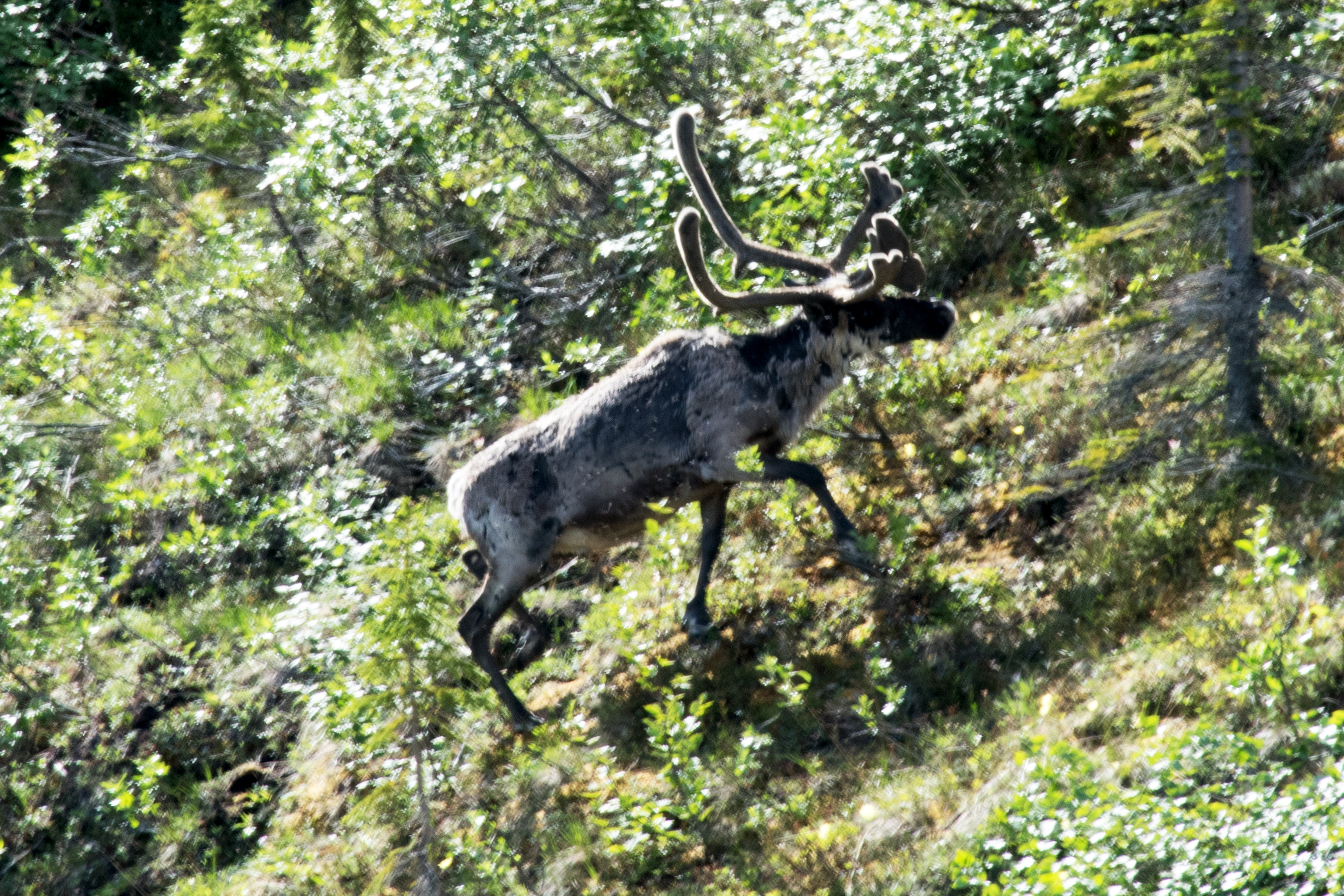
A good shake!
Needs some recovery time.
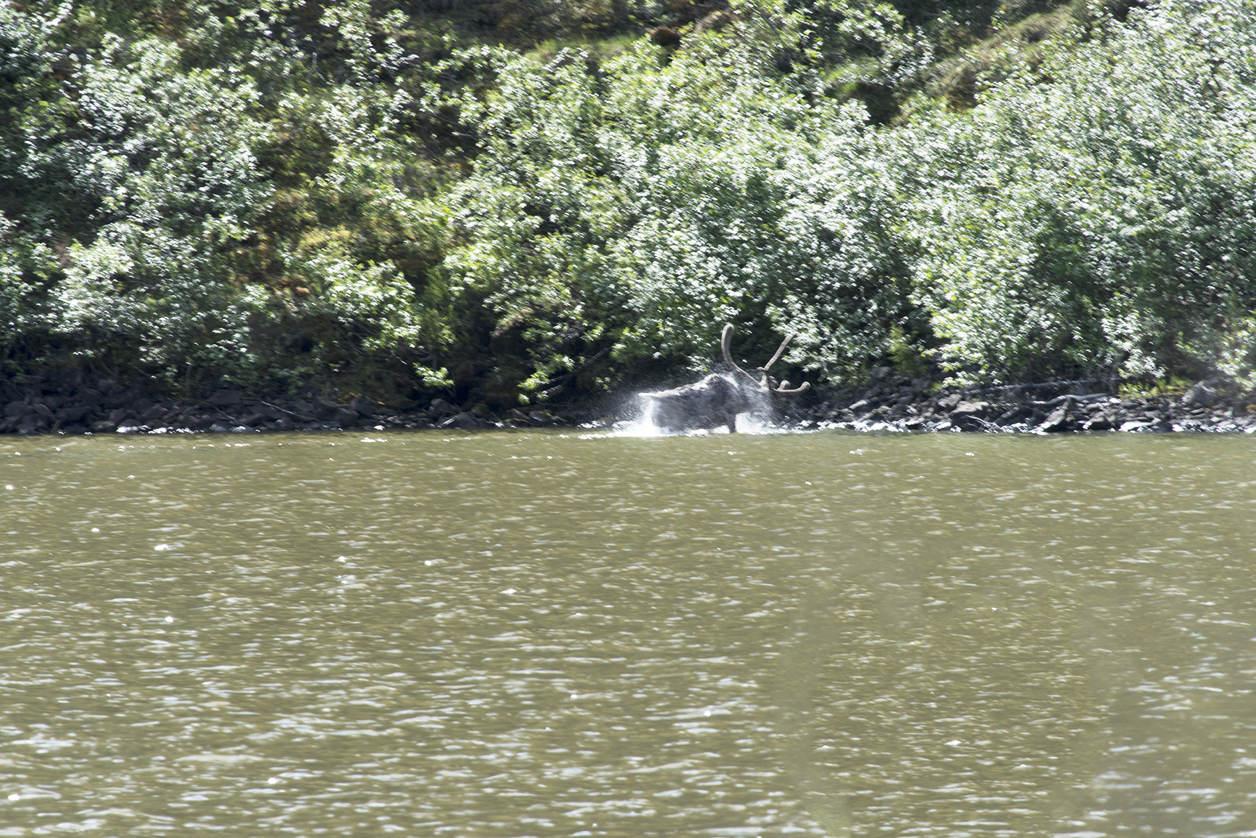
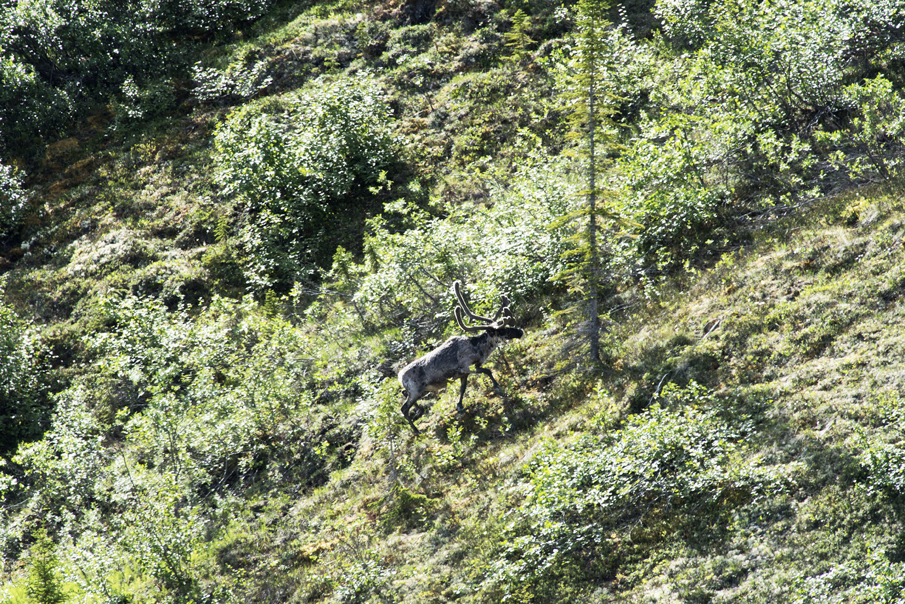
And also needs to refuel.
The slope presents no problem.
I watched for 20 minutes, and then the caribou disappeared into the thicket.
On Tuesday (June 29), I hiked 3 miles north along the Little Bell River. Early on, I hiked through a lot of Spruce.
Due east of Mount Dennis, the peak I see from the lake. On the right border, a willow thicket along a creek is seen. The first 2 mile I had to cross one of these every 100 yards or so. Trick is to stay on higher ground away from the Little Bell River, as these get very dense near the river.
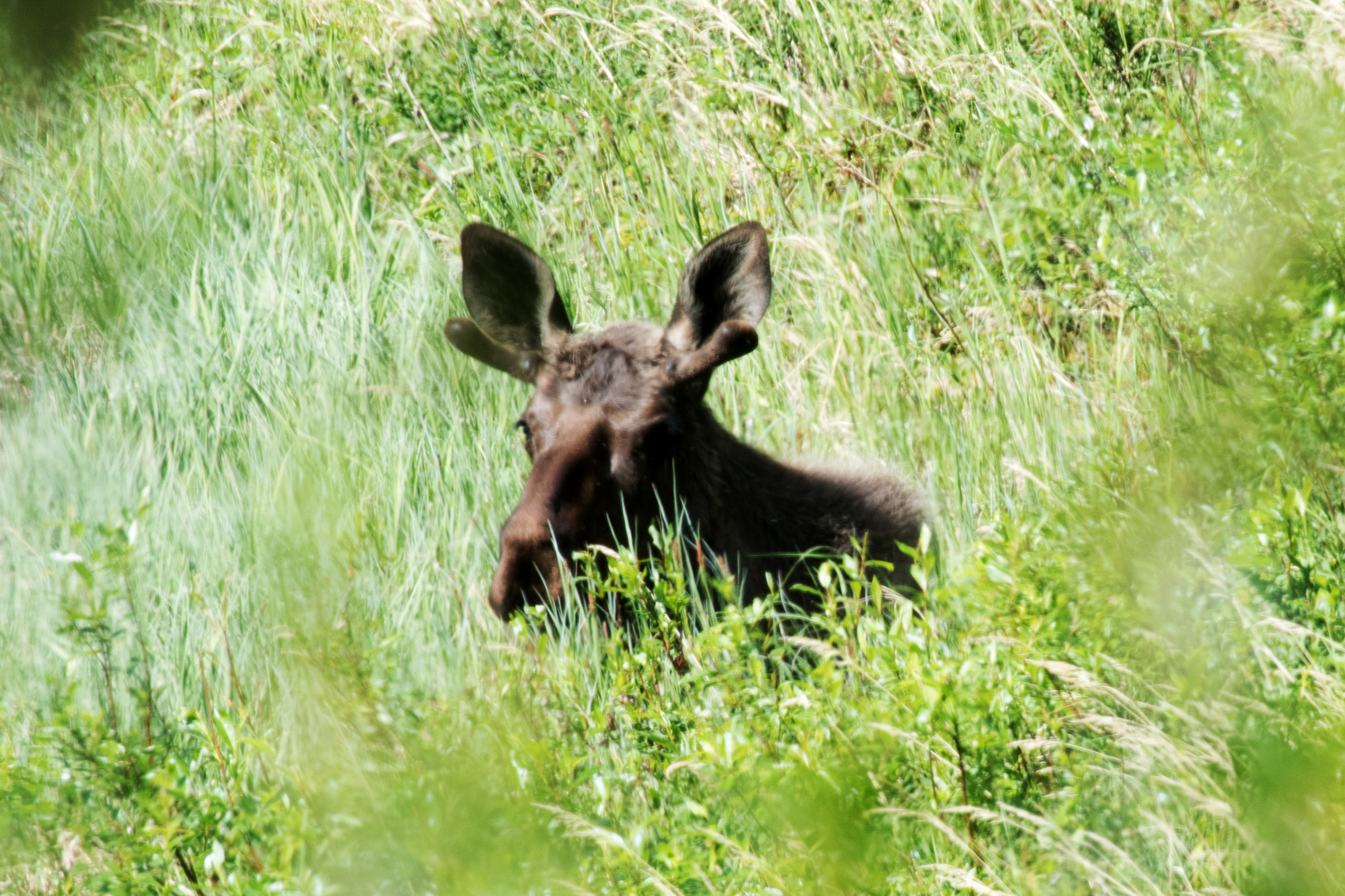
Just a few minutes later I spied this young male moose resting.
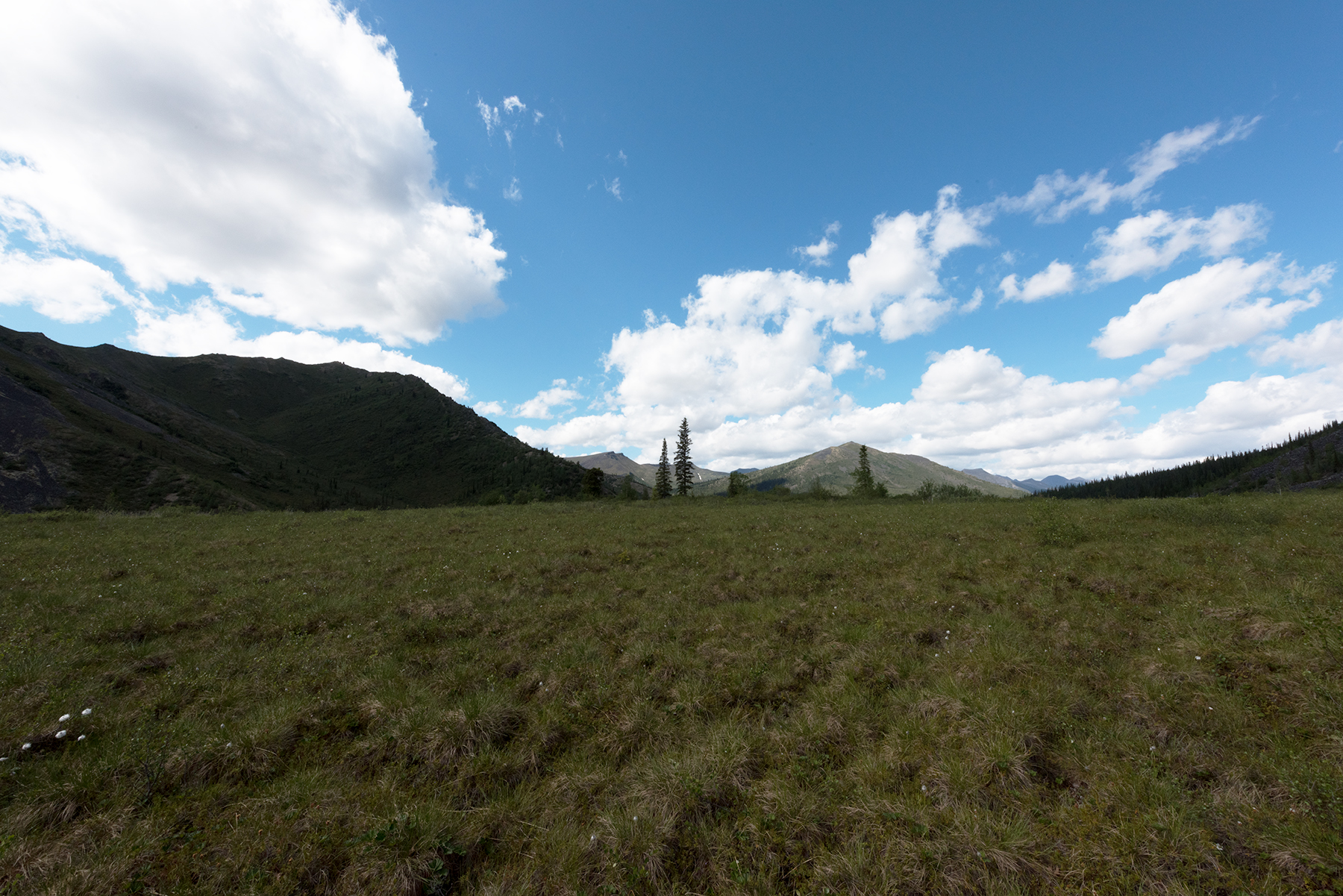
About 1.5 miles north of the lake, a clearing. This is looking back toward Summit Lake.
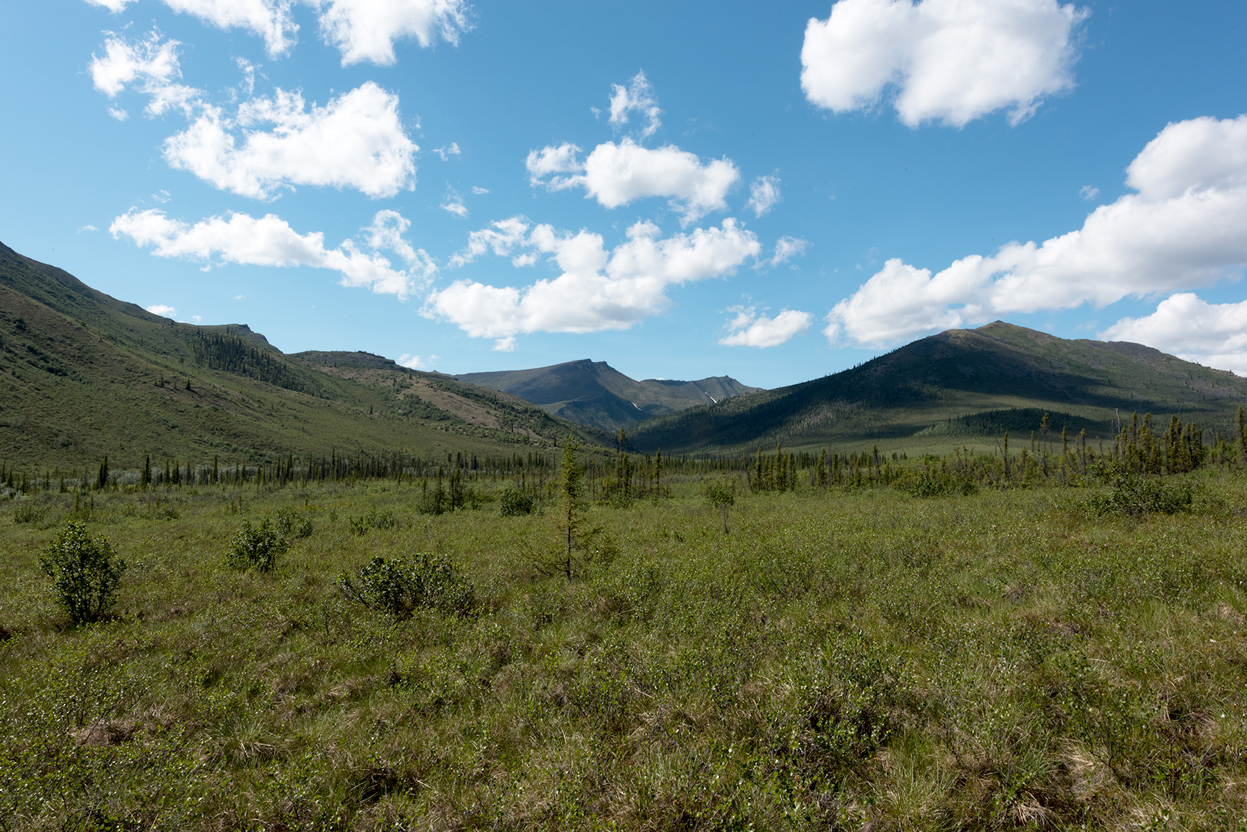
This is looking to the north.
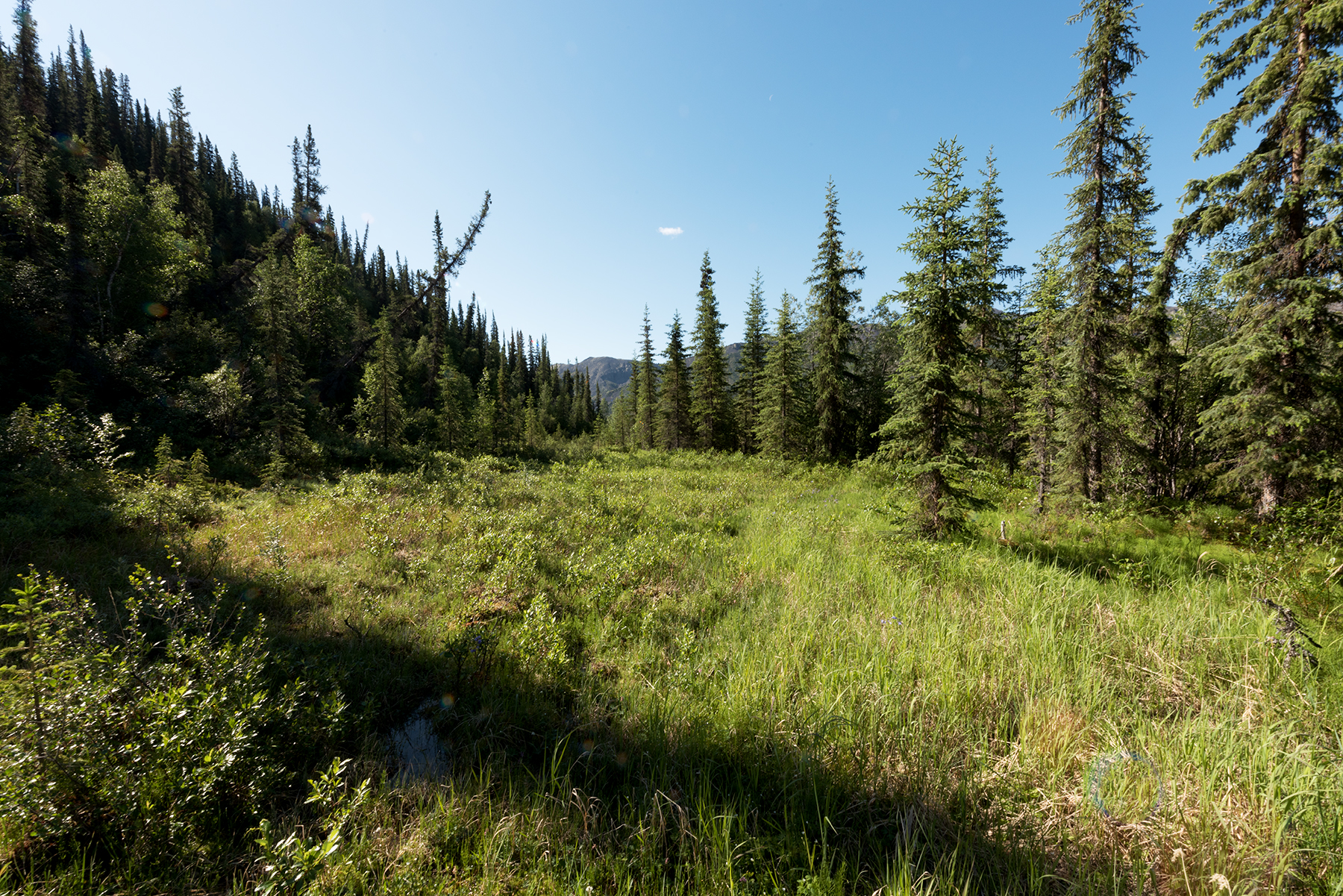
Another view to the north.
My camp site for Tuesday and Wednesday night. I have learned to seek a big tree in these Spruce woods, as the ground is usually firm and often flat here. The white is lichen, and this grows on rocky surfaces, usually dry.
This is the meadow I visited these two days, trying for Parnassius eversmanni thor. Click on this link for a
specimen photo. The river is 100 yards to the right.
Thursday I planned to hike up Dennis Creek, on the north side of Mount Dennis. This is looking to the north up the Little Bell River from the west side.
Another view. My campsite was in the middle of the photo, near the two taller trees.
I crested a small hill and am now looking to the west at the Dennis Creek valley.
Looking due south, at the back of Mount Dennis.
I hiked up a ridge on the south side of Dennis Creek. This is where the ridge flattened, looking north back to the creek.
Looking south, up Mount Dennis. Note the animal trail. I wanted to hike up the right side, and I did find a nice animal trail, but the skies clouded and I deemed it too risky to get caught in a storm up high.
Another perspective.
The animal trail to the plateau passes the tree in the center of the screen and heads at a 45 degree angle to the top.
Looking back to the creek.
Another view up Dennis Creek.
This slope is typically found at 2000 feet in the Richardson Mountains. I usually find Oeneis uhleri and Plebejus glandon bryanti on these and I took a few of each this day, even though it was cloudy and little activity was observed.
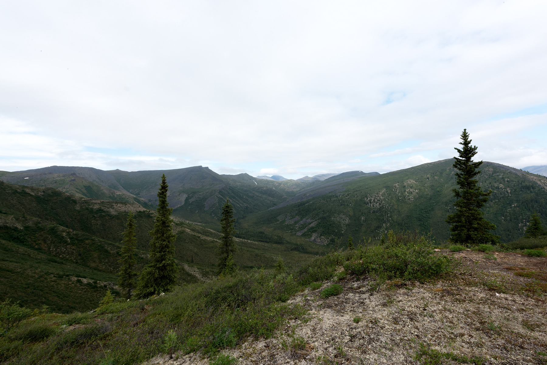
Looking back at the Little Bell River valley.
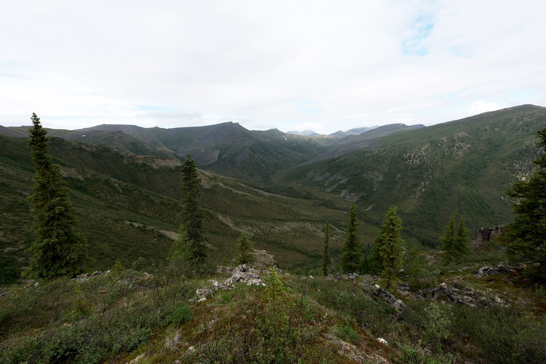
Dennis Creek valley.
Dennis Creek valley.
Dennis Creek valley.
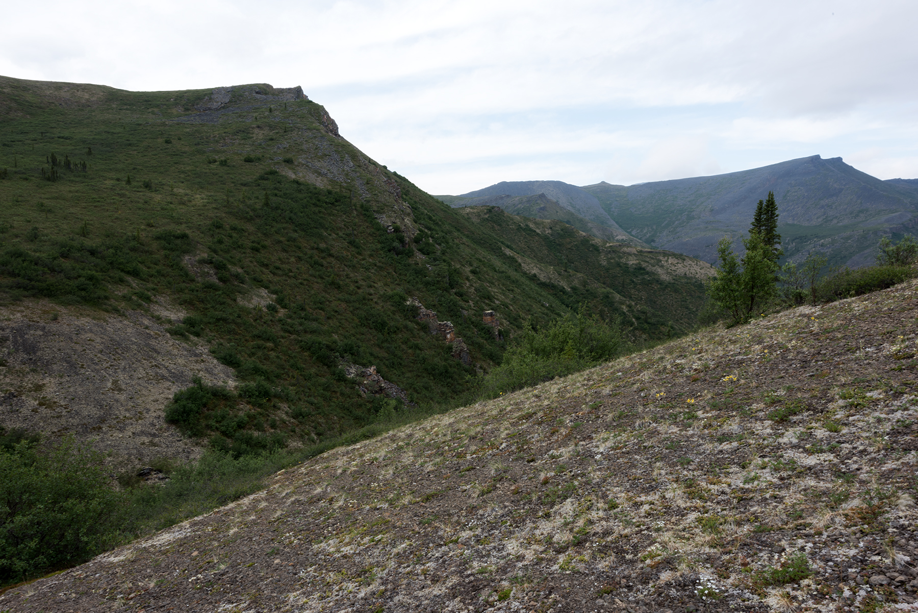
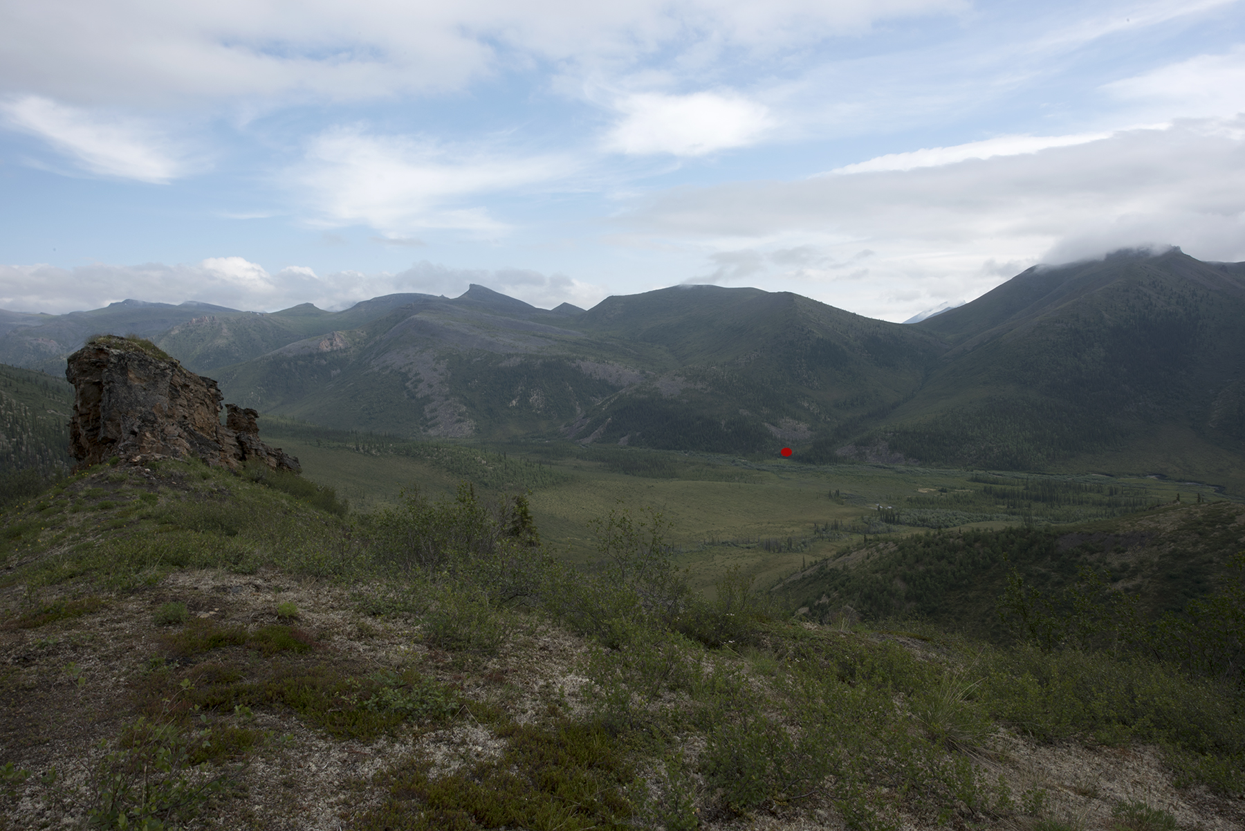
This photo helped me identify a hiking route north. At the red dot, I will hike up the hill and turn left just past the rock slide. When I crest the small ridge and the small creek, I will be able to hike for miles over these mountains. This comes back to the Little Bell River 7 miles north of Summit Lake. The advantage is that I will avoid a 2 mile stretch of the route where I have to walk in the river against a strong current, often jumping over rocks. This will eventually lead to the White Mountains, which I visited last year. To see those photos, click here.
At the confluence of Dennis Creek and the Little Beil River, I found this moose skull.
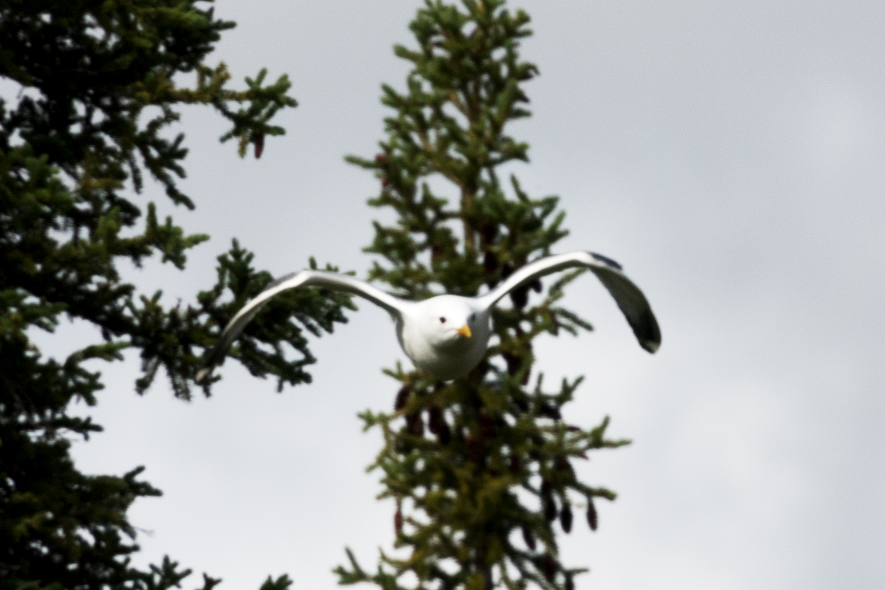
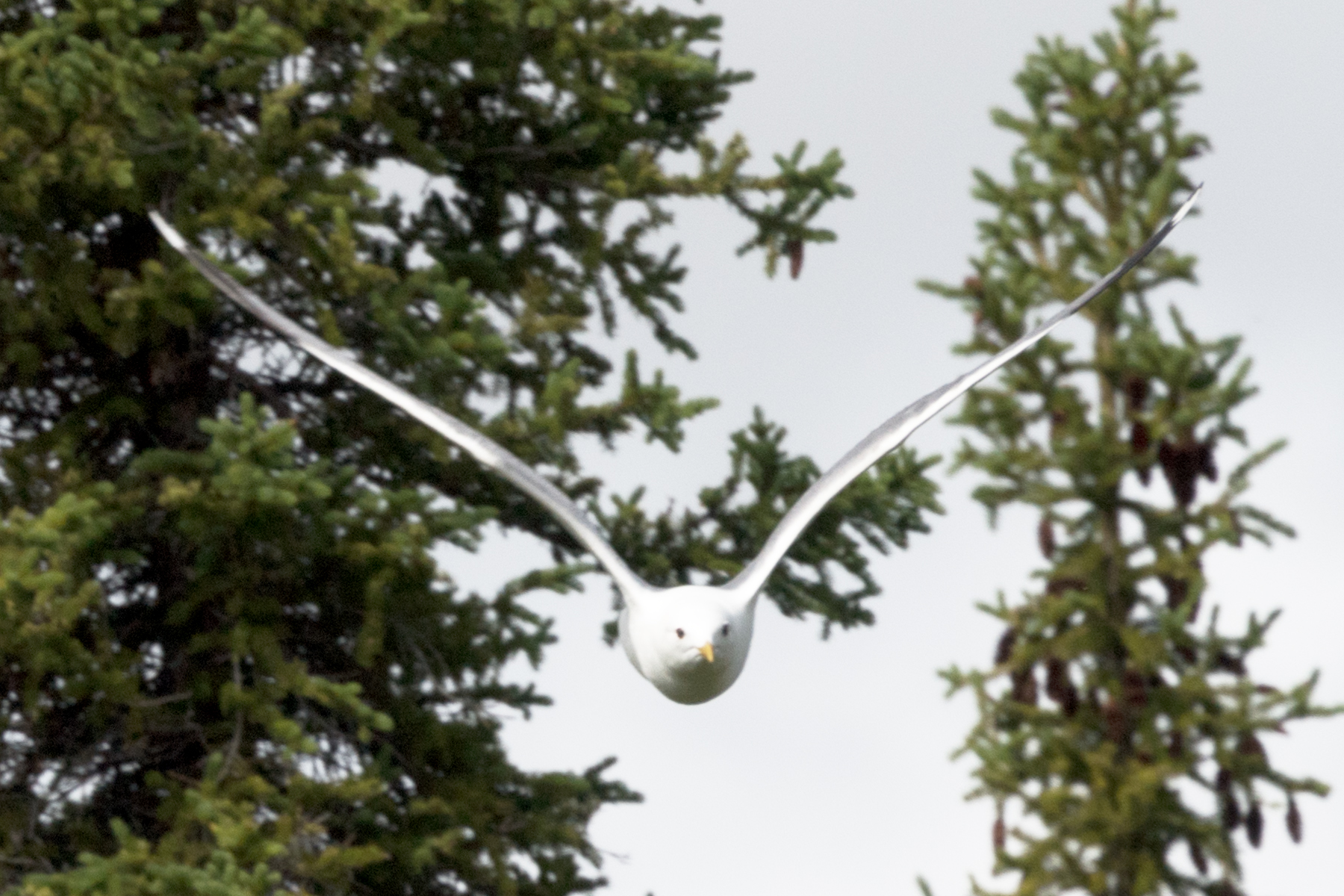
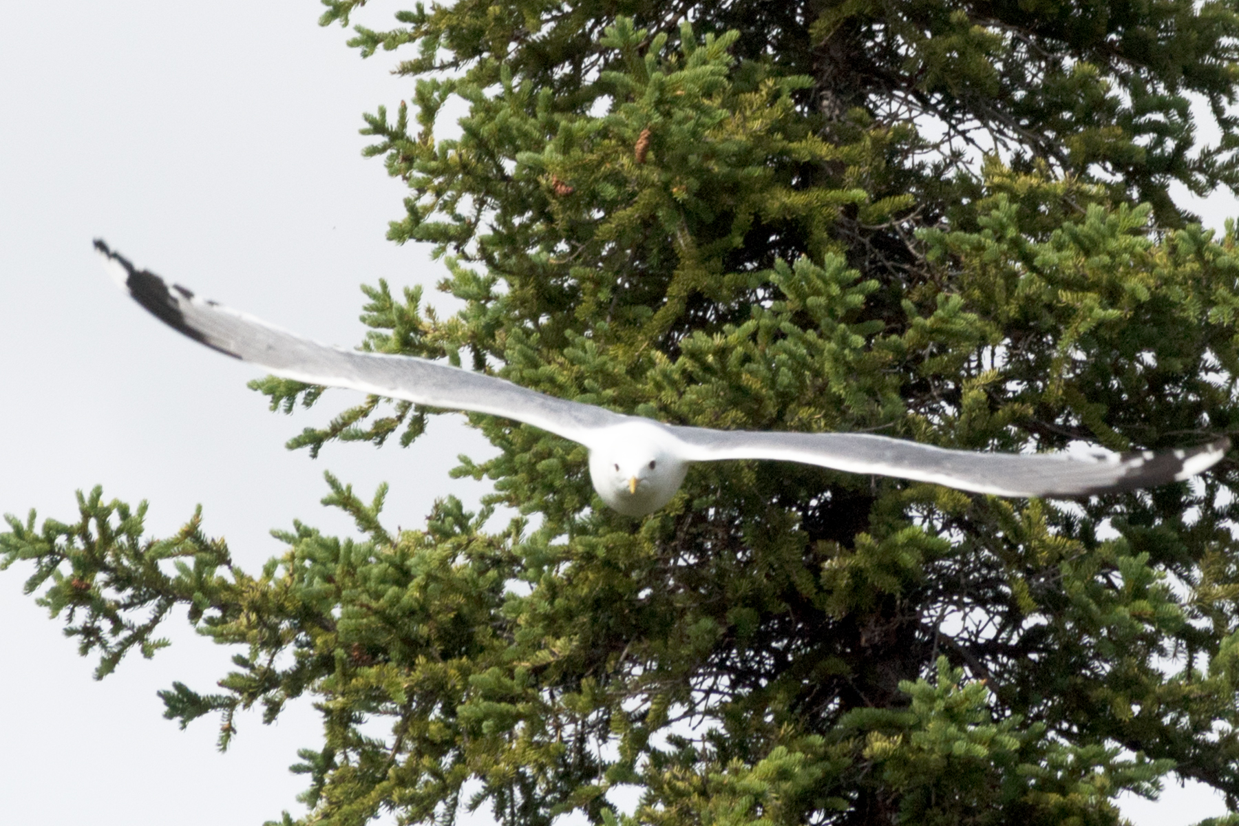
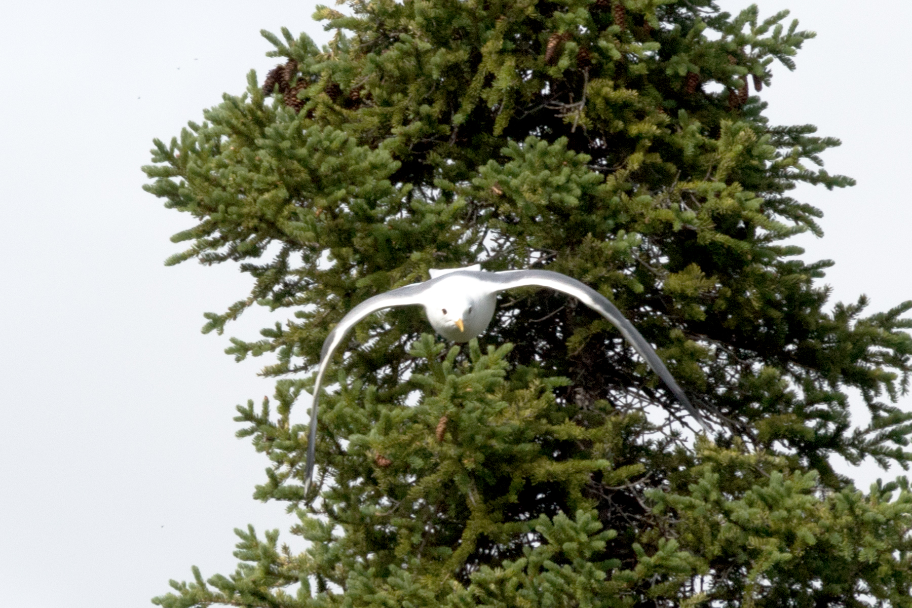
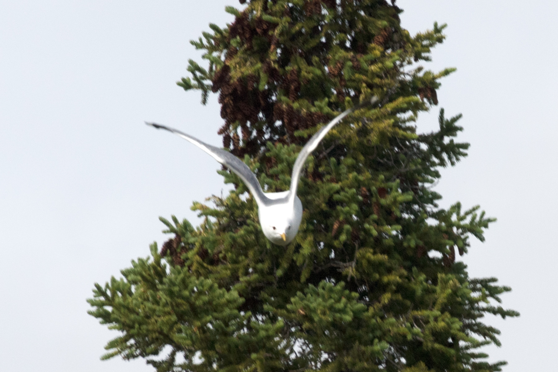
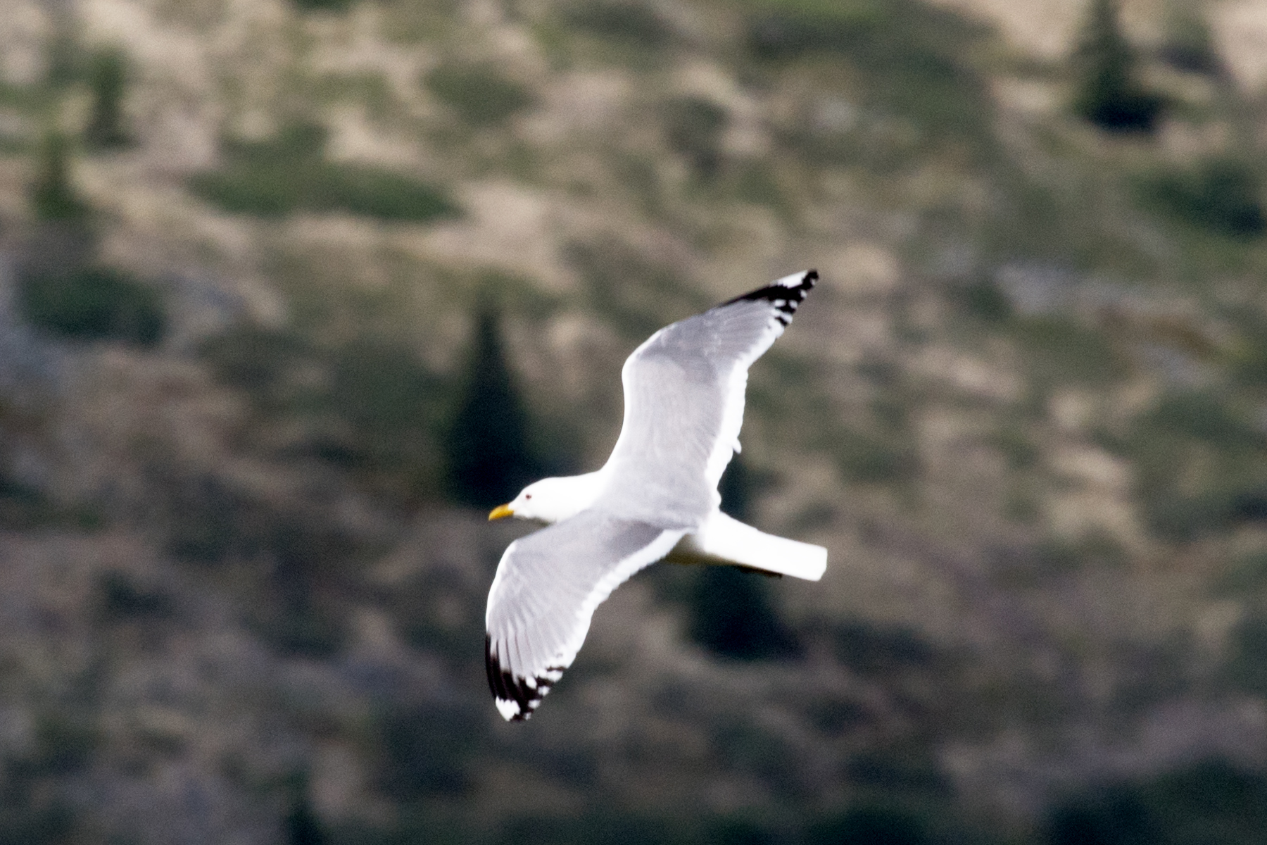
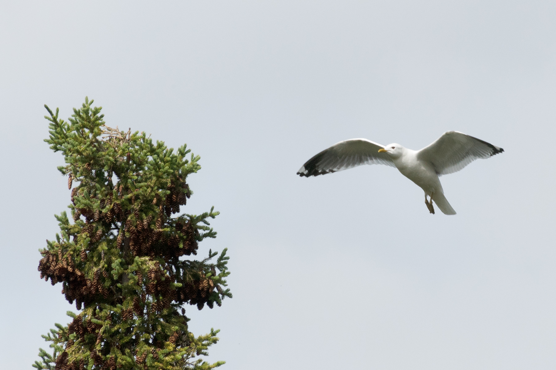
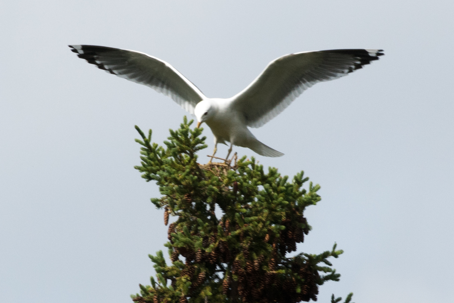
This is a Mew Gull and a very aggressive one at that. I encountered it as I crossed the open space 2 miles north of Summit Lake. Looks like it had a nest atop this Spruce, which was the only tree for a hundred yards. The next sequence shows an attack. Flew within 15 feet of me and then turned away. This went on for 10 minutes.
Squawking.
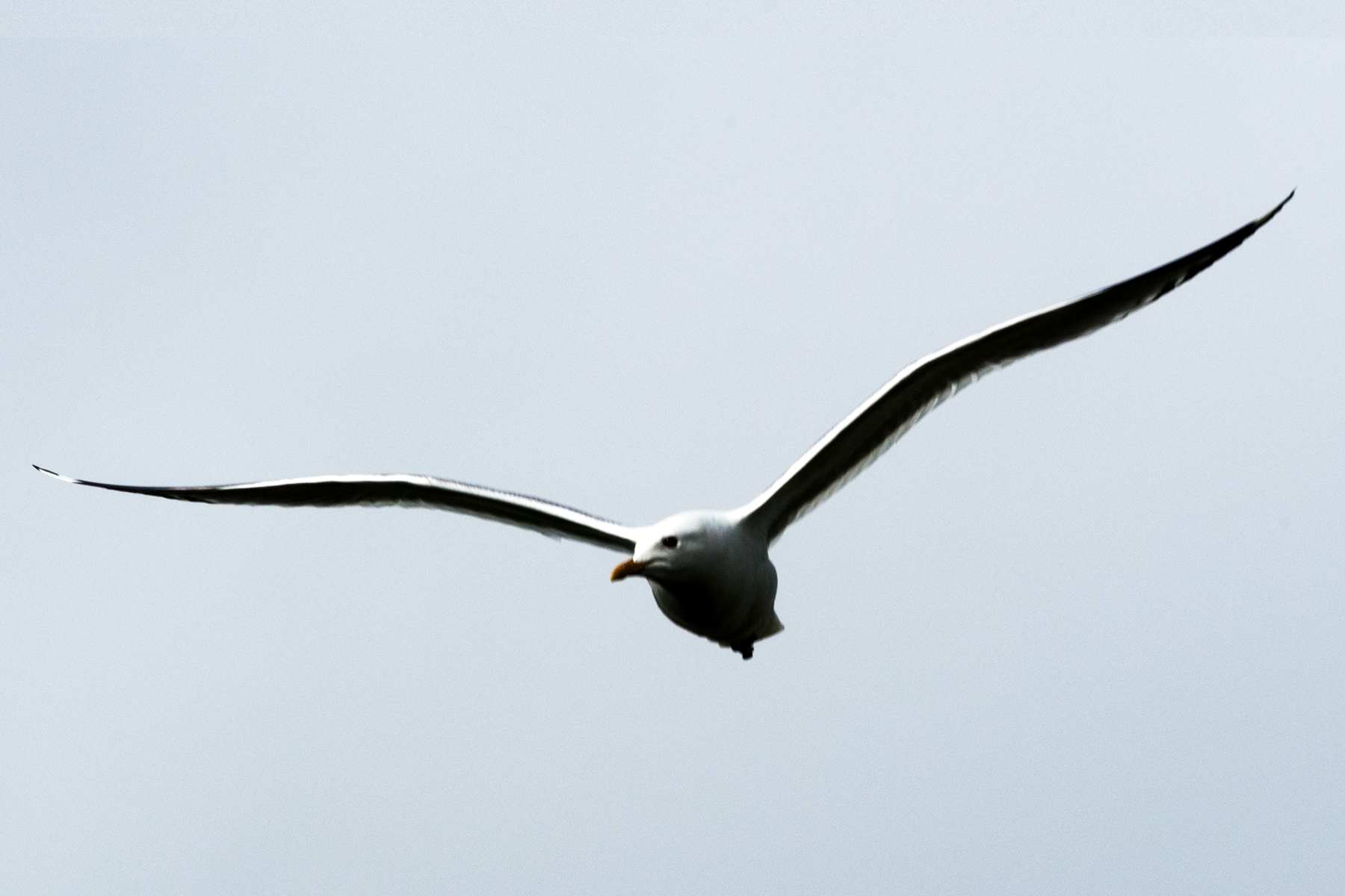
Note that the eyes never leave me.
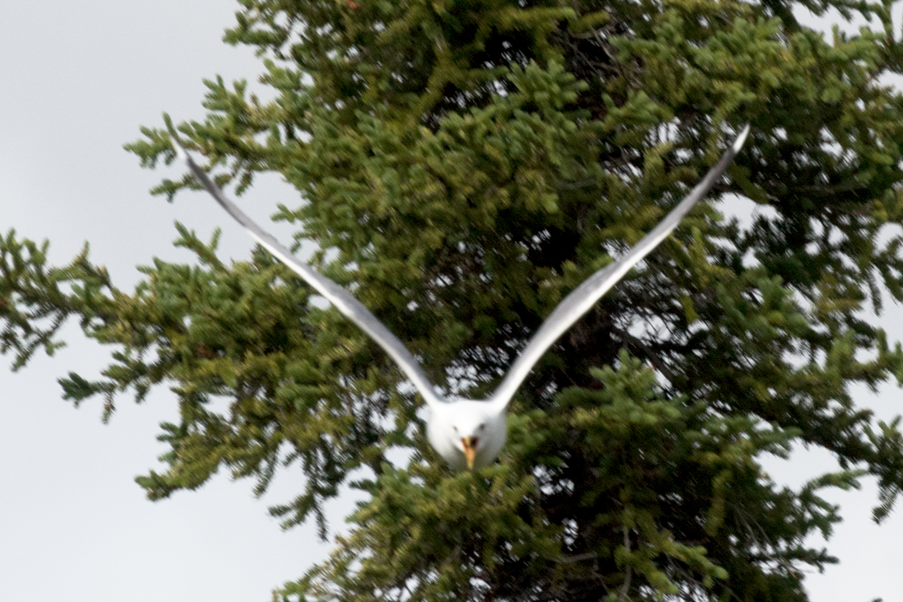
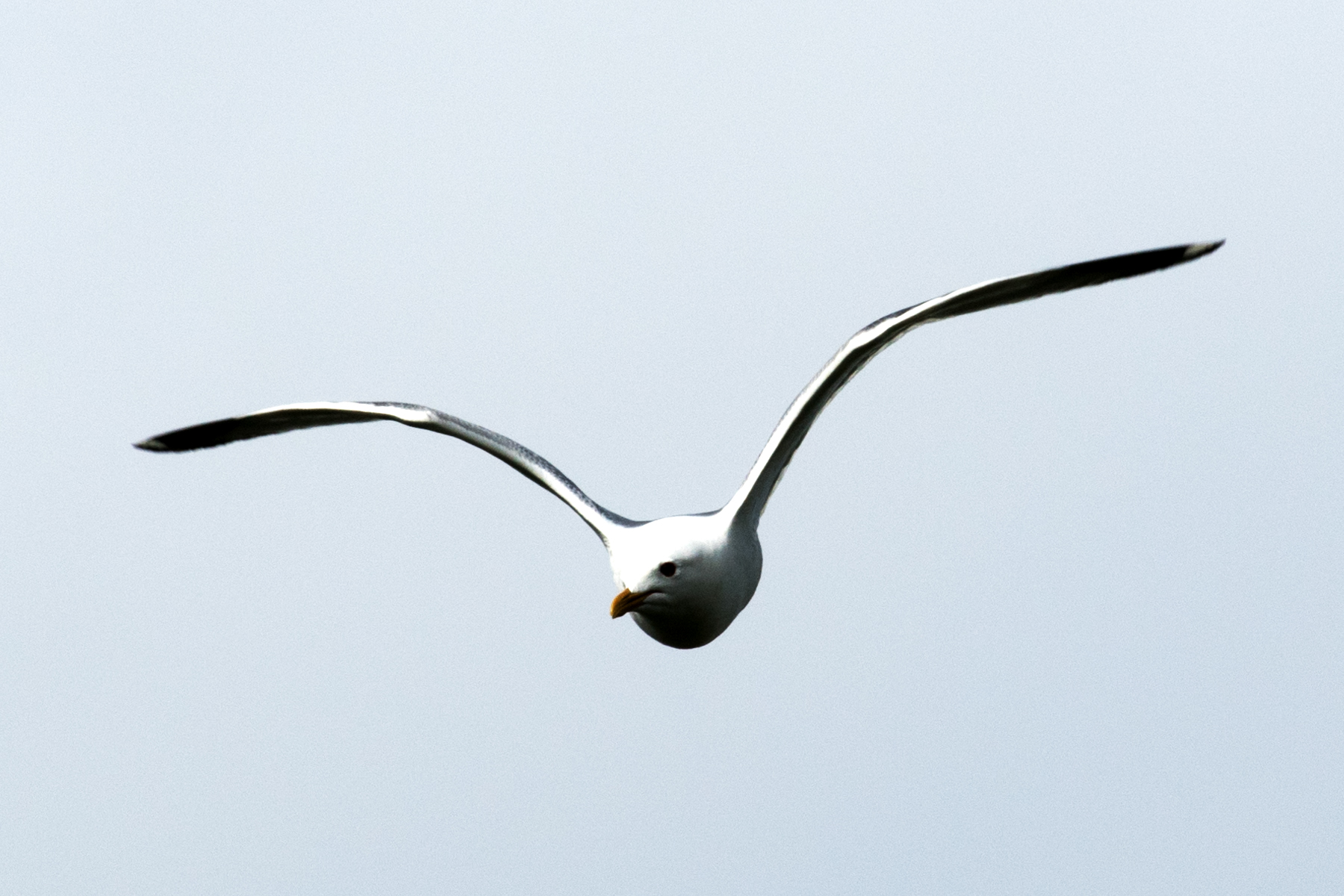
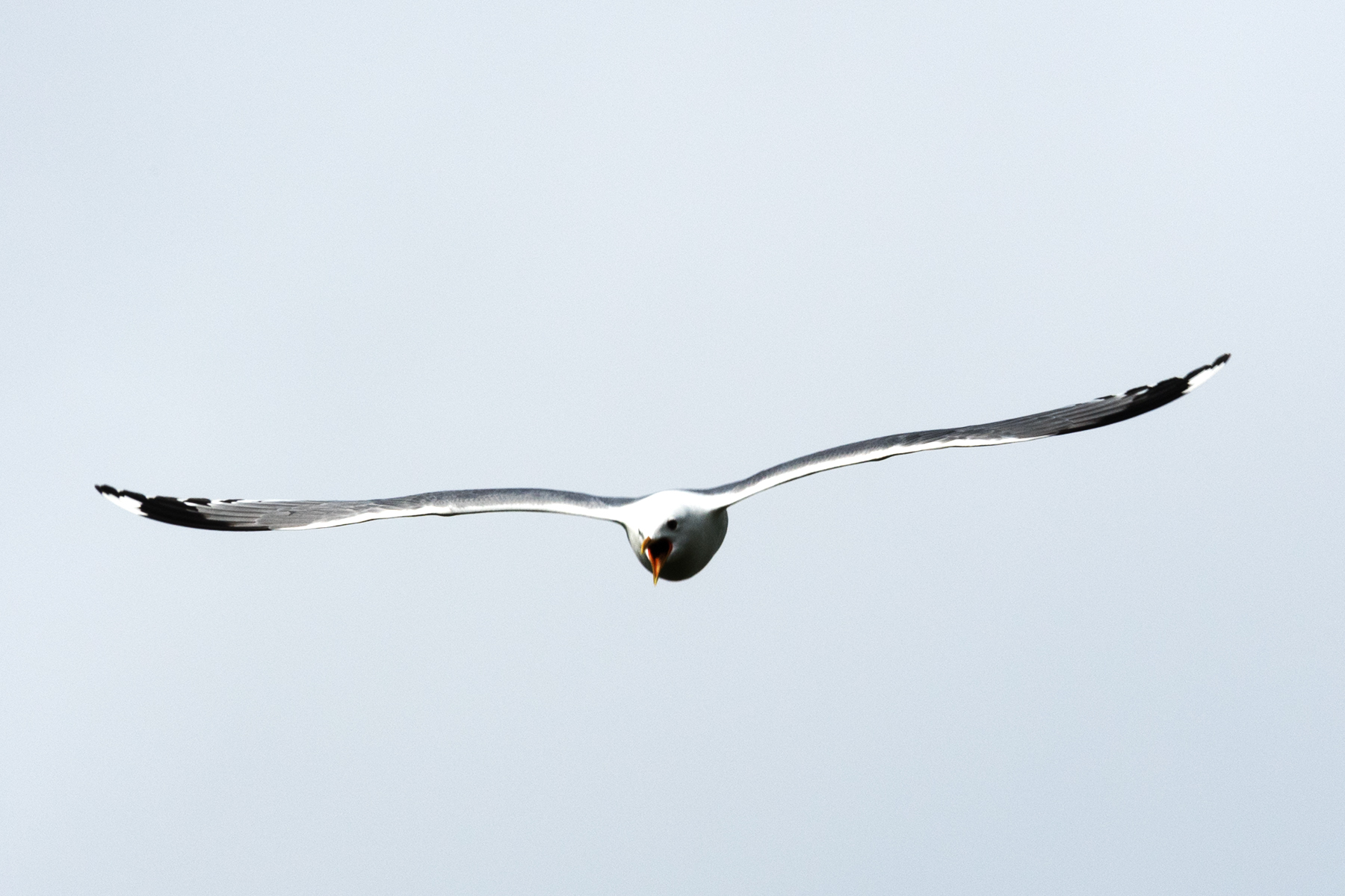
More squawking.
This was repeated about 10 times and the bird would not stop. I finally shot a bear banger her way, after which she left me alone.
This is the end of Part I. Click here to go to Part II.
The float plane airport is the upper right mark, Summit Lake is the lower left mark.
A topographic map of the area I hiked. The 'Parnassius ever' mark is the destination for my 3 day hike. Dennis Creek is the first stream below this mark that veers west. The purple and lines are my planned routes to crest Ocean Peak. The point where they split is the farthest I hiked on this trip. Bear Pond is just to the left of the marker.
Robert, my pilot, at the unloading site near my tent site on the west end of Summit Lake.
Robert taxing away before take-off.
Just before lift-off.
I'll see Robert in two weeks. Not to worry, as I carry a satellite safety device which can text him, others, and send Tweets!
This figure shows my tracks over the two weeks. I spent the first Tue-Thur north of Summit Lake, and the last 3 good weather days (Sun-Tue) south of the lake. That's about 3 miles to the north and 1.5 or so to the south. The north hike was mainly in a river valley - Little Bell River, with a side trip to a ridge to the west. The south hike takes me to 2300 feet in elevation - the lake is about 1000 feet. That's Mount Dennis on the left side of the figure, and the Yukon/NWT border in purple. Summit Lake is in the Yukon.
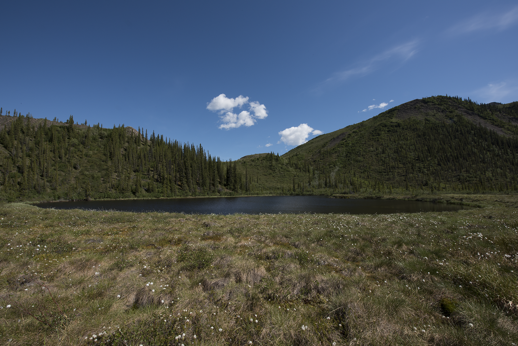
Scenery shots around Summit Lake. This is at my tent site looking east. That mountain left of the tree on the right is just into Northwest Territory - I am in Yukon Territory.
This is the peak just on the east side of the Little Bell River, to the east.
Mount Dennis, to the northwest. That slope in the left foreground is the far western side of Oceans Peak. This is right behind my tent and Summit Lake.
Now the Little Bell River valley is visible, due north of the tent site.
Just to the left of the above photo. That small nob about a third of the way from the right is at the top of the hillside I would climb when I headed south. That nob is about 1500 feet.
Closer shot of the nob. I would hike just below this to crest the first ridge.
To the left of the above photo. Still at the lake tent site.
Nice shot of the Little Bell River valley.
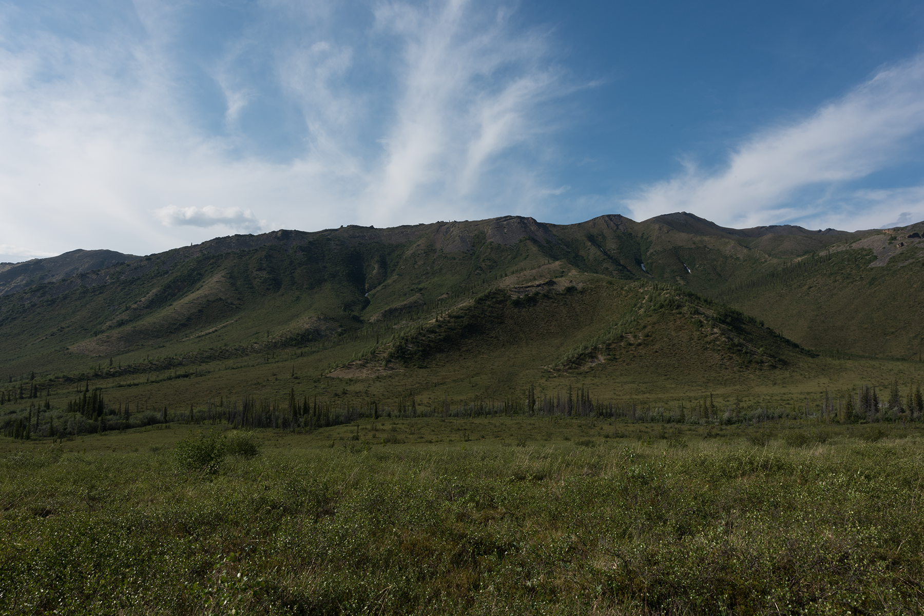
Mount Dennis, south face. I'll hike partway up the north side later.
Stormy weather this day.
My campsite. The orange tent is for storage. The fence discharges 5,000 V every second to discourage bears. I was drying items soaked from a good drenching.
A view of the tundra just west of Summit Lake, taken from the hillside I hike to access the trail over Ocean Peak. The Little Bell River is visible in the center of the photo.
Another view, from a lower elevation. My tent is visible in the lower right - look for the orange.
This shot was taken from the nob. The peninsula on which I camp is now visible. Animals rarely venture to this site, but the downside is I have about 30 minutes extra to hike to get around the water. On this trip, I used an inflatable kayak to either go south to the base of the nob, or north, landing on the shore near those two little specks in the water. This saved a lot of time.
Another view. Note the outlet creek from Summit Lake, which runs into the Little Bell River. Although it looks simple to cross, this creek is 10 feet below the nearby tundra and lined with thick, large willow bushes. Almost impossible to cross, especially with a pack.
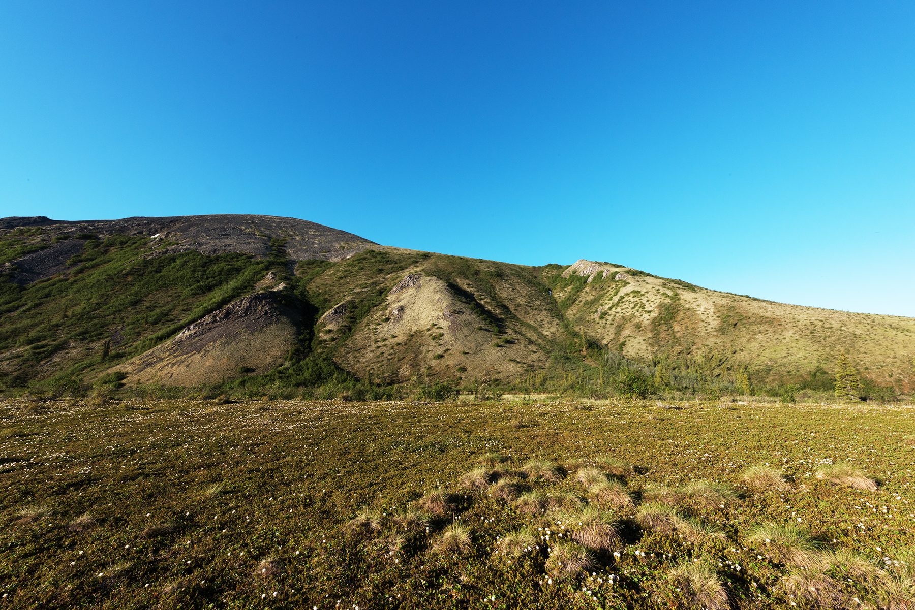
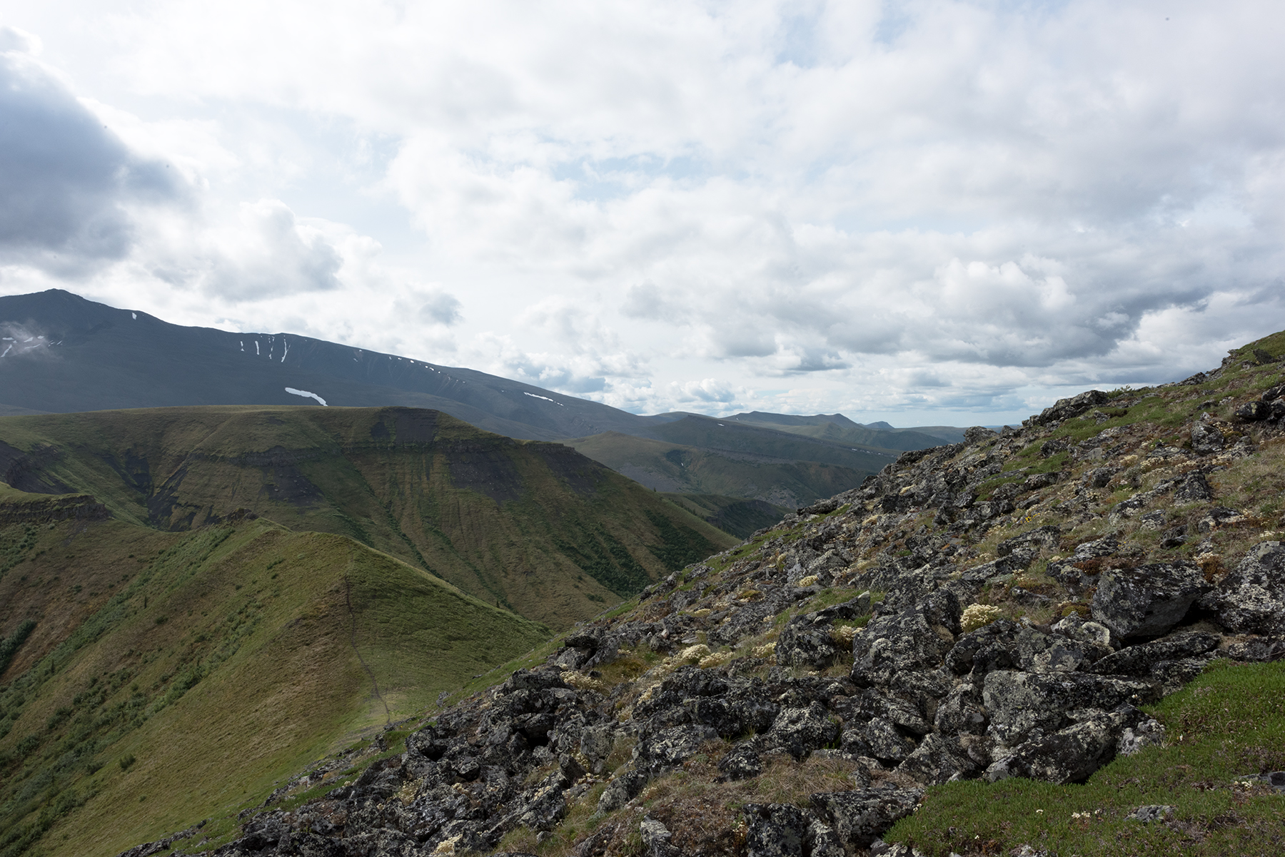
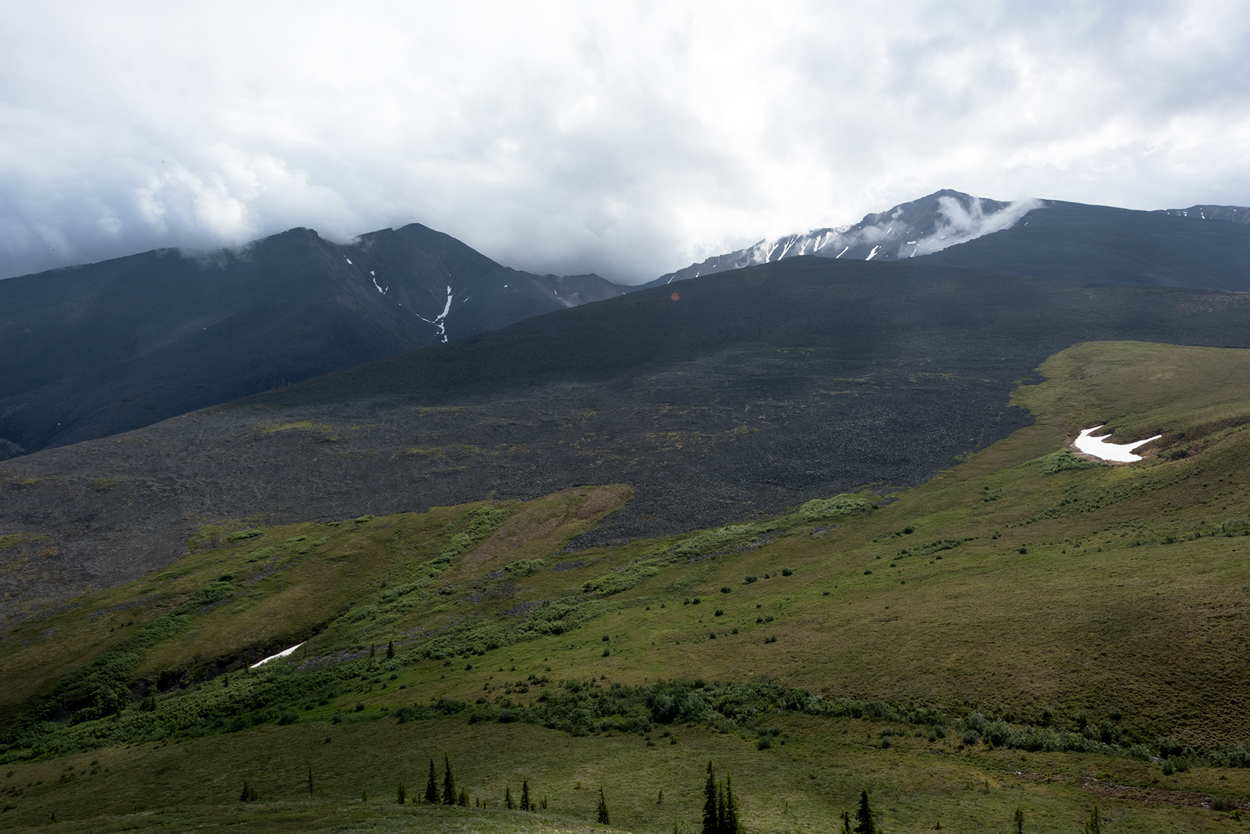
First thing I did Saturday was attempt to hike over the far south ridge, just west of Ocean Peak, which at 5000 feet creates it own weather. This shows what I call the Saddle, a dip in the ridge just south of the lake.
A better view of the trail over the Saddle. At higher elevations, the animal trails are firmer and more obvious than at lower elevations, and is one of the reasons I like it here, besides the scenery.
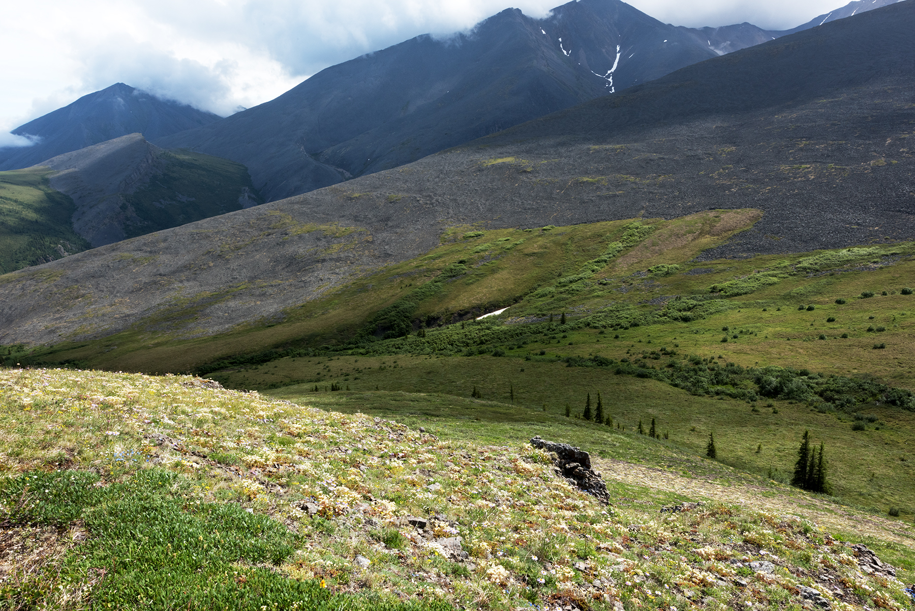
At the south end of the Saddle lies this obstacle. I hike to the left (east) to access higher ground. I have more photos of the west face of this feature.
A view to the west. These flower covered slopes are good for alpine butterflies.
And looking due north of the obstacle. The trail is just visible in the right corner.
Looking south from atop one of the ends of the Saddle.
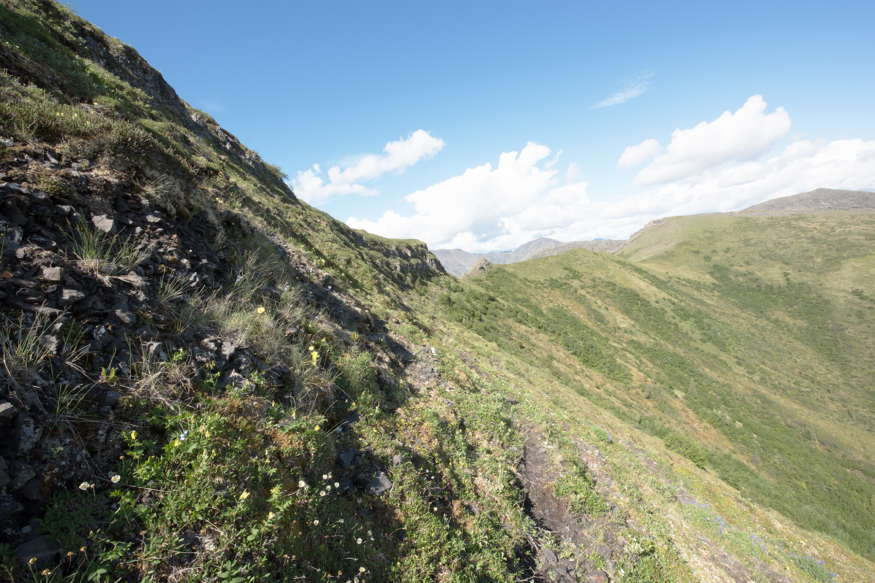
This is the trail around the obstacle, shown in the center of the photo. The trail is on a 35 degree slope and is not as firm as the others I have shown. One slip here and you can slide a good way. Still, this was pretty easy to hike.
Same spot, but looking north toward Ocean Peak.
Looking east from the same spot. That is Ogilvie and Long Lake, just east of Summit Lake in NWT.
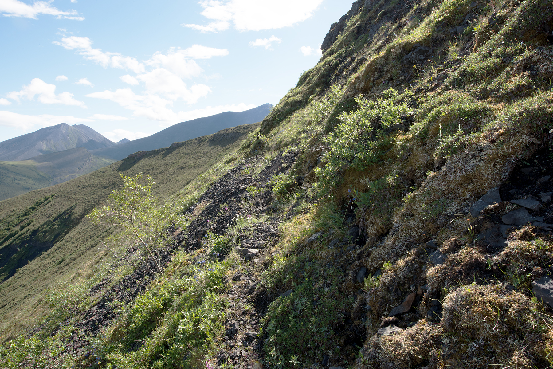
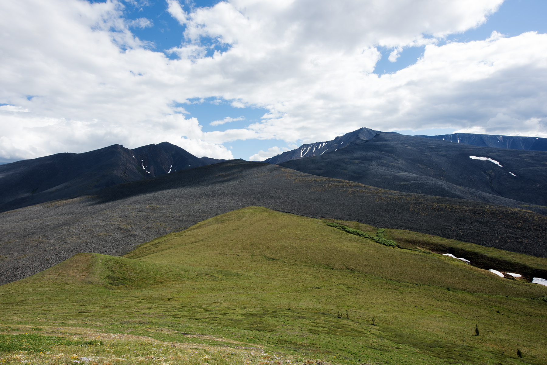
I hiked 10 more minutes and scrambled onto the ridge. The ground is now firm, like walking on your lawn, and the base is very rocky. So easy to hike!
Looking to the south. My route over the ridge is toward the upper right corner, but I would never get there. On this day, I carried too much weight and ran out of water, and had to turn back well before I got here. These photos were taken a week later. I was carrying 50 pounds, 10 of which was camera equipment. Next year, with 40 lbs I will crest the ridge
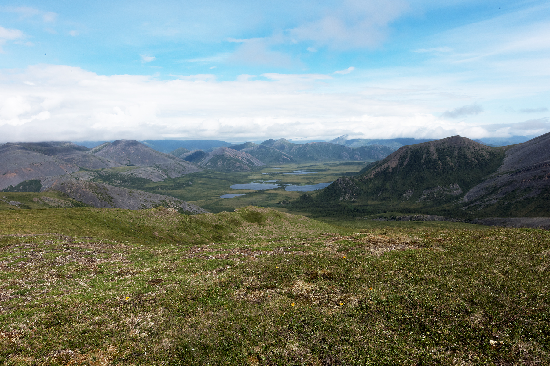
This is just to the north of the previous photo. This little creek has water, the last I would have seen for 5-6 miles if I had continued. I may camp here next year, using this as a satellite camp. Lots of bear sightings here!
This nicely shows the route over the ridge. After the grassy ridge runs the creek, and then the path veers right, just to the left of that snow. The creek is about 2200 feet, and the ridge is 5000 feet, but the 2800 or so feet elevation gain is steady, about 800 feet per mile, so this is doable.
Another view.
And another. I took Gynaephora rossi toward the bottom left of this photo.
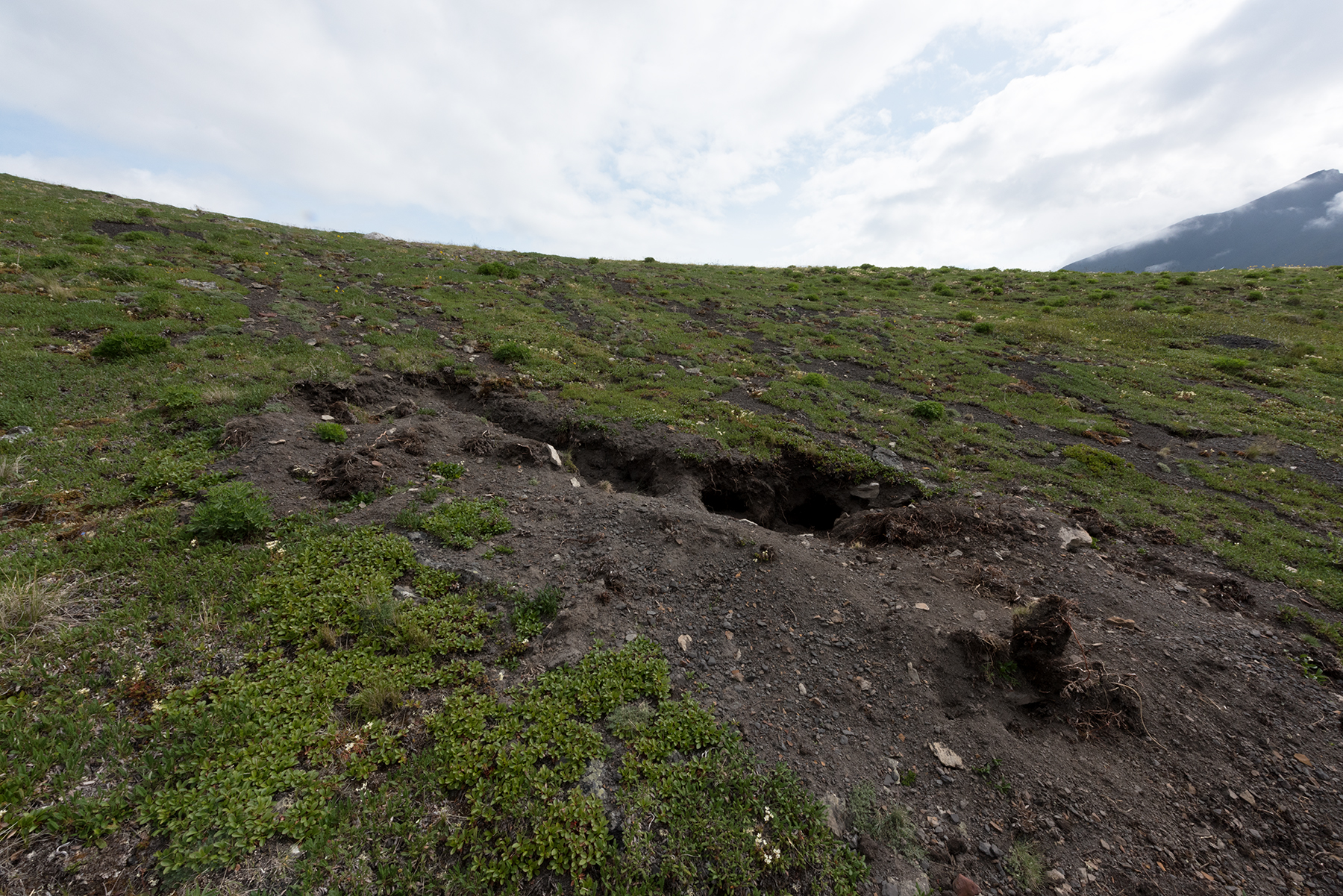
I returned to Summit Lake, having to regroup. On the way back, just below the Saddle, I found this spot where a bear had dug, looking for ground squirrels. These are new for 2016, as I did not see these in 2015.
Another view of the bear dig.
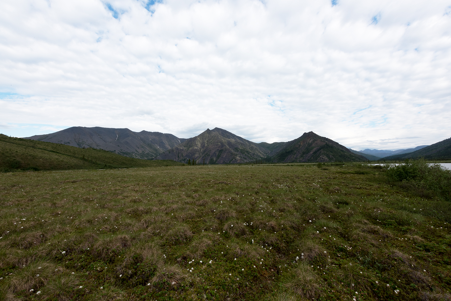
Here is a nice view of Little Bell River, just west of the lake.
One last photo before I returned to the lake on Saturday.
Sunday was again gorgeous, and I hiked west of the lake. Around 1 pm I stopped for water at Little Bell River.
A really pretty little lake, about a mile west of camp. I named this Bear Pond. This is at the base of the drainage from the saddle. I thought about camping here, but the next photo shows why I did not.
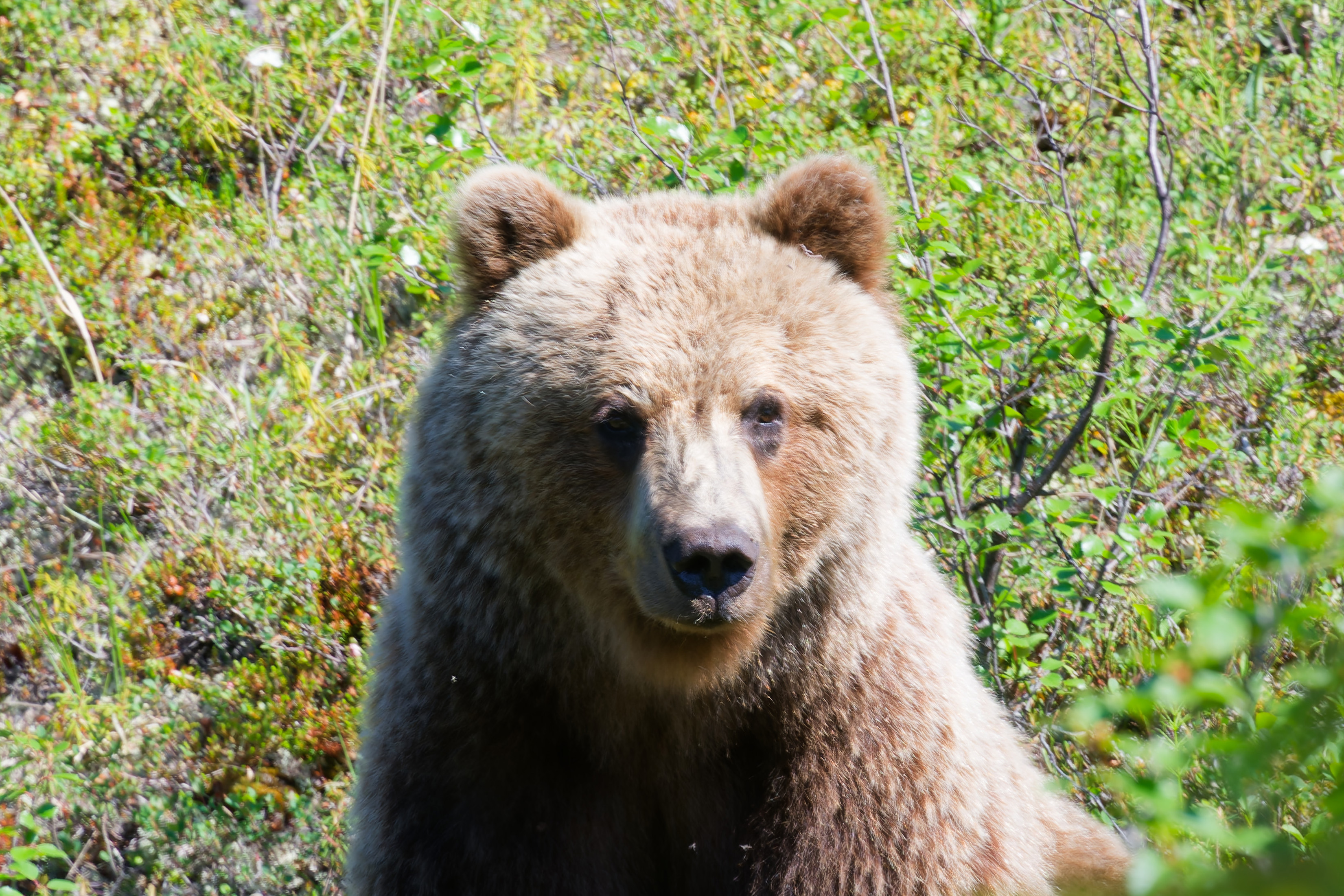
I was seeking Boloria freija on this day, and therefore kept looking for suitable habitat. I ventured into a wooded area, just west of Bear Pond, when I heard a crashing above me. It was a very large bear, running at an angle to get ahead of me. I started yelling and she stopped, sitting down like a dog. I kept saying 'hey', very firmly, with one hand on my bear spray. Bear just sat still, so I snapped these photos and backed away very slowly. She was only 90 feet away. After I had walked for 20 seconds, I looked back and saw her standing erect, peering over bushes to watch me.
Very curious but cautious.
On Tuesday (June 29), I planned to hike 3 miles north along the Little Bell River. As I prepared the kayak, I saw an large animal swimming across the lake. A caribou.
The lake is bordered by mountains on the north and south which slope into the water. I have never tried to hike around the lake. So, the caribou is taking the direct route.
A good shake!
Needs some recovery time.
And also needs to refuel.
The slope presents no problem.
I watched for 20 minutes, and then the caribou disappeared into the thicket.
On Tuesday (June 29), I hiked 3 miles north along the Little Bell River. Early on, I hiked through a lot of Spruce.
Due east of Mount Dennis, the peak I see from the lake. On the right border, a willow thicket along a creek is seen. The first 2 mile I had to cross one of these every 100 yards or so. Trick is to stay on higher ground away from the Little Bell River, as these get very dense near the river.
Just a few minutes later I spied this young male moose resting.
About 1.5 miles north of the lake, a clearing. This is looking back toward Summit Lake.
This is looking to the north.
Another view to the north.
My camp site for Tuesday and Wednesday night. I have learned to seek a big tree in these Spruce woods, as the ground is usually firm and often flat here. The white is lichen, and this grows on rocky surfaces, usually dry.
This is the meadow I visited these two days, trying for Parnassius eversmanni thor. Click on this link for a
specimen photo. The river is 100 yards to the right.
Thursday I planned to hike up Dennis Creek, on the north side of Mount Dennis. This is looking to the north up the Little Bell River from the west side.
Another view. My campsite was in the middle of the photo, near the two taller trees.
I crested a small hill and am now looking to the west at the Dennis Creek valley.
Looking due south, at the back of Mount Dennis.
I hiked up a ridge on the south side of Dennis Creek. This is where the ridge flattened, looking north back to the creek.
Looking south, up Mount Dennis. Note the animal trail. I wanted to hike up the right side, and I did find a nice animal trail, but the skies clouded and I deemed it too risky to get caught in a storm up high.
Another perspective.
The animal trail to the plateau passes the tree in the center of the screen and heads at a 45 degree angle to the top.
Looking back to the creek.
Another view up Dennis Creek.
This slope is typically found at 2000 feet in the Richardson Mountains. I usually find Oeneis uhleri and Plebejus glandon bryanti on these and I took a few of each this day, even though it was cloudy and little activity was observed.
Looking back at the Little Bell River valley.
Dennis Creek valley.
Dennis Creek valley.
Dennis Creek valley.
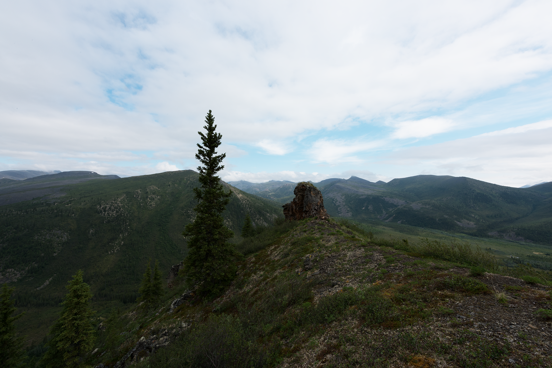
This photo helped me identify a hiking route north. At the red dot, I will hike up the hill and turn left just past the rock slide. When I crest the small ridge and the small creek, I will be able to hike for miles over these mountains. This comes back to the Little Bell River 7 miles north of Summit Lake. The advantage is that I will avoid a 2 mile stretch of the route where I have to walk in the river against a strong current, often jumping over rocks. This will eventually lead to the White Mountains, which I visited last year. To see those photos, click here.
At the confluence of Dennis Creek and the Little Beil River, I found this moose skull.
This is a Mew Gull and a very aggressive one at that. I encountered it as I crossed the open space 2 miles north of Summit Lake. Looks like it had a nest atop this Spruce, which was the only tree for a hundred yards. The next sequence shows an attack. Flew within 15 feet of me and then turned away. This went on for 10 minutes.
Squawking.
Note that the eyes never leave me.
More squawking.
This was repeated about 10 times and the bird would not stop. I finally shot a bear banger her way, after which she left me alone.
This is the end of Part I. Click here to go to Part II.