2015 Vacation photographs
Part 1
Photographs are shown in chronological order.
For the second part of the vacation photos, click here.
For the third part of the vacation photos, click here.
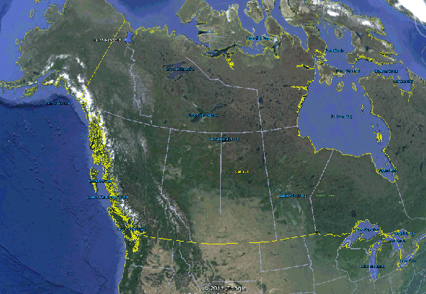
An overview of the destination - the upper left mark, in perspective to Chicago.
The float plane airport is the upper right mark, Summit Lake is the lower left mark, and my hiking destination in the White Mountains is the upper left mark.
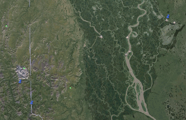
The hike from Summit Lake to the SW corner of the White Mountains, which are composed of white rocks and readily identifiable from space.
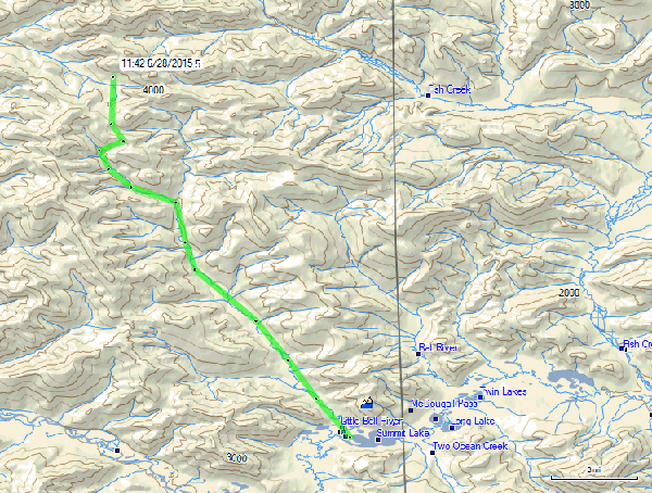
A topological view of my hiking route. I followed the Little Bell River about 9 miles to an unnamed creek, followed that for about 3 miles, hiked about 1/4 miles up another unnamed creek, then turned north and hiked about 2 miles over a mountain pass to reach the base camp, just at the SW edge of the White Mountains. 14 miles map-wise, but about 20 miles of hiking with all the zigs and zags. I went from 1000 feet elevation at Summit Lake to about 2500 feet at the base camp. That grey line in the middle is the Yukon/Northwest Territory (NWT) border.
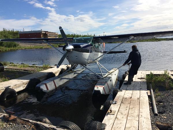
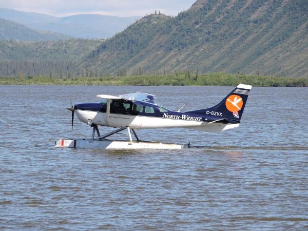
Quinton, the pilot, pulling the plane from the dock.
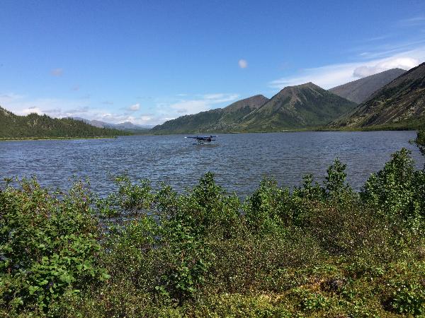
The plane at the west end of Summit Lake. This is June 23.
Quinton departing for Inuvik. I'll see him in two weeks.
A close up of Quinton departing for Inuvik.
Unloading my gear from the plane.
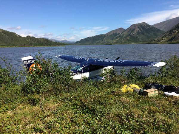
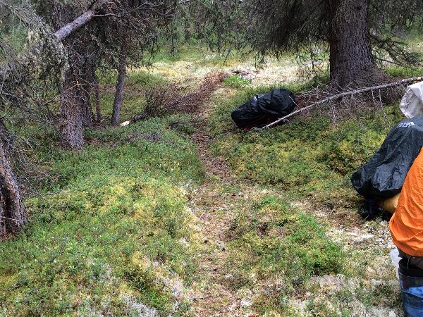
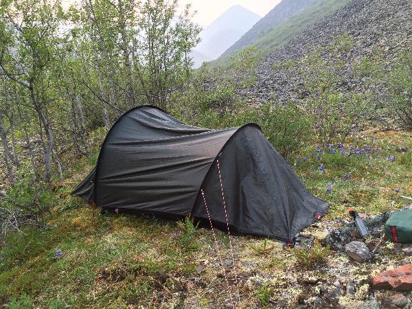
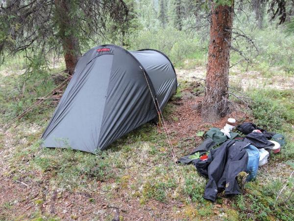
The orange tent is for storage, and the dark tent is my sleeping tent. The fence gives 5,000 volts every second, to discourage bears! This photograph was actually shot after the backpack trip, as I only left the orange tent and the bear fence as I was hiking.
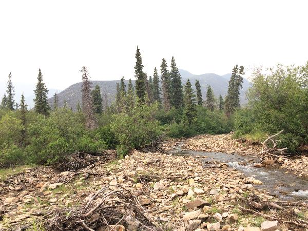
I hiked for about 2 hours, and camped on a glacial deposit overlooking Little Bell River, about a mile south of the lake. You can see the river in the background. No fish!
Notice the white lichen. This grows on firmer surfaces, so I learned to look for this when hiking the boggy areas of the taiga.
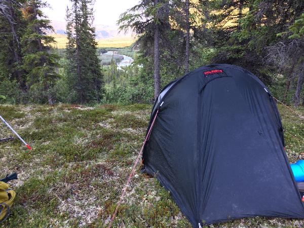
My campsite the second night. This is along an animal trail frequented by moose and wolves. Fortunately, I only saw one wolf on the trip, and only one moose, near Summit Lake.
These trails were great, but after 40-50 yards, one always has to walk around a downed tree, or two or three. Still, beat walking in the surrounding boggy taiga.
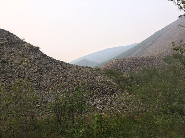
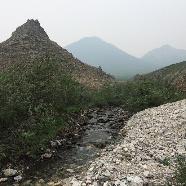
Now I am on the small unnamed creek. This is Thursday, June 25. The haze is smoke from a forest fire, likely started by lightning that struck the day I landed at the lake. This will get worse over the next three days.
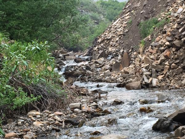
Occasionally, the creek or river passed a narrow spot or gorge. I had to hike in the creek in these spots.
Campsite of day three, on a ridge just above two creeks.
Another view of my campsite.
A view to the north from the campsite.
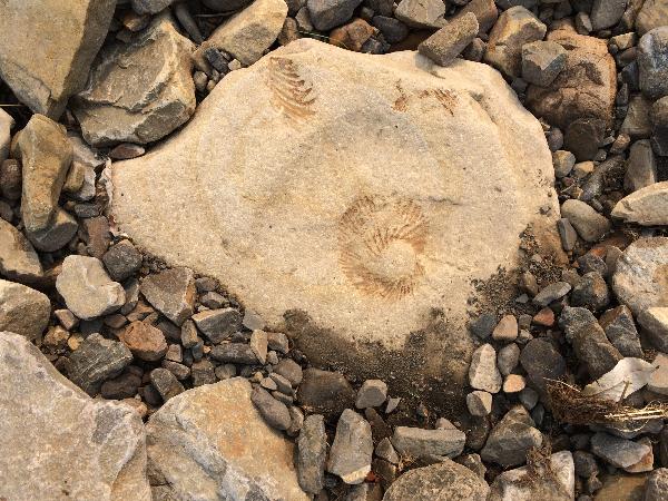
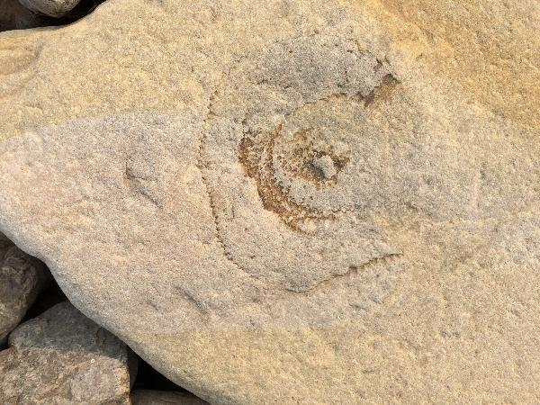
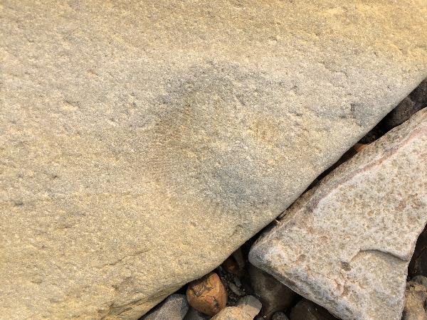
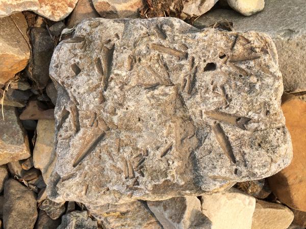
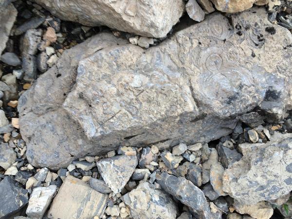
Next day on my hike, the creek ran dry for a stretch, and I found some ammonite fossils, probaly 251 mya from the Triassic Period.
Another fossil.
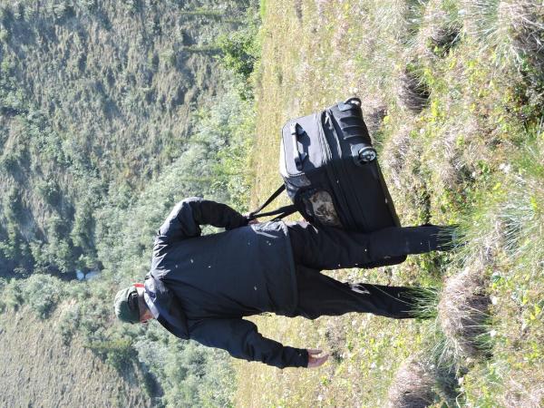
Unintentional selfie, Friday, June 26.
Another fossil, just up the creek bed.
A really neat fossil.
This is the intersection of the larger unnamed creek with the smaller one that will take me to the pass, from which I can see the White Mountains. The smaller creek is between the two hills. This site was great for O. polixenes, B. chariclea and freija, and C. chippewa and canadensis.
Now I have reached the pass. Almost all downhill from here.
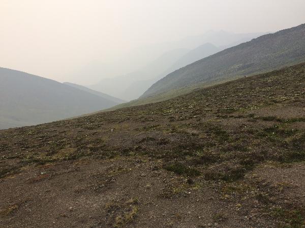
Landscape is interesting here, barren.
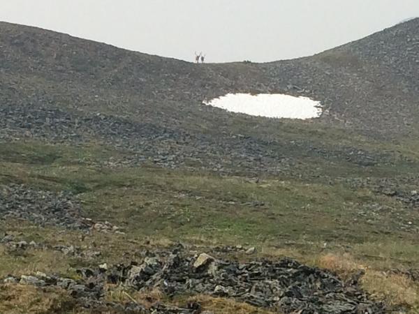
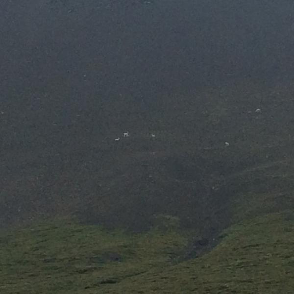
Caribou on a pass to the south.
Now they are scrambling past me.
The smoke is really bad today and ruining the view.
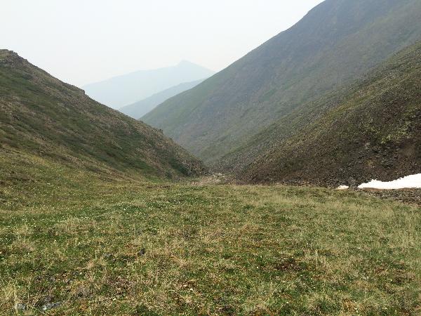
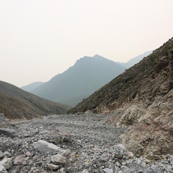
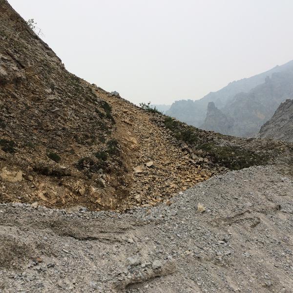
This wash heads north toward the White Mountains, but I am going to take another route to my destination.
A view up the creek.
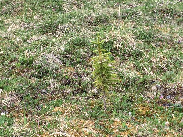
Technically I am above the tree line, but occasionally small spruce are found.
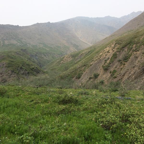
Alpine tundra, great to hike.
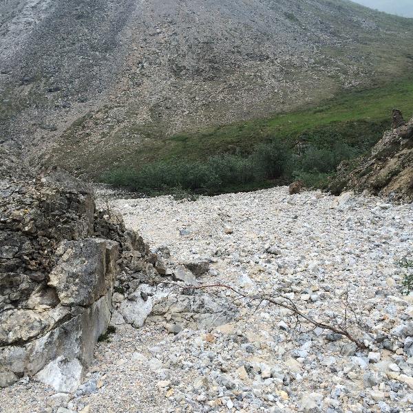
A scree slope. These are also great to hike, very firm footing.
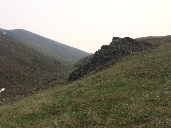
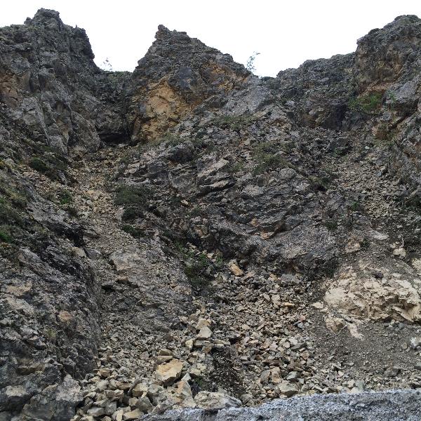
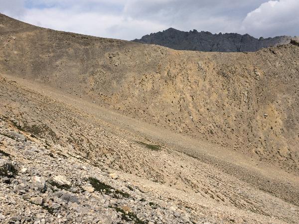
Today is Saturday, June 27. I have hiked about 2 miles north, over a pass, and am now right on the edge of the White Mountains. Very desolate here. I wanted to search this canyon, but it quickly became too difficult to hike, with little promise of butterflies. The white rocks flow from these canyons, but the canyon walls are much darker.
The side of a nearby hill.
Still very smoky today.
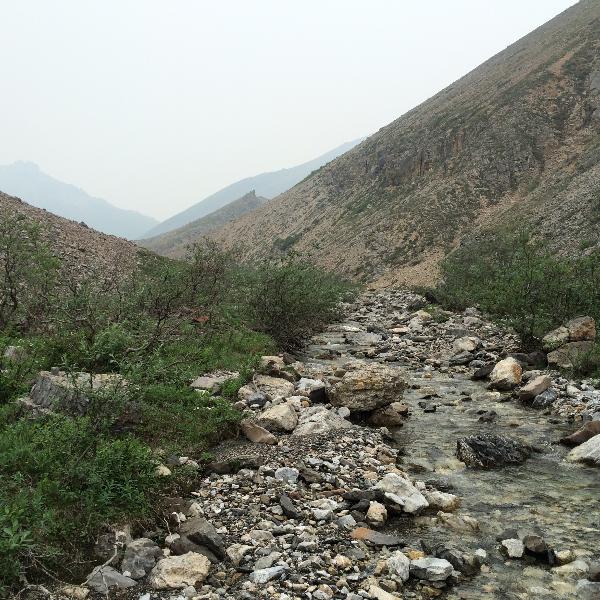
A view downstream of the unnamed stream I followed on the hike. I hoped to find char, but only saw a few chubs, so no fish for me.
A view up a second canyon. I would turn back at this point, but not before I encountered a female grizzly bear, which was about 50 feet away. I eventually coaxed her 40 yards away, and shot two bear bangers - flares that explode like a shotgun, about 30 yards away - and these scared the bear, who ran east. I headed west.
Another view of the creek.
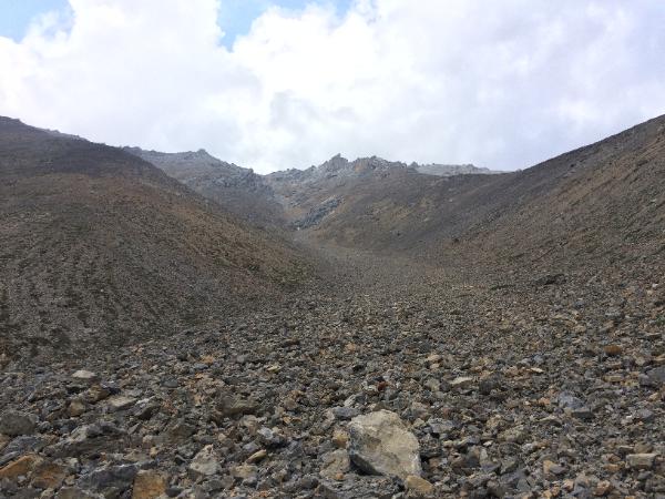
A view up another canyon. I hiked about 1/4 in this one before it became too difficult.
This is the view up the creek that leads to the pass I crossed early in the morning, and was my way back to the campsite.
I would collect butterflies in this meadow, but I had to walk and kick them up, as they do not fly very much in cool, cloudy conditions. Temperature was around 57F.
Another view of the meadow.
I found a bunch of Dall Sheep, 18 were in this group, but not all are visible in this shot.
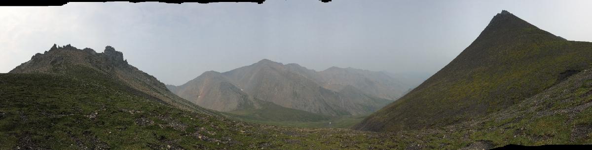
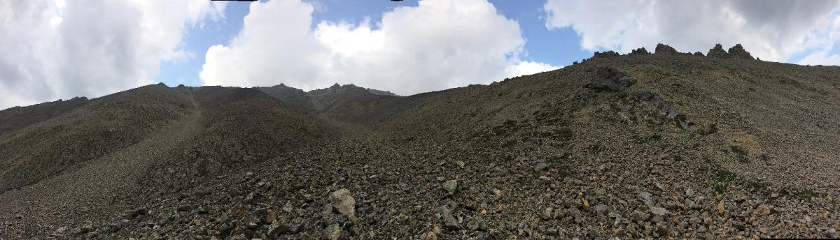
Above is a panorama shot looking back toward the White Mountains from the pass.
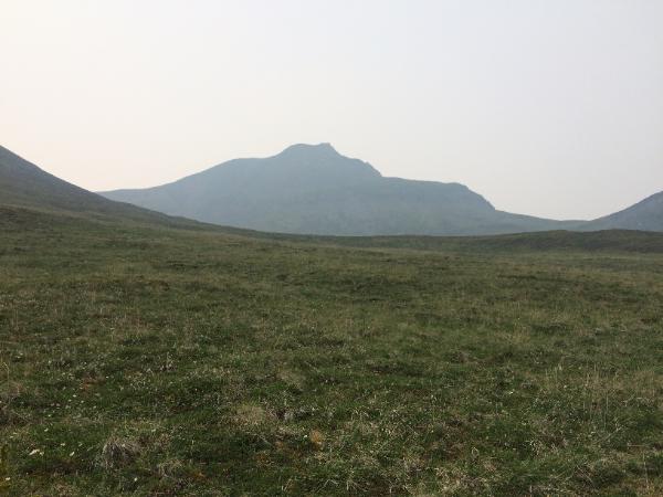
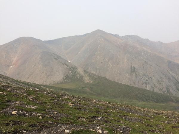
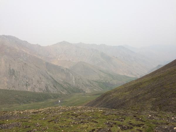
The next three shots are images from the pass, looking north toward the White Mountains.
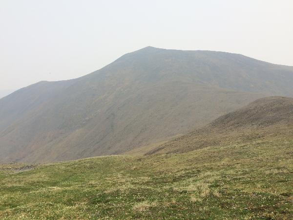
Looking north toward the White Mountains.
Looking north toward the White Mountains.
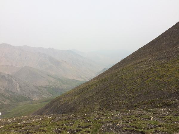
A fossil found on the pass. I am about 1 mile from my tent, at 3500 feet.
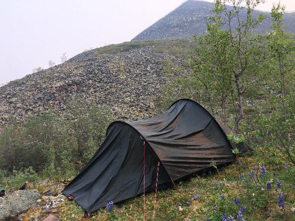
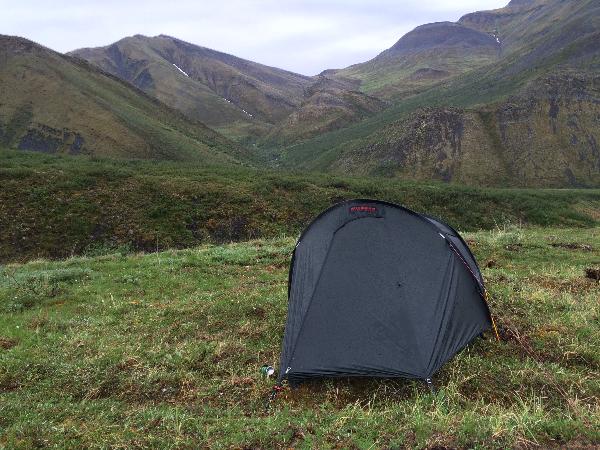
My tent. The pass which I will hike on my way back to Summit Lake is the low point on the horizon.
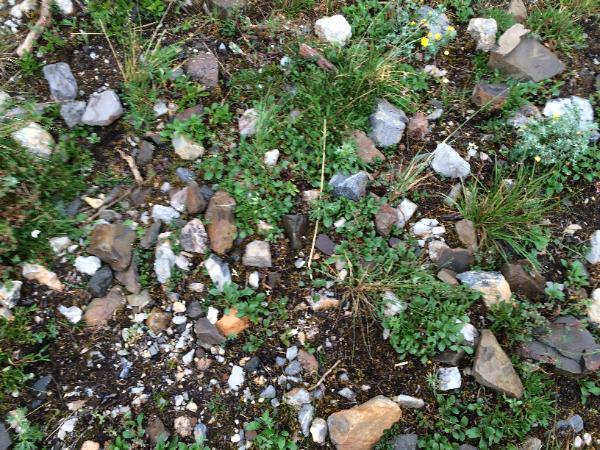
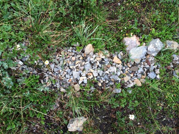
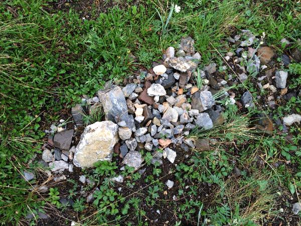
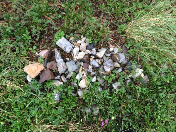
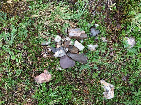
This next series of photos is interesting. Seemed like piles of rocks placed by humans, possibly covering graves, or used to make tools. However, they probably are the result of a process called 'frost upheaval'. Frost forms on the bottom of a rock, which is cooler than the top. The frost pushes the rock up, and eventually other rocks are pushed under as well, leading to a pile. I was more excited when I thought this was an archaeological site!
This is the second pile to the south.
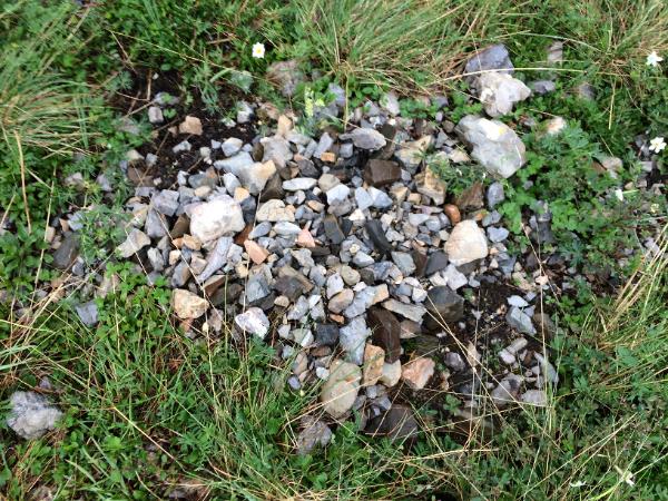
This is the third pile to the south.
This is the fourth pile to the south.
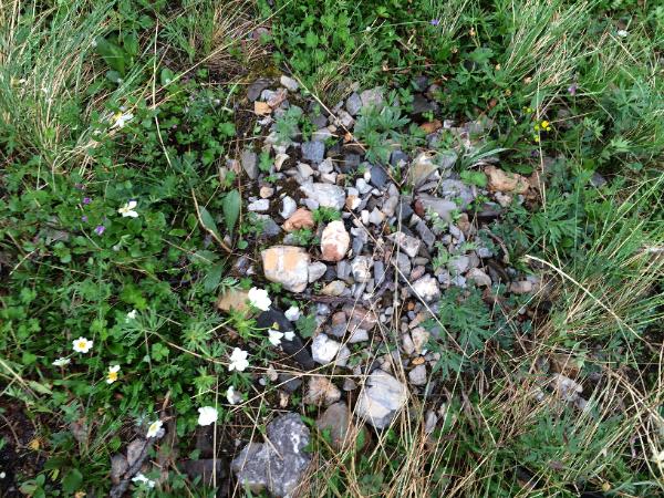
This is the fifth pile to the south
This is the sixth pile to the south.
This is the seventh pile to the south.
This is the eight pile to the south.
This is the ninth pile to the south.
This is the tenth pile to the south.
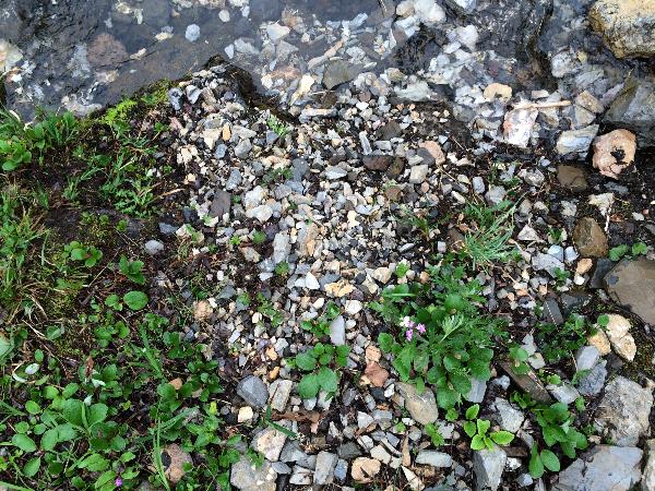
This is the eleventh and final pile, to the south. This one is in a stream.
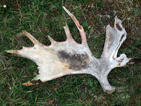
A moose antler. Found near my tent in the White Mountains.
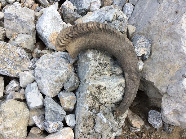
A Dall Sheep horn, found in the White Mountains.
Monday, June 29. The skies are smoke free! I hiked to the south end of the White Mountains. Here are some shots.
A panorama centered on the shot shown in the previous photo.
About the same spot.
Still in the same spot. Note the river of rocks that flow down the hill.
I hiked up this slide, thinking of going to the top. But it was so desolate, no plants or butterflies, so I turned back. These rocks are very sharp, and I wore gloves to protect my hands, as I would catch myself on a rock whenever I stumbled.
Another panorama centered on the above photo.
Part 1
Photographs are shown in chronological order.
For the second part of the vacation photos, click here.
For the third part of the vacation photos, click here.
An overview of the destination - the upper left mark, in perspective to Chicago.
The float plane airport is the upper right mark, Summit Lake is the lower left mark, and my hiking destination in the White Mountains is the upper left mark.
The hike from Summit Lake to the SW corner of the White Mountains, which are composed of white rocks and readily identifiable from space.
A topological view of my hiking route. I followed the Little Bell River about 9 miles to an unnamed creek, followed that for about 3 miles, hiked about 1/4 miles up another unnamed creek, then turned north and hiked about 2 miles over a mountain pass to reach the base camp, just at the SW edge of the White Mountains. 14 miles map-wise, but about 20 miles of hiking with all the zigs and zags. I went from 1000 feet elevation at Summit Lake to about 2500 feet at the base camp. That grey line in the middle is the Yukon/Northwest Territory (NWT) border.
Quinton, the pilot, pulling the plane from the dock.
The plane at the west end of Summit Lake. This is June 23.
Quinton departing for Inuvik. I'll see him in two weeks.
A close up of Quinton departing for Inuvik.
Unloading my gear from the plane.
The orange tent is for storage, and the dark tent is my sleeping tent. The fence gives 5,000 volts every second, to discourage bears! This photograph was actually shot after the backpack trip, as I only left the orange tent and the bear fence as I was hiking.
I hiked for about 2 hours, and camped on a glacial deposit overlooking Little Bell River, about a mile south of the lake. You can see the river in the background. No fish!
Notice the white lichen. This grows on firmer surfaces, so I learned to look for this when hiking the boggy areas of the taiga.
My campsite the second night. This is along an animal trail frequented by moose and wolves. Fortunately, I only saw one wolf on the trip, and only one moose, near Summit Lake.
These trails were great, but after 40-50 yards, one always has to walk around a downed tree, or two or three. Still, beat walking in the surrounding boggy taiga.
Now I am on the small unnamed creek. This is Thursday, June 25. The haze is smoke from a forest fire, likely started by lightning that struck the day I landed at the lake. This will get worse over the next three days.
Occasionally, the creek or river passed a narrow spot or gorge. I had to hike in the creek in these spots.
Campsite of day three, on a ridge just above two creeks.
Another view of my campsite.
A view to the north from the campsite.
Next day on my hike, the creek ran dry for a stretch, and I found some ammonite fossils, probaly 251 mya from the Triassic Period.
Another fossil.
Unintentional selfie, Friday, June 26.
Another fossil, just up the creek bed.
A really neat fossil.
This is the intersection of the larger unnamed creek with the smaller one that will take me to the pass, from which I can see the White Mountains. The smaller creek is between the two hills. This site was great for O. polixenes, B. chariclea and freija, and C. chippewa and canadensis.
Now I have reached the pass. Almost all downhill from here.
Landscape is interesting here, barren.
Caribou on a pass to the south.
Now they are scrambling past me.
The smoke is really bad today and ruining the view.
This wash heads north toward the White Mountains, but I am going to take another route to my destination.
A view up the creek.
Technically I am above the tree line, but occasionally small spruce are found.
Alpine tundra, great to hike.
A scree slope. These are also great to hike, very firm footing.
Today is Saturday, June 27. I have hiked about 2 miles north, over a pass, and am now right on the edge of the White Mountains. Very desolate here. I wanted to search this canyon, but it quickly became too difficult to hike, with little promise of butterflies. The white rocks flow from these canyons, but the canyon walls are much darker.
The side of a nearby hill.
Still very smoky today.
A view downstream of the unnamed stream I followed on the hike. I hoped to find char, but only saw a few chubs, so no fish for me.
A view up a second canyon. I would turn back at this point, but not before I encountered a female grizzly bear, which was about 50 feet away. I eventually coaxed her 40 yards away, and shot two bear bangers - flares that explode like a shotgun, about 30 yards away - and these scared the bear, who ran east. I headed west.
Another view of the creek.
A view up another canyon. I hiked about 1/4 in this one before it became too difficult.
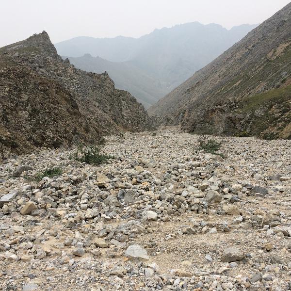
This is the view up the creek that leads to the pass I crossed early in the morning, and was my way back to the campsite.
I would collect butterflies in this meadow, but I had to walk and kick them up, as they do not fly very much in cool, cloudy conditions. Temperature was around 57F.
Another view of the meadow.
I found a bunch of Dall Sheep, 18 were in this group, but not all are visible in this shot.
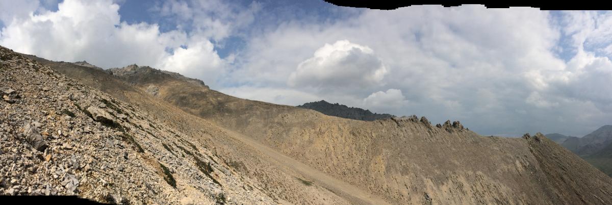
Above is a panorama shot looking back toward the White Mountains from the pass.
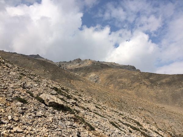
The next three shots are images from the pass, looking north toward the White Mountains.
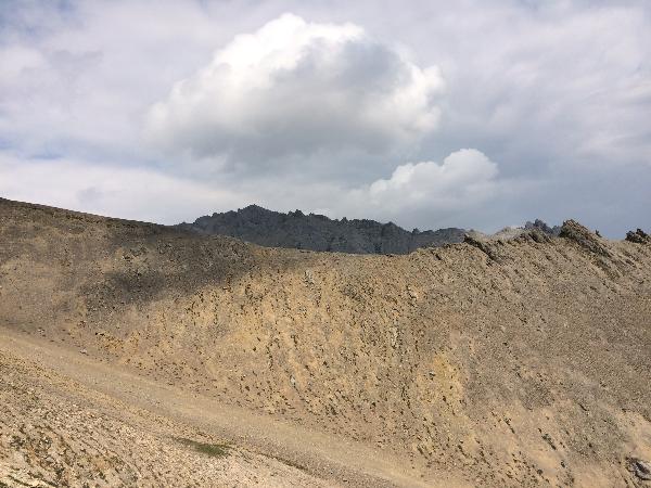
Looking north toward the White Mountains.
Looking north toward the White Mountains.
A fossil found on the pass. I am about 1 mile from my tent, at 3500 feet.
My tent. The pass which I will hike on my way back to Summit Lake is the low point on the horizon.
This next series of photos is interesting. Seemed like piles of rocks placed by humans, possibly covering graves, or used to make tools. However, they probably are the result of a process called 'frost upheaval'. Frost forms on the bottom of a rock, which is cooler than the top. The frost pushes the rock up, and eventually other rocks are pushed under as well, leading to a pile. I was more excited when I thought this was an archaeological site!
This is the second pile to the south.
This is the third pile to the south.
This is the fourth pile to the south.
This is the fifth pile to the south
This is the sixth pile to the south.
This is the seventh pile to the south.
This is the eight pile to the south.
This is the ninth pile to the south.
This is the tenth pile to the south.
This is the eleventh and final pile, to the south. This one is in a stream.
A moose antler. Found near my tent in the White Mountains.
A Dall Sheep horn, found in the White Mountains.
Monday, June 29. The skies are smoke free! I hiked to the south end of the White Mountains. Here are some shots.
A panorama centered on the shot shown in the previous photo.
About the same spot.
Still in the same spot. Note the river of rocks that flow down the hill.
I hiked up this slide, thinking of going to the top. But it was so desolate, no plants or butterflies, so I turned back. These rocks are very sharp, and I wore gloves to protect my hands, as I would catch myself on a rock whenever I stumbled.
Another panorama centered on the above photo.


This is the end of Part I. Click here to go to Part II.