2018 Quebec trip photographs
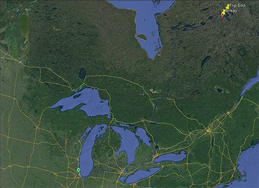
The trip overview. The total drive is about 2000 miles, with the last 500 or so on the Trans Taiga Highway, an improved primitive road that services four dams on the La Grande River
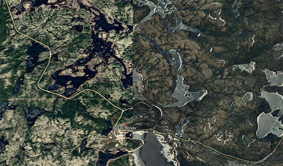
The first dam of the series, the farthest from Chicago. The work town is Brisay. The water from the Caniapiscau River is diverted to the La Grande River at this point. I fished for 5 days below the dam. A later photo better shows the campsite, located about an inch from Brisay on this image, at about 10-15 degrees east from due north.
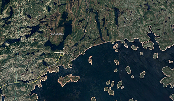
The dam at the Caniapiscau River. The long narrow body of water in the center near the top of the image is near the dam. Photos to follow. I had hoped to take a 4 day boat trip down the river, but the river was bone dry just below the dam.
Spent several days near Matagami Quebec. Bears were the theme of this trip, as I saw 25 in two weeks. They often had grass in their mouths.
June 23, a P. canadensis puddle party, on Route 1050, near the Bell River.
The start of the Route de Nord, which connects the James Bay Highway to Chibougamau.
Had good weather the first few days of the trip, but it would soon change.
A rest stop near Quevillon.
I would try for Brook Trout here, with no success.
This was a few days later, now on the James Bay Highway, near one of the large river crossings. The highway crosses 3 very large rivers. This bear was probably scavenging from the nearby garbage bin.
A little later a fox kit ran across the road.
I am about 8 feet away.
Mom must have been hunting.
This is one of the large rivers. Note the sparse landscape. Plus, about 150 kms of the drive was through fire damage.
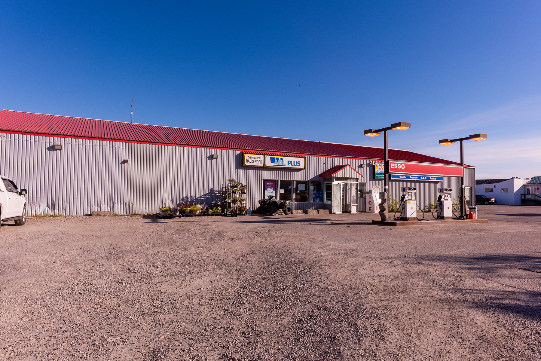
This station is halfway up the James Bay Highway, and offers food along with a free shower.
Here is the fourth dam, the nearest to James Bay on the La Grande River.
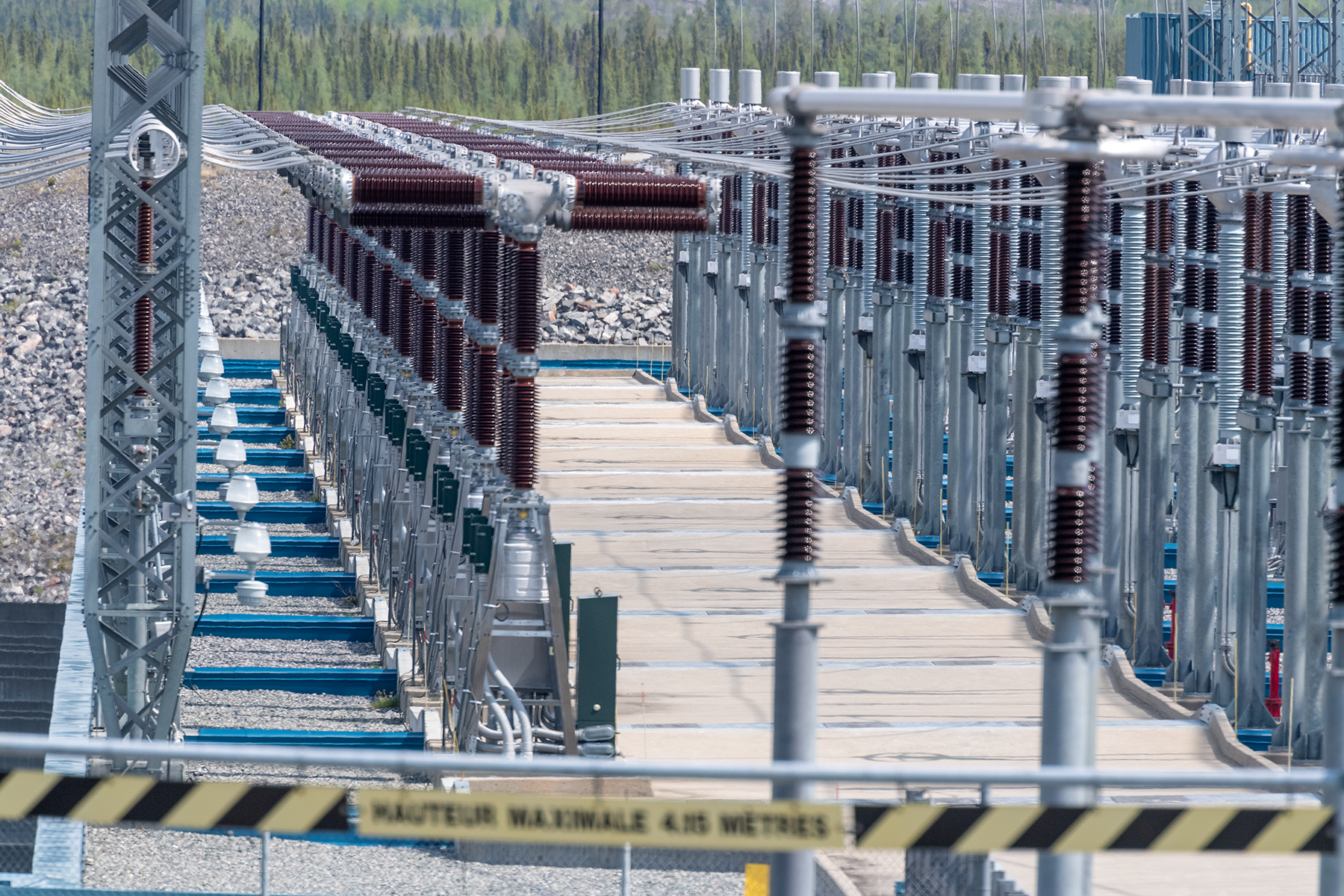
The business section of the dam.
Now at the start of the Trans Taiga Highway. This sign indicates the next place to purchase gas.
My rig.
Another outfitter sign.
Saw little wildlife besides the bears, but here are a few geese.
Turned cloudy soon, an lasted a few days. This is typical of the scenery on the Trans Taiga Highway.
Now I am at the campsite near Brisay. This is right above were I parked.
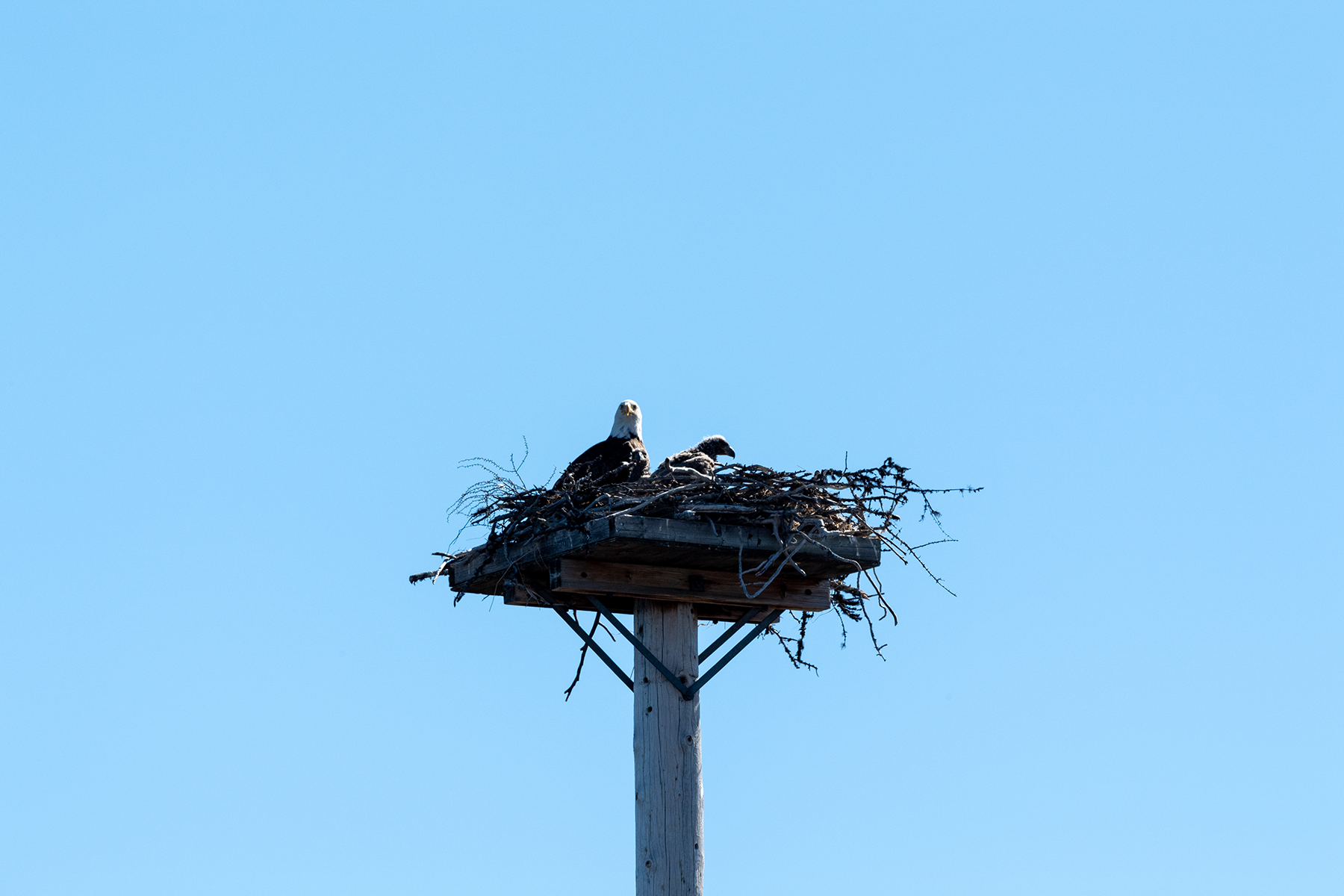
Two chicks, which were not often visible.
Nice little waterfall just off the road. Clean water, good for taking a bird bath.
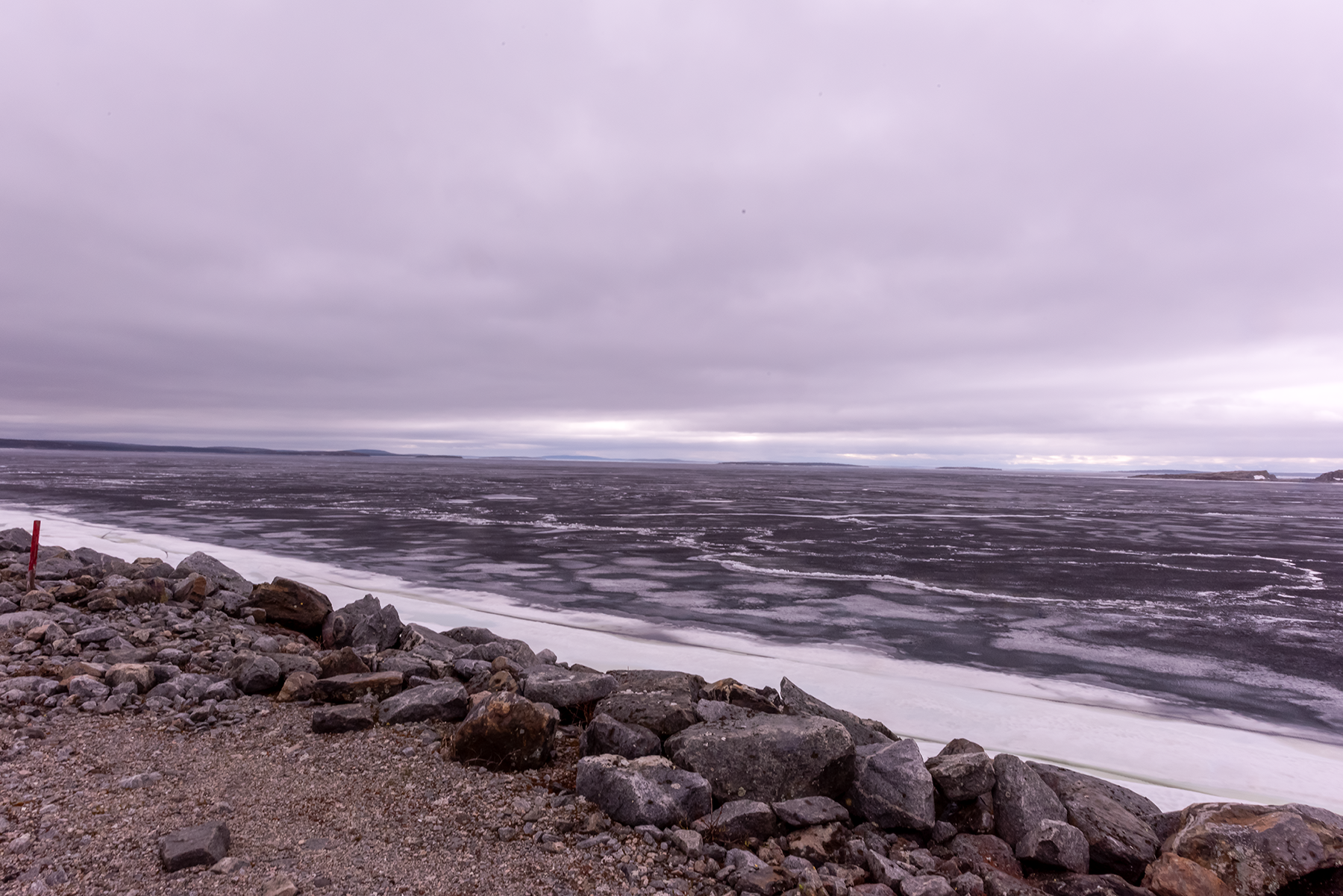
Approaching the end of the road. The Caniapiscau Reservoir, covered with ice. Around June 30 or so.
I wanted to fish here, but could not launch the boat. This was clear the next day. The reservoir was not frozen, but ice got blown to the shore by high winds. Most of the water was free of ice.
Another view of the ice. I am about 15 km from the end of the road.
These structures cover access points underneath the embankment.
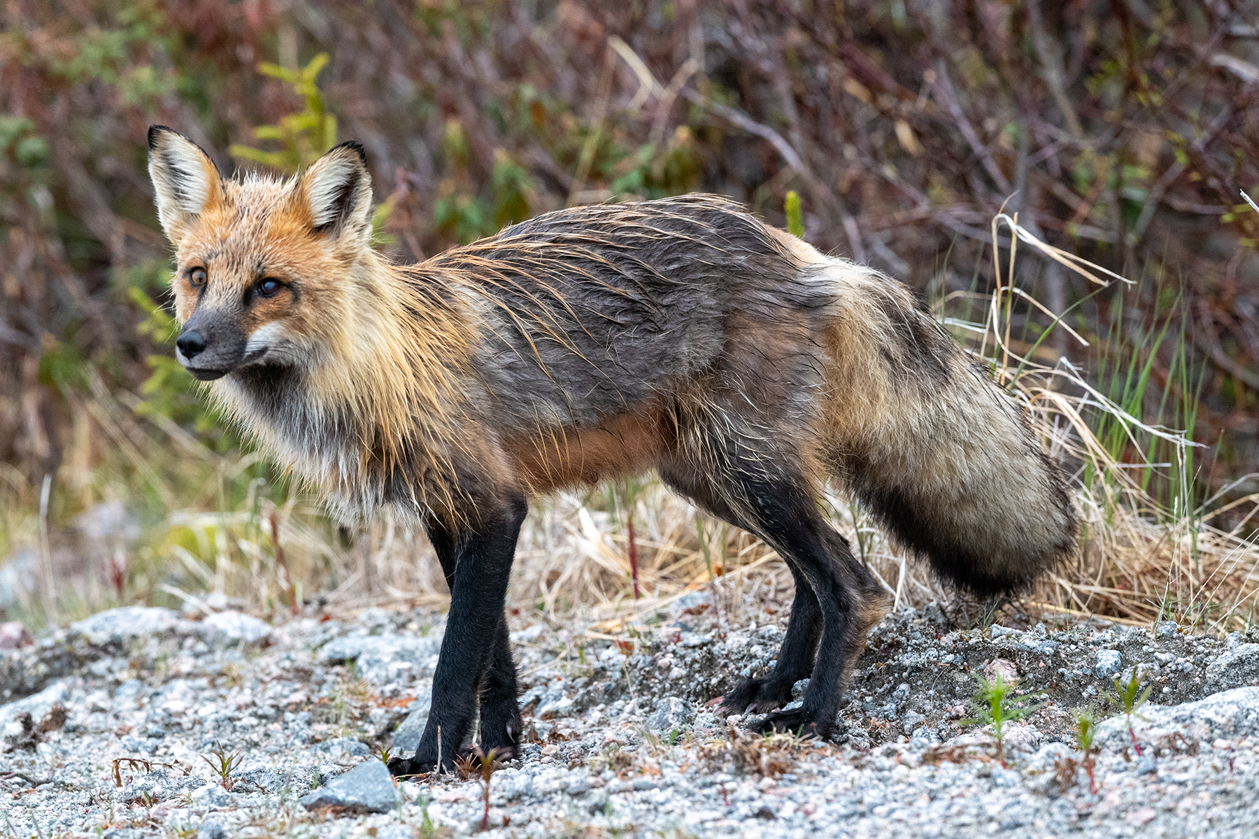
Spied this fox by the last embankment.
This is the Caniapiscau River, headed downstream from the reservoir.
Same spot, looking toward the reservoir.
The dam.
I would try these spots on nicer days but found few leps.
More geese.
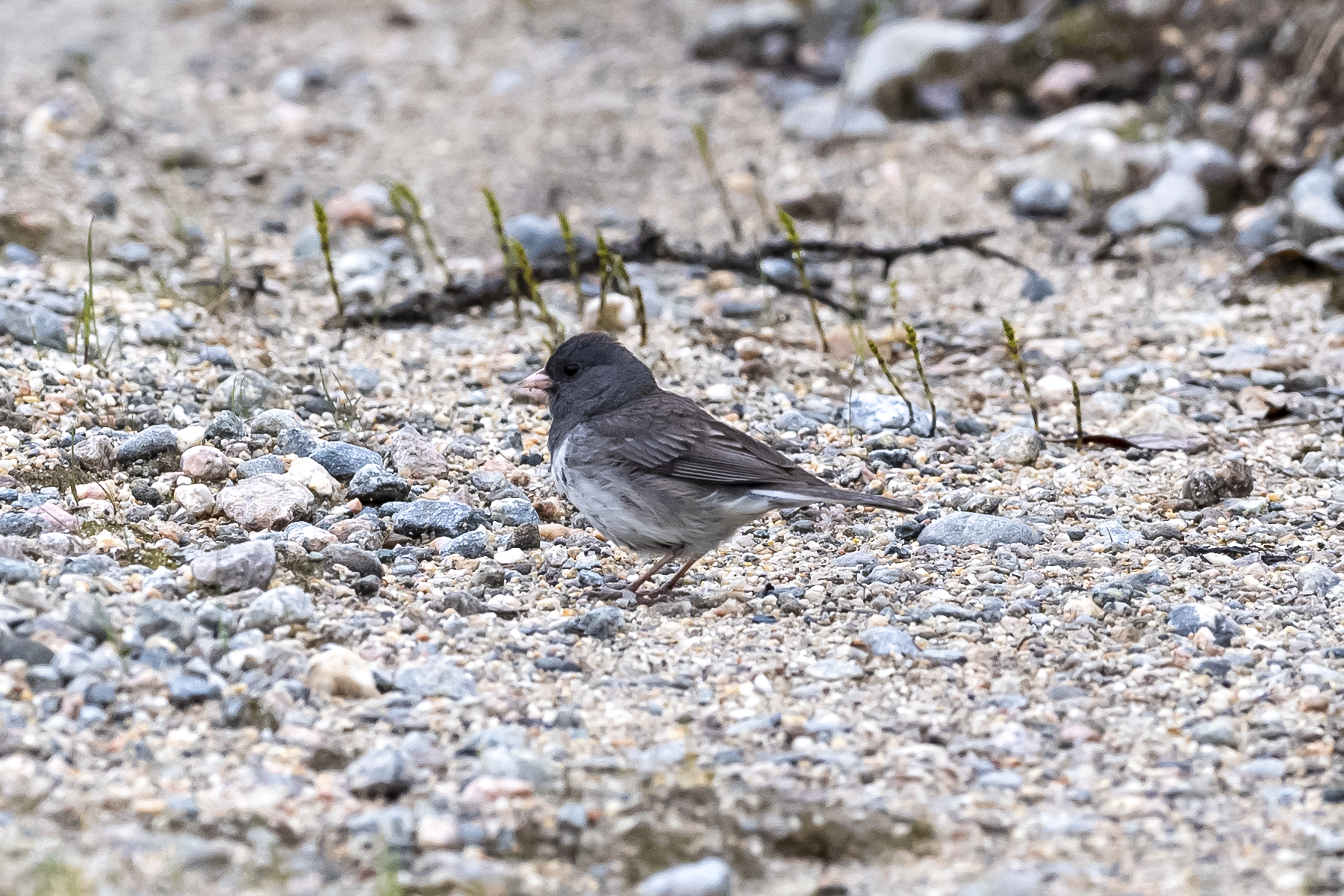
Spied this dark-eyed junco feeding on the road.
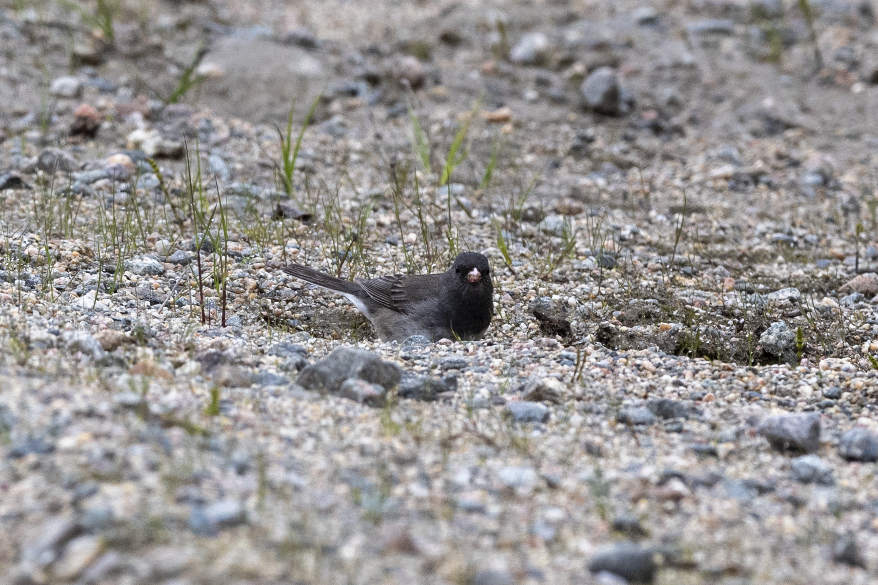
Another shot.
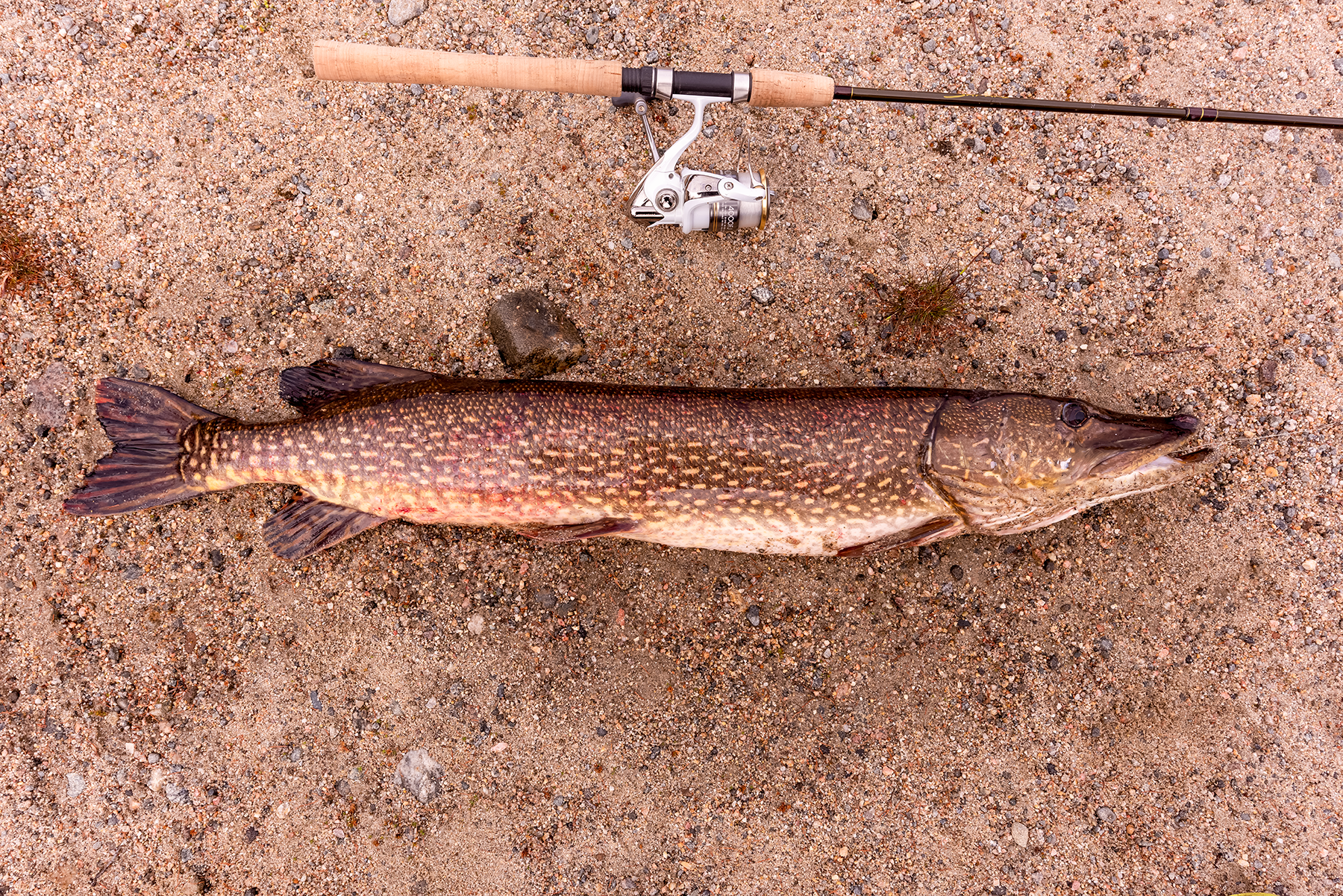
Just down the road, I spotted this northern in a roadside flowage. Cast once, and it inhaled the lure. About 36 inches, biggest fish of the trip.
The trees had not yet leafed out, making these shots seem bleak.
I was launching my boat on the reservoir when these two came foraging.
A chilly day, 50F, but sunny skies.
Saw a lot of lichen.
Nice shot of two Common Mergansers.
Same pair, later in the day.
Small beaver dam. Tried for trout here, but no bites.
Road shot.
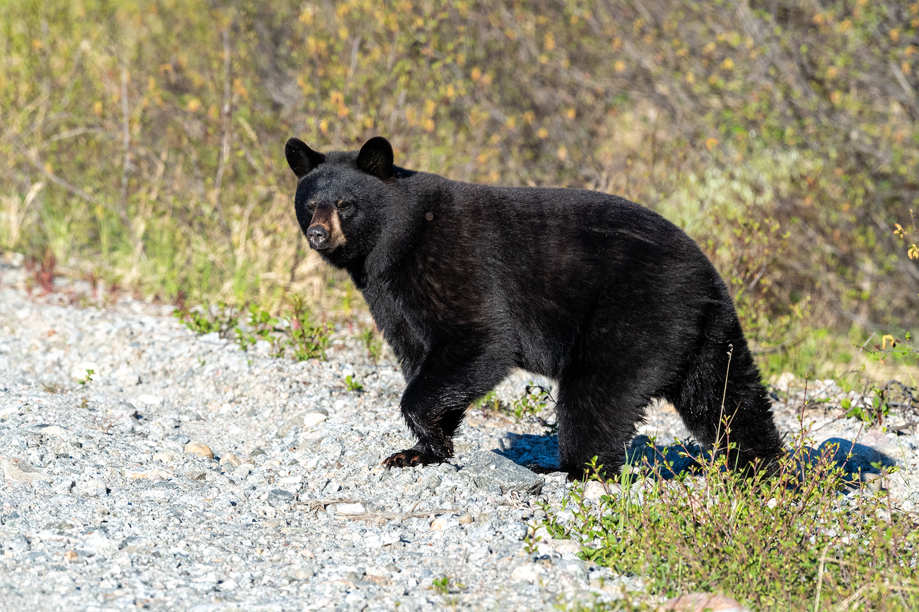
Another bear.
Same bear.
This is near Brisay. A much younger bear.
Sunset on the reservoir, near Brisay.
The eagle nest on a sunny day.
These Lake Trout are smaller than the ones I caught in 2019 on Reindeer Lake. Most were caught while trolling in the river, always upstream against the current. Several were caught from the shore one evening. They were really biting that night. Two followed the lure into shallow water, only 4-5 inches deep. One turned back, because the water was too shallow, but I let the lure rest on the bottom, motionless, and the fish turned back, and sucked the lure off the bottom!
The reservoir on a clear, windy day.
This fox came to the campsite seeking a handout.
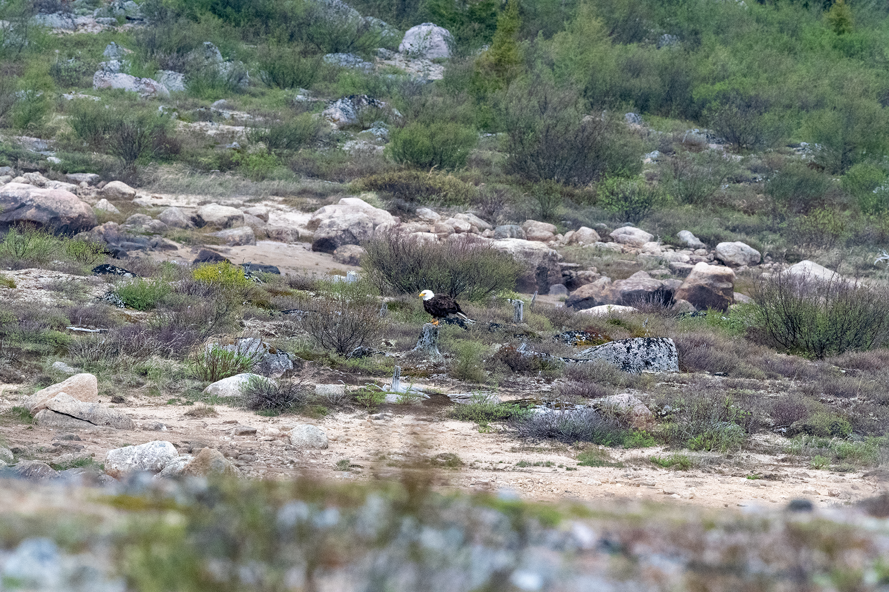
The eagle occasionally landed on the ground to rest.
The fish on the right is the biggest I caught this trip. These fish roll in the water when hooked, and often wrap the line around their bodies, attempting to break the line. Some had marks on their bodies, line burns. You can see the fillet board in the background, on the garbage can. More on that later.
I spooked a mom with two cubs. One lagged behind. Poor little guy had a deformed right paw. He dragged his nose on the ground as he walked.
Struggling to walk.
Now sitting, exhausted.
Now crying, actually bawling.
Mom and the sibling were in the bushes, long gone.
Finally made it to the bushes.
A bear invaded camp and turned over the barrel, which was not easy to do, as the base was buried in the ground. Probably smelled fish, as I cleaned them on the top of the can. I was lucky, as I was going to leave the camper door open for some fresh air. The bear could have done some serious damage to my new camper. I was fishing, and this spot is up a hill from the water. I saw the bear walking around the shore, then disappear. I went to investigate and saw the bear, yelled at him, and it ran into the nearby bushes. Had to dispatch him with two bear banger charges.
Saw this bear moments later, as I was driving to an overlook of the area. Again, munching on grass.
This is the mom and sibling to the other cub, who now were frequenting the campground.
This nicely shows the area I fished. The road to the campsite is just visible on the far side of the channel, and ends right before the little island. I fished on the far side of that island, mostly, but sometimes came into the channel, which was also good.
Here is the power plant, with the dam in the middle of the photo. Actually, water moves through a tunnel of 100 yards or so, and exits into the channel. Fish move through this tunnel, but I suspect some get injured or killed, serving as forage for the downstream fish.
Another view.
On the way back to the campsite, saw the cub.
Can see the deformed right paw, and how difficult it is to walk.
Bawling again.
Tired from a good cry.
Disheartening to watch this, as he probably did not live very long.
Now headed back. The many embankments for the reservoirs are visible from the road.
Now on the James Bay Highway, where I photographed a Solitary Sandpiper.
This is upstream the Eastman River bridge.
The bridge over the Rupert River.
Upsteam from the Rupert River bridge.
Downstream from the Rupert River bridge.
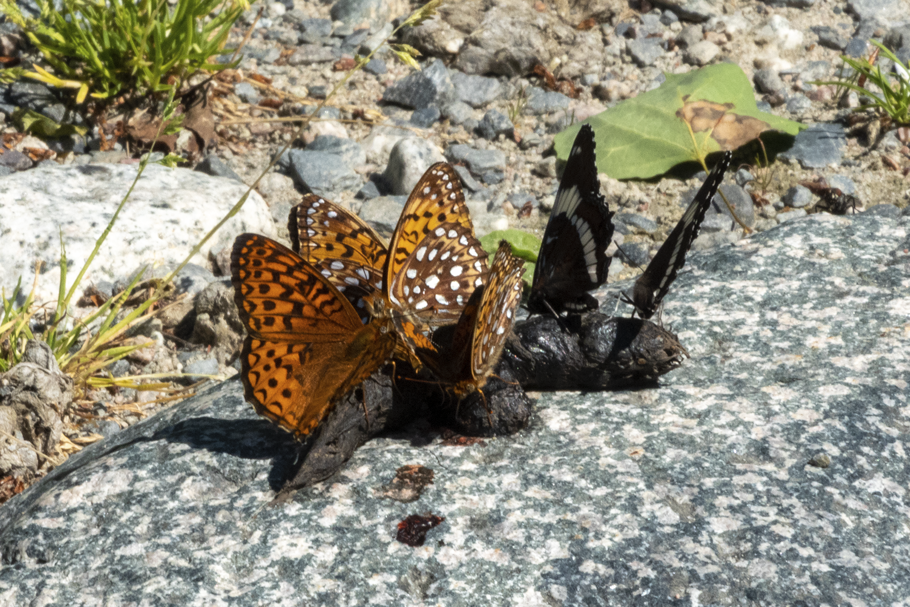
Last day near Matagami I photographed these S. atlantis and L. arthemis.
The trip overview. The total drive is about 2000 miles, with the last 500 or so on the Trans Taiga Highway, an improved primitive road that services four dams on the La Grande River
The first dam of the series, the farthest from Chicago. The work town is Brisay. The water from the Caniapiscau River is diverted to the La Grande River at this point. I fished for 5 days below the dam. A later photo better shows the campsite, located about an inch from Brisay on this image, at about 10-15 degrees east from due north.
The dam at the Caniapiscau River. The long narrow body of water in the center near the top of the image is near the dam. Photos to follow. I had hoped to take a 4 day boat trip down the river, but the river was bone dry just below the dam.
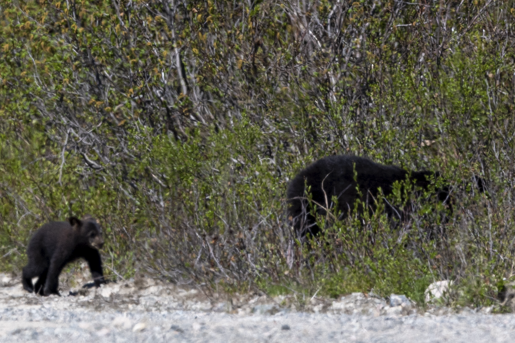
Spent several days near Matagami Quebec. Bears were the theme of this trip, as I saw 25 in two weeks. They often had grass in their mouths.
June 23, a P. canadensis puddle party, on Route 1050, near the Bell River.
The start of the Route de Nord, which connects the James Bay Highway to Chibougamau.
Had good weather the first few days of the trip, but it would soon change.
A rest stop near Quevillon.
I would try for Brook Trout here, with no success.
This was a few days later, now on the James Bay Highway, near one of the large river crossings. The highway crosses 3 very large rivers. This bear was probably scavenging from the nearby garbage bin.
A little later a fox kit ran across the road.
I am about 8 feet away.
Mom must have been hunting.
This is one of the large rivers. Note the sparse landscape. Plus, about 150 kms of the drive was through fire damage.
This station is halfway up the James Bay Highway, and offers food along with a free shower.
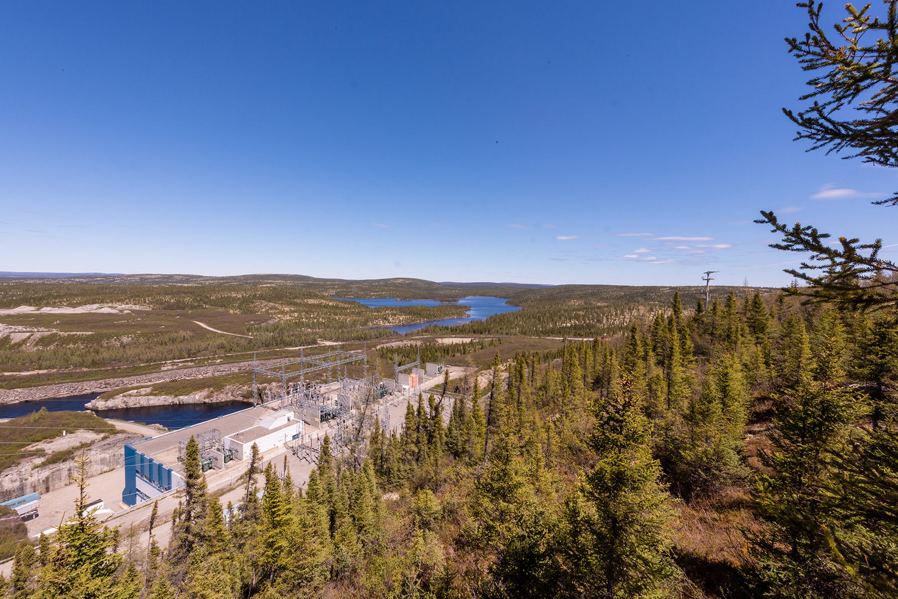
Here is the fourth dam, the nearest to James Bay on the La Grande River.
The business section of the dam.
Now at the start of the Trans Taiga Highway. This sign indicates the next place to purchase gas.
My rig.
Another outfitter sign.
Saw little wildlife besides the bears, but here are a few geese.
Turned cloudy soon, an lasted a few days. This is typical of the scenery on the Trans Taiga Highway.
Now I am at the campsite near Brisay. This is right above were I parked.
Two chicks, which were not often visible.
Nice little waterfall just off the road. Clean water, good for taking a bird bath.
Approaching the end of the road. The Caniapiscau Reservoir, covered with ice. Around June 30 or so.
I wanted to fish here, but could not launch the boat. This was clear the next day. The reservoir was not frozen, but ice got blown to the shore by high winds. Most of the water was free of ice.
Another view of the ice. I am about 15 km from the end of the road.
These structures cover access points underneath the embankment.
Spied this fox by the last embankment.
This is the Caniapiscau River, headed downstream from the reservoir.
Same spot, looking toward the reservoir.
The dam.
I would try these spots on nicer days but found few leps.
More geese.
Spied this dark-eyed junco feeding on the road.
Another shot.
Just down the road, I spotted this northern in a roadside flowage. Cast once, and it inhaled the lure. About 36 inches, biggest fish of the trip.
The trees had not yet leafed out, making these shots seem bleak.
I was launching my boat on the reservoir when these two came foraging.
A chilly day, 50F, but sunny skies.
Saw a lot of lichen.
Nice shot of two Common Mergansers.
Same pair, later in the day.
Small beaver dam. Tried for trout here, but no bites.
Road shot.
Another bear.
Same bear.
This is near Brisay. A much younger bear.
Sunset on the reservoir, near Brisay.
The eagle nest on a sunny day.
These Lake Trout are smaller than the ones I caught in 2019 on Reindeer Lake. Most were caught while trolling in the river, always upstream against the current. Several were caught from the shore one evening. They were really biting that night. Two followed the lure into shallow water, only 4-5 inches deep. One turned back, because the water was too shallow, but I let the lure rest on the bottom, motionless, and the fish turned back, and sucked the lure off the bottom!
The reservoir on a clear, windy day.
This fox came to the campsite seeking a handout.
The eagle occasionally landed on the ground to rest.
The fish on the right is the biggest I caught this trip. These fish roll in the water when hooked, and often wrap the line around their bodies, attempting to break the line. Some had marks on their bodies, line burns. You can see the fillet board in the background, on the garbage can. More on that later.
I spooked a mom with two cubs. One lagged behind. Poor little guy had a deformed right paw. He dragged his nose on the ground as he walked.
Struggling to walk.
Now sitting, exhausted.
Now crying, actually bawling.
Mom and the sibling were in the bushes, long gone.
Finally made it to the bushes.
A bear invaded camp and turned over the barrel, which was not easy to do, as the base was buried in the ground. Probably smelled fish, as I cleaned them on the top of the can. I was lucky, as I was going to leave the camper door open for some fresh air. The bear could have done some serious damage to my new camper. I was fishing, and this spot is up a hill from the water. I saw the bear walking around the shore, then disappear. I went to investigate and saw the bear, yelled at him, and it ran into the nearby bushes. Had to dispatch him with two bear banger charges.
Saw this bear moments later, as I was driving to an overlook of the area. Again, munching on grass.
This is the mom and sibling to the other cub, who now were frequenting the campground.
This nicely shows the area I fished. The road to the campsite is just visible on the far side of the channel, and ends right before the little island. I fished on the far side of that island, mostly, but sometimes came into the channel, which was also good.
Here is the power plant, with the dam in the middle of the photo. Actually, water moves through a tunnel of 100 yards or so, and exits into the channel. Fish move through this tunnel, but I suspect some get injured or killed, serving as forage for the downstream fish.
Another view.
On the way back to the campsite, saw the cub.
Can see the deformed right paw, and how difficult it is to walk.
Bawling again.
Tired from a good cry.
Disheartening to watch this, as he probably did not live very long.
Now headed back. The many embankments for the reservoirs are visible from the road.
Now on the James Bay Highway, where I photographed a Solitary Sandpiper.
This is upstream the Eastman River bridge.
The bridge over the Rupert River.
Upsteam from the Rupert River bridge.
Downstream from the Rupert River bridge.
Last day near Matagami I photographed these S. atlantis and L. arthemis.