PAPILIO INDRA PARVINDRA
Papilio indra parvindra is found only
in the Dead Mountains just northwest
of Needles, California. The only
sightings of which I am aware are on
Manchester Mountain, the highest
peak in the range. The mountain is
accessible only by foot, and the
difficulty of the terrain makes this
short hike very challenging. Although
many attempt to access the mountain
from the east, possibly due to the fact
that this hike is shorter, the western
approach starts at a higher elevation,
traverses easier terrain, and offers a
very easy scramble to the peak. The
eastern approach will take about 4-4.5
hours, whereas I have made the
western trek in 2 hours 15 minutes.
This overview highlights the easy hike
from the west to the peak. The hike
will take you across several modest
washes, but the only challenging
obstacle is the wash just below the
peak. Manchester Mountain is
located at N35.02776 W114.74885,
but head just to the north of this
point. Notice my two trails, on the
way out, I headed straight to the
mountain, only to veer north at the
end of the hike. On the way back, I
was able to head directly to the car.
Mark your start position using your
GPS receiver, as you will not see you
car during the hike.
Park near the large wash that crosses
Highway 95 due west of Manchester
Mountain.
You will enter the wash with about a
mile to go. When it veers south, exit
to the east, and try to find the ridge
leading to the peak.
The peak of Manchester Mountain is
worn, perhaps from the few
parvindra seekers who have made it
to the top.
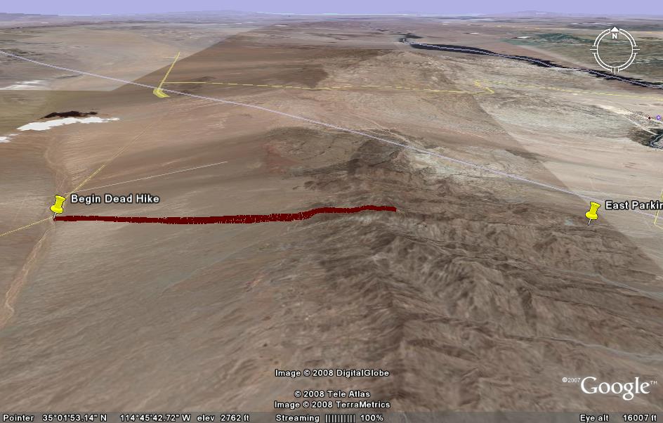
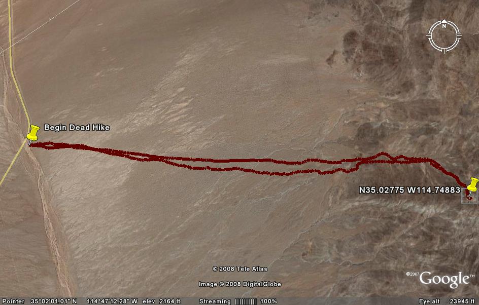
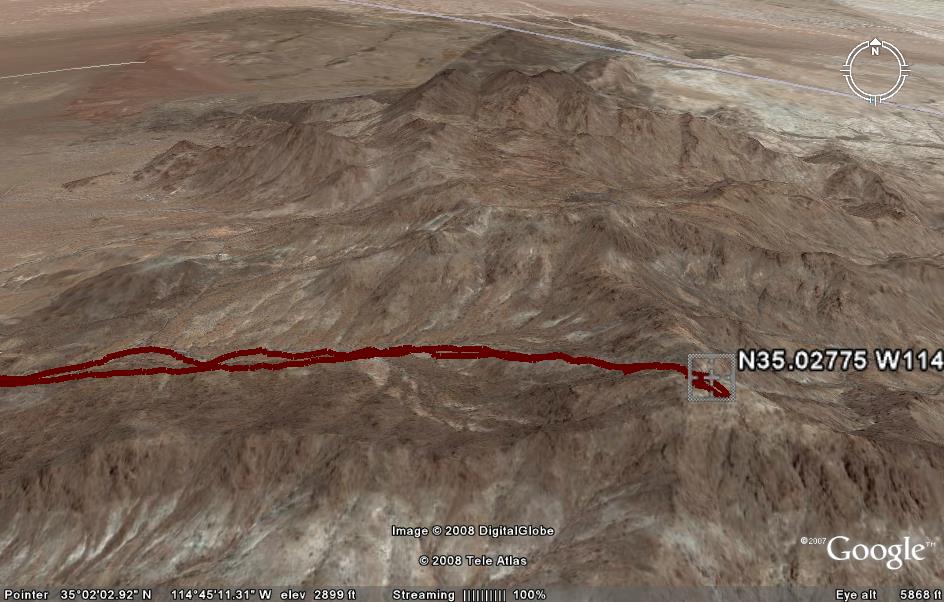
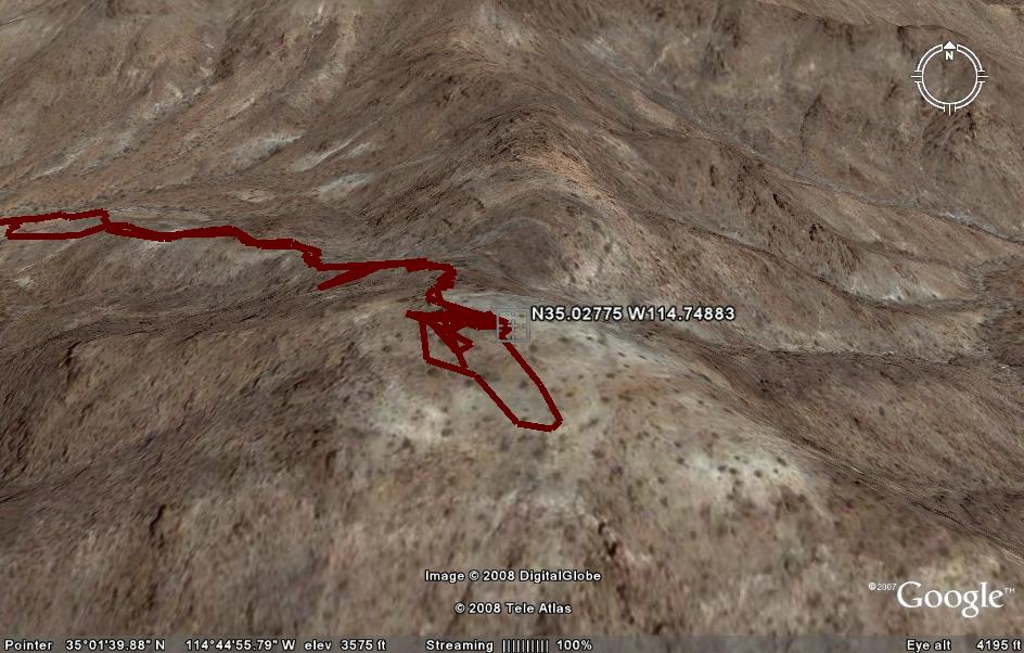
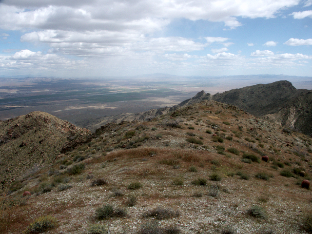
An overview of the Dead Mountains showing the path from the west to
Manchester Mountain.
Manchester Mountain.
An overview of the Dead Mountains showing the path from the west to
Manchester Mountain. Note that trail passes through a wash the last 3/4 mile,
and then involves a moderate scramble of 1/4 mile to the top.
Manchester Mountain. Note that trail passes through a wash the last 3/4 mile,
and then involves a moderate scramble of 1/4 mile to the top.
The hike starts at the large wash that crosses Highway 95 at N35.03466
W114.82430. Park your car off the road in the wash, but of course be aware
of the possibility of flash floods. Head just to the north of Manchester
Mountain, N35.02776 W114.74885.
W114.82430. Park your car off the road in the wash, but of course be aware
of the possibility of flash floods. Head just to the north of Manchester
Mountain, N35.02776 W114.74885.
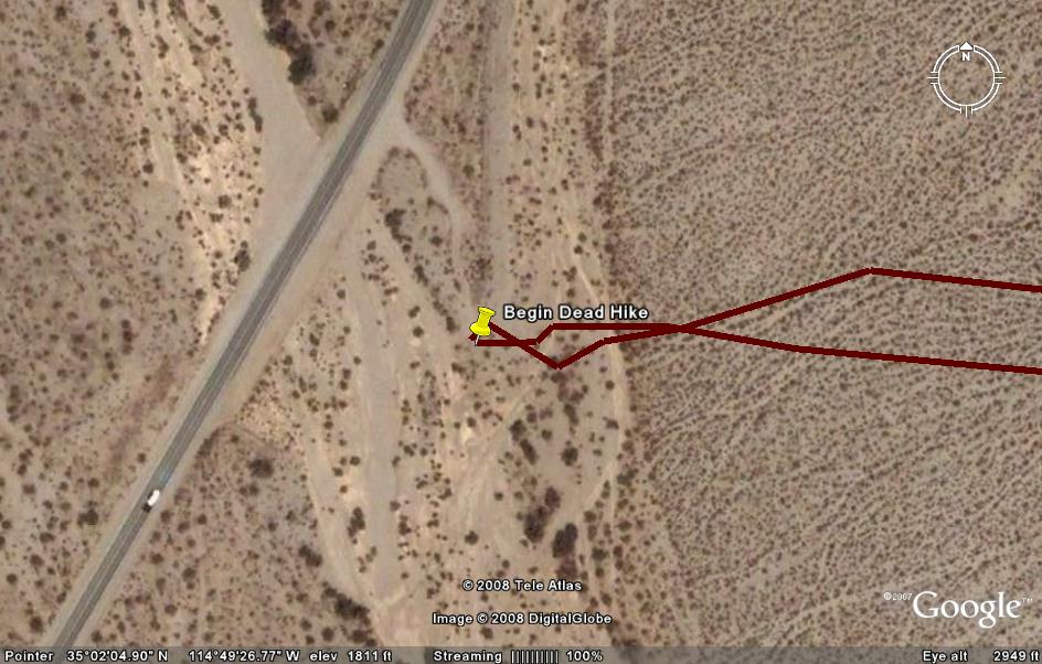
Enter the large wash below Manchester Mountain, go about 1/2 a mile, and then
exit to the north. Scramble up the subtle ridge that appears. A tip: In the
desert, whenever you have to go around a small obstacle such as a bush, go
north. This is uphill, and helps to keep your path linear.
exit to the north. Scramble up the subtle ridge that appears. A tip: In the
desert, whenever you have to go around a small obstacle such as a bush, go
north. This is uphill, and helps to keep your path linear.
This view shows the barren peak. You can see two ridges, one that you should
travel, and one that forms the upper canyon wall of the eastern approach.
travel, and one that forms the upper canyon wall of the eastern approach.

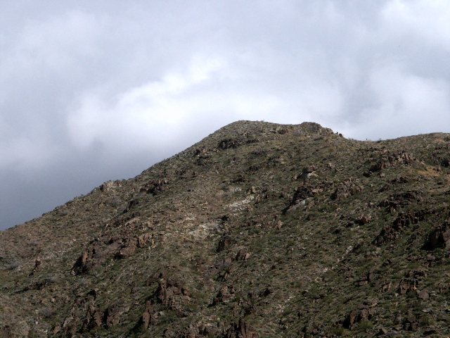
Another view of the barren peak.
This view shows the last scramble to the top. Easier than it looks!
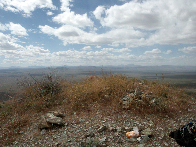
This view shows the very peak of Manchester Mountain.
Another view from the top of Manchester Mountain.
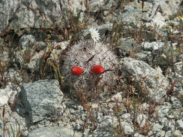
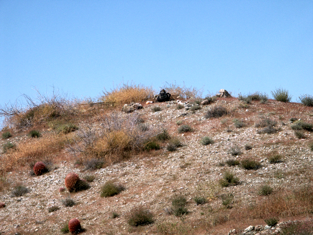
A young barrel cactus.
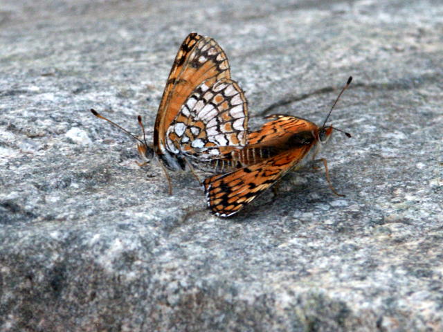
A mating pair of Chlosyne acastus.
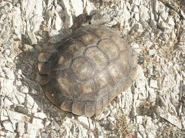
A desert tortoise. An endangered species, these are common in this area.
A mating pair of Chlosyne acastus.
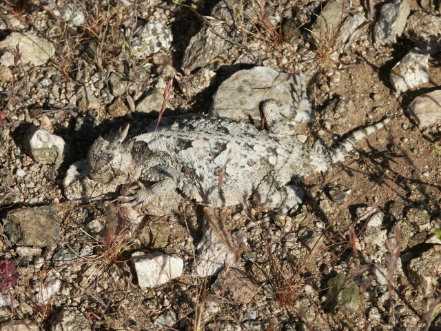
A horned toad.